¿Habla español? | Accessibility and Language Options(Opens in new window.)
Stations
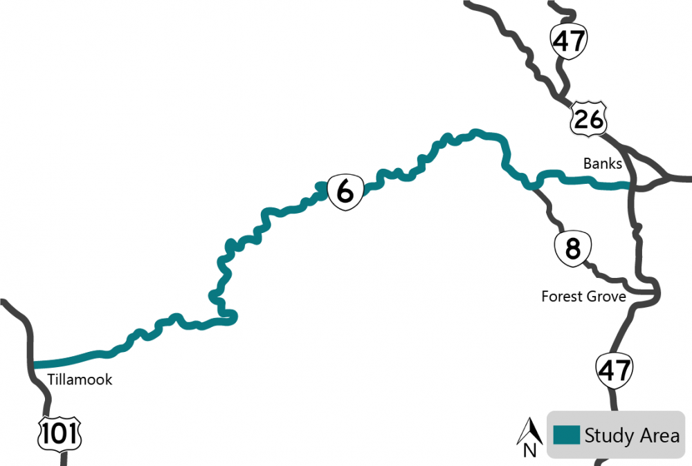
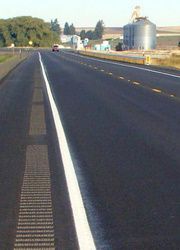
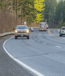
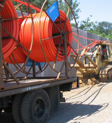
![]() In response to local concerns, the Oregon State Legislature passed a bill to initiate this study and present the findings in fall 2023.
In response to local concerns, the Oregon State Legislature passed a bill to initiate this study and present the findings in fall 2023.
To understand the needs along the corridor, we gathered public feedback on existing problems and issues related to safety, freight, operations and overall road conditions.
When finished, we'll have a complete study of the highway that includes potential solutions, projects and cost estimates.
The study won't result in specific project work until funding becomes available.
Funding
As cars become more efficient and fuel tax revenue declines, we have less money to spend on maintenance and other areas and we are making difficult decisions. We’re still determining potential cuts but less maintenance will mean deteriorating road conditions, slower responses to incidents and winter weather events and more.
Click the "+" or the title below to view the information in each section.
Community Events
Your feedback is an important part of our process. Thank you to everyone who has helped us with this study.
-
We asked you to share your experiences at our community events last November and heard from more than 500 people.
-
We used your experiences to help us find what issues to focus on, which we shared in February and heard from more than 500 people again.
-
Now we're sharing potential solutions to the issues – learn more and tell us what you think!
Advisory Committees
We have two stakeholder committees that help review the study information. We've met with both committees twice and plan to meet one more time.
-
The Stakeholder Advisory Committee has 22 community members who review our findings and provide local knowledge and input.
-
The Technical Advisory Committee reviews our findings and provides guidance on technical issues through collaboration with city and county partners.
What's In the Corridor
To understand the current conditions of the highway, we reviewed what's in the corridor, including:
-
Geography, like hills, curves, land stability, etc.
-
Bridges and equipment like roadside barriers, signs, etc.
-
Pedestrian, bicycle and transit areas.
-
Environmental resources, like water, plants, wildlife, wetlands, historic sites, etc.
How Many People Drive the Corridor
To understand how much traffic is in the corridor, we counted. We looked at the corridor in August, September and October 2022 collecting data at the Wilson River Loop, Timber Road, Gales Creek Road intersections and at milepost 12. We found that:
-
The Gales Creek Road intersection meets the criteria for a dedicated left turn lane.
-
The highway capacity works for traffic now and the projected traffic volumes in 2044.
Crashes in the Corridor
We looked at the crash data and found:
-
There were 428 crashes between 2016 to 2020, 46 had fatal or severe injuries.
-
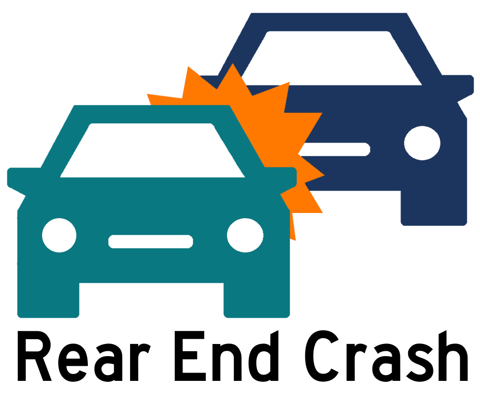
The most common types of crashes were fixed objects, rear ends and turning crashes.
-
The most commonly reported factor was driving too fast for the road conditions.
-
Some of the key crash locations were:
- Wilson River Loop East intersection.
- Milepost 31 to 35.
- Gales Creek Road intersection.
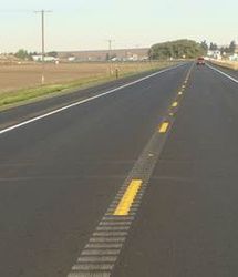
![]()
![]()
Click the "+" or the title below to view the information in each section.
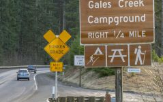
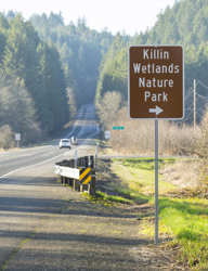
Access to Recreational Destinations
 OR 6 provides access to many recreational destinations, like campgrounds and hiking trails.
There aren't consistent signs to alert drivers of entrances. This causes drivers to slow down to look for their destination or make sudden turns.
The accesses are difficult to see, so it can surprise drivers on OR 6 as vehicles exit these locations.
Potential Solutions
Click on each tab below to learn more about potential solutions.
We don't have funding for these solutions as part of the study.
If funding became available, the cost and time it takes to implement would depend on the chosen solution.
Delineators to Define Driveways and Intersections
 About
About
To help make accesses more visible to drivers, we could install delineators at driveways or intersections. Delineators are reflective devices mounted above the surface of the road to help visually guide the driver.
Benefits
Delineators could increase the visibility and awareness for drivers if installed consistently throughout the corridor. With more advanced warning, drivers may slow down and be less likely to make sudden turns.
Estimated Cost and Other Considerations
The cost would vary depending on the option.
Defining Access Points
 About
About
There are many places where vehicles can get on and or turn off the highway, we looked at ways to make these accesses more visible to drivers. To define access points we could:
- Install curbs or paint.
- Encourage appropriate use of parking areas along the side of the road.
- Add signs to make parking areas more visible.
- Partner with other agencies to encourage defined parking areas near destinations.
Benefits
These methods could mean fewer conflict points along the corridor and more awareness that drivers may make turns off of and onto OR 6.
Estimated Cost and Other Considerations
The cost would vary depending on what method is used. For example, installing a curb is usually around $50 per foot.
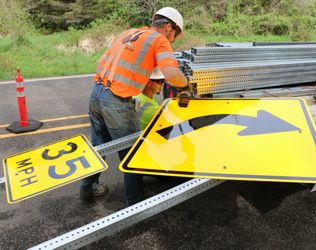
Install Warning Signs
 About
About
To help make access locations clear, we could install more warning signs consistently throughout the corridor. These signs may include:
- Advanced pedestrian warning signs.
- Congestion ahead warning signs.
- Advance intersection warning signs.
- Destination signs for recreational areas or trailheads.
- Street name signs on both sides of the road.
- More frequent milepost signs so it is easier to locate destinations and report incidents.
Benefits
More warning signs along the corridor could increase driver awareness and reduce sudden and unexpected reactions.
Estimated Cost and Other Considerations
The cost would vary depending on the type of sign being installed.
Encourage Slower Speeds
 About
About
To help encourage drivers to slow down, especially near recreational destinations, we could:
- Install signs that inform drivers they're entering a community.
- Install speed feedback signs that notify drivers how fast they're going.
- Where possible, change the layout of the road by adding larger shoulders or eliminating passing zones.
- When possible, consider reevaluating speed limits.
Benefits
Signs alerting drivers how fast they're going and reminding them that they're in a community could help encourage them to slow down. Larger shoulders and eliminating passing zones near driveways and accesses could minimize potential conflicts.
Estimated Cost and Other Considerations
The cost would vary depending on the option.
Intersection Warning System – OR 6 Traffic
 About
About
We could install an intersection warning system so drivers on OR 6 know that there may be vehicles stopped ahead of them waiting to turn.
Benefits
Intersection warning systems flash lights alerting drivers that they may need to come to a stop ahead. This could help drivers know to slow down and drive more cautiously.
Estimated Cost and Other Considerations
This solution would cost about $45,000. It would be costly to maintain this kind of system. We'd likely only install a system like this as part of a larger project.
Intersection Warning System – Side Street Traffic
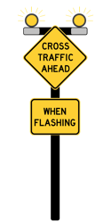 About
About
We could install an intersection warning system that flashes lights so drivers on OR 6 know that there is traffic on side streets that may enter the intersection.
Benefits
Intersection warning systems use flashing lights so drivers know there is traffic on side streets. This could help drivers know to slow down and drive more cautiously.
Estimated Cost and Other Considerations
This solution would cost about $95,000. It would be costly to maintain this kind of system. We'd likely only install a system like this as part of a larger project.
Improve Sight Distance at Intersections
 About
About
We could make changes at intersections along the corridor to help drivers see oncoming traffic better. This might include:
- Trimming trees that are blocking the view.
- Removing minor obstacles.
- Removing trees or fences.
- Rebuilding the roads at the intersection so it's easier to see farther.
Benefits
If drivers can see farther, they can make a more informed decision on when to turn onto OR 6.
Estimated Cost and Other Considerations
The cost would vary depending on the option.
Left Turn Lanes
 About
About
We could install left turn lanes at key locations in the corridor.
Benefits
Left turn lanes create a space for drivers to wait until it is safe to turn, removing them from the other traffic. Dedicated left turn lanes at intersections help reduce rear-end crashes.
Estimated Cost and Other Considerations
The cost could vary depending on the area. Installing left turn lanes may require us to widen the highway, which could be a significant cost.
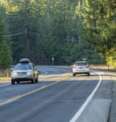
Curves in the Road
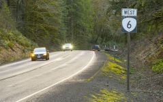
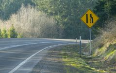
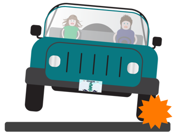
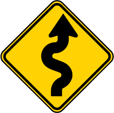 OR 6 has many curves. At some locations, there's a pattern of drivers leaving the road or crossing the centerline when curves and other conditions exist.
Examples of those conditions are:
-
Hills.
-
Snow, ice and wet pavement.
-
Passing lanes that are in curves.
-
Pull-outs in curves with limited sight distance, meaning drivers can't see very far ahead of them.
Drivers have shared that visibility can be poor due to curves, hills and trees. Drivers noted that some curves have pavement that slopes in the opposite direction, making it difficult to stay in your lane.
Potential Solutions
Click on each tab below to learn more about potential solutions.
We don't have funding for these solutions as part of the study.
If funding became available, the cost and time it takes to implement would depend on the chosen solution.
Delineators Along Curves
About
To help make curves in the road more visible to drivers, we could install delineators on both sides of the road defining the curves. Delineators are reflective devices mounted above the surface of the road to help visually guide the driver. We could also install them on the existing guardrail.
Benefits
Delineators could increase the visibility and awareness for drivers if installed consistently throughout the corridor. With more advanced warning, drivers may slow down and be less likely to make sudden turns.
Estimated Cost and Other Considerations
The cost would vary depending on the option.
Shoulder Rumble Strips
 About
About
We could add rumble strips along the outside of the travel lane, or shoulders, to help drivers be more aware if they're leaving the road. Rumble strips are grooves cut into the pavement that make a sound and vibration when you drive on them.
Benefits
Shoulder rumble strips help reduce run-off-the-road type crashes. They alert drivers when they're leaving their lane so that they have time to return.
Estimated Cost and Other Considerations
This solution would cost about $4,500 per mile. We'd need to review locations and make sure the shoulder is wide enough for rumble strips and that they follow guidelines for proximity to residents. We have a Northwest Oregon rumble strip project we haven't started yet. With this project, we'll look at possible locations we could install rumble strips along OR 6.
Centerline Rumble Strips
 About
About
We could add rumble strips along the center of the road to help drivers be more aware if they're leaving their lane and crossing into oncoming traffic. Rumble strips are grooves cut into the pavement that make a sound and vibration when travelers drive on them.
Benefits
Rumble strips through the center of the road helps reduce head-on and sideswipe crashes. They alert drivers when they're leaving their lane so that they have time to return.
Estimated Cost and Other Considerations
This solution would cost about $2,500 per mile. We'd need to review locations and make sure they follow guidelines for proximity to residents. We have a Northwest Oregon rumble strip project we haven't started yet. With this project, we'll look at possible locations we could install rumble strips along OR 6.
Modifying the Curves in the Road
 About
About
We could flatten or modify certain curves along the corridor.
Benefits
By flattening or modifying the curves, it may be easier for drivers to see farther ahead of them.
Estimated Cost and Other Considerations
The cost would vary based on the area and what work needed to be done. To be able to modify the road like this, it'd have to be included in another project or a stand-alone project of its own.
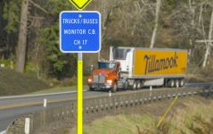
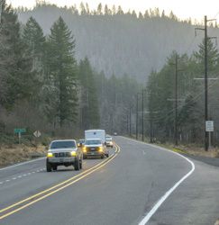
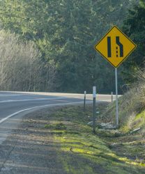
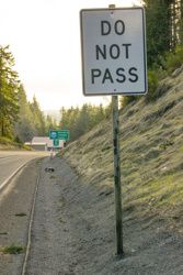
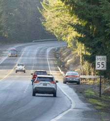
Passing Lanes
 Passing lanes are located throughout the corridor and help keep traffic moving. Several of the passing lanes aren't long enough to meet current standards. Many passing lanes are located within curves where crashes have been reported.
Risky driver behavior has been attributed to a lack of opportunity to pass slower-moving vehicles. People mentioned that some turnouts are not paved or there isn’t enough warning to be able to use them safely.
Potential Solutions
Click on each tab below to learn more about potential solutions.
We don't have funding for these solutions as part of the study.
If funding became available, the cost and time it takes to implement would depend on the chosen solution.
Signs and Paint
 About
About
We could install consistent signs and paint along the corridor to make sure drivers can see passing lanes and turnouts.
Benefits
This would provide drivers with consistent information along the corridor so they know when passing opportunities are coming and when passing lanes will end.
Estimated Cost and Other Considerations
The cost would vary based on what work needed to be done.
Evaluate Existing Passing Lanes
 About
About
We could complete a study to evaluate the existing passing lanes in the corridor. This study would look at the lengths, taper lengths and other conditions within the passing lanes against current standards.
Benefits
A study like this would help us identify the needs and opportunities to provide passing lanes that minimize risky driver behavior.
Estimated Cost and Other Considerations
This solution would cost about $100,000.
Modify Climbing Lanes Near the Summit
 About
About
We could modify existing passing lanes that are near the summit, in both directions, making them longer. We could do this by:
- Connecting existing passing lanes.
- Extending passing lanes over the summit.
Benefits
By making the passing lanes longer, drivers would have more time to complete their movements. It would reduce the risks of short passing lanes, helping prevent higher speeds and quick merges.
Estimated Cost and Other Considerations
This solution would cost about $32.2 to $61.9 million. Either of the options would require a lot of work to stabilize the slopes, which would be extremely complex and cost about an additional $40.9 million. This area does have some environmental concerns to consider. Devils Lake Fork Wilson River is designated as critical habitat for coho salmon and steelhead. We would need to follow environmental processes and permitting. This would add time and expense to the project.
Remove Short Climbing Lanes Near the Summit
 About
About
We could remove or convert short climbing lanes that are near the summit. We could do this by:
- Removing the short existing climbing lanes.
- Converting the short climbing lanes into vehicle turnouts.
Benefits
By removing short climbing lanes, we'd remove the risks associated with them. Drivers would be less likely to speed to quickly pass slower traffic. We'd also have more buffer width within curves which would allow us to use wider centerlines and shoulders which could reduce road departures. By converting the short climbing lanes we'd also remove the risks associated with them but still provide drivers a place to stop in an emergency.
Estimated Cost and Other Considerations
This solution would cost about $4.8. Either of the options would require a lot of work to stabilize the slopes, which would be extremely complex and cost about an additional $40.9 million. This area may have some environmental processes and permitting we'd need to follow. This would add time and expense to the project.
Evaluate New Passing Lanes
 About
About
We could evaluate if there are locations we could add new passing lanes along the corridor. This would be helpful especially if the short passing lanes are removed along the corridor.
Benefits
By evaluating and possibly adding new passing lanes along the corridor, drivers would have an opportunity to pass slower traffic reducing driver impatience throughout the corridor.
Estimated Cost and Other Considerations
Segments of the work could be included in other projects. The segmented sections would cost about $17.6 to $24.6 million. For the full section, milepost 31 to 35, the solution could be done as a stand-alone project of its own. Depending on the design, the full project would cost about $45.7 to $445.7 million. This area may have some environmental processes and permitting we'd need to follow. This would add time and expense to the project.
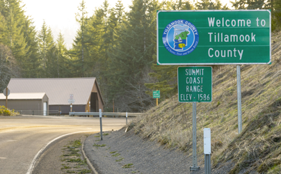
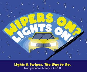
Roadway Conditions
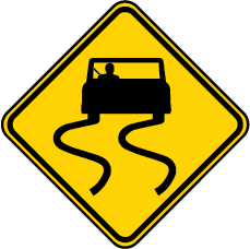 Some locations along the highway have more crashes when there is snow, ice or wet pavement.
Milepost 31 to 38 is the highest elevation within the corridor and is especially at risk for snow and ice-related crashes.
The data shows that 38% of crashes along this section happened during snowy and icy conditions.
During our outreach, people shared that conditions such as ice, snow, fog, landslides and rocks on the road were listed as major safety issues.
Potential Solutions
Click on each tab below to learn more about potential solutions.
We don't have funding for these solutions as part of the study.
If funding became available, the cost and time it takes to implement would depend on the chosen solution.
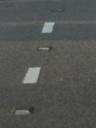
Update Missing or Old Reflective Markings and Signs
 About
About
We could update old or replace missing reflective markings and signs along the corridor. This could include:
- Reflective striping.
- Reflective signs.
- Delineators.
- Recessed pavement markers.
- Milepost signs.
Benefits
By updating old and replacing missing markers and signs, drivers would have more awareness and visibility when it is dark or the road is wet.
Estimated Cost and Other Considerations
The cost would vary depending on the option.
Road Narrowing Warning Signs
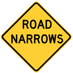 About
About
We could install warning signs that notify drivers that the road is narrowing ahead.
Benefits
These warning signs could alert drivers to be more cautious, as vehicles may slow down as lanes narrow.
Estimated Cost and Other Considerations
This solution would cost about $1,500 per sign. We would include this work as part of a larger project.
Narrow Bridge Warning Signs
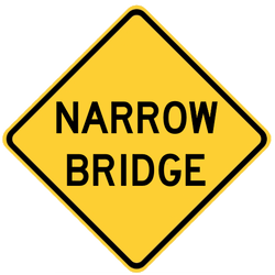 About
About
We could install warning signs that notify drivers that there is a narrow bridge ahead.
Benefits
These warning signs could alert drivers to be more cautious, as vehicles may be slowing down.
Estimated Cost and Other Considerations
This solution would cost about $1,500 per sign. We would include this work as part of a larger project.
Repaving Rough Pavement
 About
About
We could repave areas with rough pavement and use a type of pavement that is better for wet conditions. We could also correct settled roads and reinforce the pavement.
Benefits
By installing pavement that is better for wet conditions along curves and intersections, we may be able to help reduce some lane departure and wet road crashes.
Estimated Cost and Other Considerations
The cost would depend on the treatment. We would include this work as part of a larger project.
Safety Corridor Evaluation
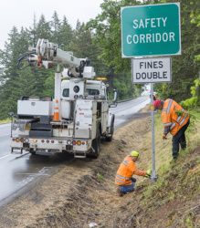 About
About
We could review OR 6 to see if sections meet the criteria to be a safety corridor. Safety corridors are about two to 10 miles in length.
Benefits
If a section of OR 6 met the criteria and became a designated safety corridor, then it could have more enforcement and double fines for traffic violations. Drivers may also be asked to turn on headlights during the day, reduce their speed and refrain from passing.
Estimated Cost and Other Considerations
This solution would cost about $1,500 per safety corridor sign. There would be additional costs to review the corridor to see if it meets the criteria. If it meets the criteria, the corridor would be added to the list and compete with corridors across the state for designation.
Weather Warning System
 About
About
We could install temperature gauges, cameras and message signs so drivers can see current conditions and so we could alert drivers when we're recommending an alternate route.
Benefits
The weather warning system would include temperature and moisture detection so drivers could be alerted when pavement conditions may be poor or difficult to drive in. Drivers would know to use caution during weather events and know when we advise an alternate route.
Estimated Cost and Other Considerations
The cost would vary depending on the measurement system, signs and connections between all of the different pieces. The cost would likely be significant.
Install Traffic Cameras
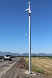 About
About
We could install traffic cameras with temperature gauges so TripCheck can reflect more accurate road conditions.
Benefits
By having cameras and more accurate temperature information on TripCheck, drivers can know before they leave what driving the corridor may look like. Drivers could plan ahead and take a different route or use caution during weather events.
Estimated Cost and Other Considerations
This solution would cost about $55,000 per location. This does assume that internet or some other connection is installed in the area. The cameras would require power to operate and would be costly to maintain.
Variable Message Signs
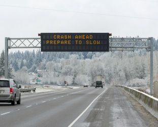 About
About
We could install variable message signs to alert drivers of incidents, conditions ahead, travel times or messages to emphasize driving safely.
Benefits
By having message signs along the corridor, drivers could be more informed when there are unexpected crashes or incidents ahead so they can use caution. We could also help set drivers' expectations for travel time.
Estimated Cost and Other Considerations
This solution would cost about $600,000 per location. This work would be part of a larger project.
Variable Speed Guidance System
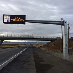 About
About
We could install variable message signs to provide updated speed limits based on winter weather.
Benefits
By having message signs along the corridor, drivers could be warned about conditions so they can drive more cautiously during winter conditions.
Estimated Cost and Other Considerations
This solution would cost about $600,000 per location. This work would be part of a larger project.
Chain Up Areas
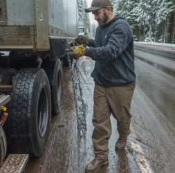 About
About
We could install areas where drivers can put on their snow chains. This could be done by either widening the shoulder, converting locations that already have the space, or passing lanes that are short.
Benefits
This would create a space where drivers could pull over and put on their snow chains during winter conditions. This could be especially helpful for trucks and other large vehicles.
Estimated Cost and Other Considerations
The cost would vary depending on the work. If we needed to widen the road, it would cost more.
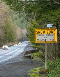
Updated Snow Zone Signs
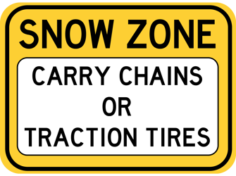 About
About
We could install updated snow zone signs that can be activated remotely.
Benefits
Updated signs that can be turned on remotely mean we could alert travelers quicker of road conditions, without sending staff to sign locations along the corridor.
Estimated Cost and Other Considerations
The cost would vary.
Poor Pavement and Landslides
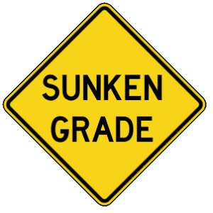 This is one of the main issues for OR 6 we heard when we talked with the community. There are many areas of unstable slopes that have led to poor pavement conditions. Areas with unstable ground will require more complex and generally more expensive treatments.
Milepost 28 to 37 is the main area on the corridor with unstable slopes. Milepost 32 to 37 is the area with the most slides. We're working on stabilizing an active slide at milepoint 34.8.
Potential Solutions
Click on each tab below to learn more about potential solutions.
We don't have funding for these solutions as part of the study.
If funding became available, the cost and time it takes to implement would depend on the chosen solution.
Rough Pavement Warning Signs
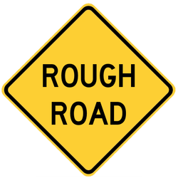 About
About
We could install warning signs that notify drivers that rough pavement is ahead.
Benefits
These signs would alert drivers to use caution and be aware that other vehicles may slow down as they go through rough pavement areas.
Estimated Cost and Other Considerations
This solution would cost about $1,500 per sign. The work would be included as part of a larger project.
Address Unstable Slopes
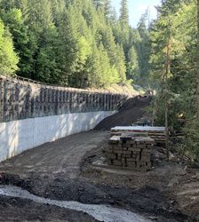 About
About
As part of larger projects, we could address unstable slopes in the corridor.
Benefits
By addressing unstable slopes we could help prevent landslides and other events, our staff wouldn't have to spend as much time caring for these locations, the pavement may stay in better condition and drivers may feel more comfortable going through these areas.
Estimated Cost and Other Considerations
This solution would cost about $38 million to repair our 18 highest-priority sites. We estimate it would cost about $114.8 million to repair all of the unstable slopes in the corridor.
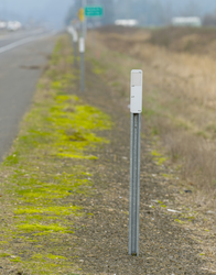
Cell Phone Reception
![]() An overall lack of cell phone reception along the highway creates challenges with reporting and responding to crashes. Drivers are concerned that when a crash happens, they'd need to leave the site to find cell service to call for help. When a driver leaves the site, it makes it harder for them to remember or describe the location of the crash. This can make it take longer for emergency services to respond.
An overall lack of cell phone reception along the highway creates challenges with reporting and responding to crashes. Drivers are concerned that when a crash happens, they'd need to leave the site to find cell service to call for help. When a driver leaves the site, it makes it harder for them to remember or describe the location of the crash. This can make it take longer for emergency services to respond.
There is also limited phone or data lines along the highway. This is partly because of limited space and electricity access along the highway.
Potential Solutions
Click on each tab below to learn more about potential solutions.
We don't have funding for these solutions as part of the study.
If funding became available, the cost and time it takes to implement would depend on the chosen solution.
Fiber Communications
 About
About
We could install fiber communication lines along the corridor.
Benefits
By installing more fiber communication lines, drivers would likely have better cell service and could report incidents, reach family or friends during an emergency and navigate the corridor easier.
Estimated Cost and Other Considerations
The cost is unknown at this point for this potential solution.
Install Intelligent Transportation System Equipment and Warning Systems
About
If more fiber communications are installed along the corridor, we'd have the tools to be able to add more warning system solutions we've outlined for other issues along the corridor.
Benefits
More technology and warning systems would allow us to monitor the corridor more efficiently. We'd be able to change or manage the message boards alerting drivers as needed and change things remotely in some cases.
Estimated Cost and Other Considerations
Improvements would be part of larger projects.
Risky Driver Behavior
 We've heard concerns, and our data supports them, that drivers are going too fast, passing vehicles in unsafe ways and sometimes driving impaired.
Overall, 49% of crashes that are fatal or cause serious injuries within the area involved at least one of the following risky driving behaviors:
-
Impaired driving.
-
Speeding.
-
Unsafe passing.
-
Careless or reckless driving.
-
Distracted driving.
Potential Solutions
Click on each tab below to learn more about potential solutions.
We don't have funding for these solutions as part of the study.
If funding became available, the cost and time it takes to implement would depend on the chosen solution.
Safe Driving Media Campaign
 About
About
We could develop a media campaign for safe driving. We could cover topics like:
- Speeding.
- Impaired driving.
- Passing opportunities and behavior.
- Setting expectations for travel time in varying conditions.
- Winter weather driving.
Benefits
If we increase driver awareness of their impacts on other drivers, they may be more cautious. We'd also be setting appropriate expectations for how to drive through the corridor.
Estimated Cost and Other Considerations
The cost would vary depending on the campaign and how long it runs.
Evaluate Funding Opportunities for Increased Enforcement
 About
About
We could evaluate funding opportunities to support more state, county and other local enforcement along the corridor. If OR 6 meets the criteria to become a safety corridor, more funding opportunities could become available.
Benefits
Increased enforcement in the area could encourage drivers to follow the speed limit and pass others appropriately. More responders would be in the area and be closer if a driver needed help.
Estimated Cost and Other Considerations
The cost would vary. Increasing enforcement in the area would be dependent on available personnel.
Install Solutions to Encourage Safer Driver Behavior
 About
About
We could install signs, delineators and rumble strips to help encourage safer driver behavior. This could include:
- Wildlife warning signs.
- Gateway signs to introduce access points like businesses or pedestrian/bicycle activity.
- Speed feedback signs so drivers know how fast they're going.
- Delineators.
- Rumble strips.
- Weather warning signs.
Benefits
By installing warnings, drivers will have notice of what they can expect along the corridor and may drive more cautiously.
Estimated Cost and Other Considerations
The cost would vary.
Note: The costs listed are rough estimates and may change. They only include the cost to install, not ongoing maintenance.
Click the "+" or the title below to view the information in each section.
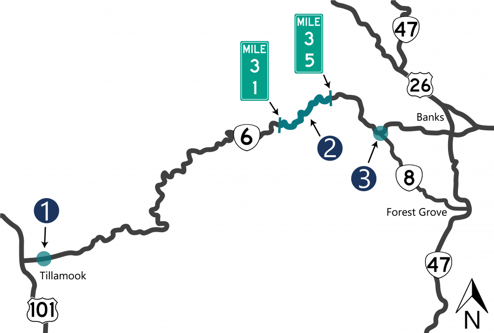
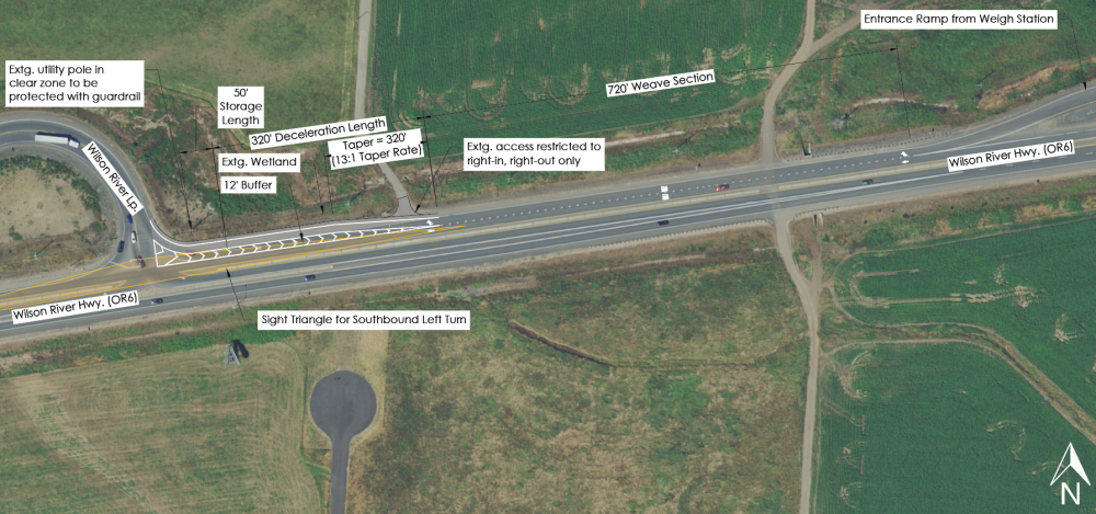
Wilson River Loop East Intersection, Milepoint 2 to 2.1
There have been more crashes than we'd expect for this type of intersection. We identified the intersection as a high-priority safety issue in 2019 and 2020.
Between 2016 and 2020, there were 15 reported crashes:
-
14 were turning crashes.
-
One was a fixed object crash.
-
Out of the 15 crashes, one had severe injuries.
Other issues at this location:
-
The weigh station that's east of the intersection. Semi trucks are merging back onto the highway, as others are trying to slow down to turn right.
-
Cars in the westbound right turn lane block the view for drivers waiting to make a southbound turn.
Potential Solutions
Click on each tab below to learn more about potential solutions.
We don't have funding for these solutions as part of the study.
If funding became available, the cost and time it takes to implement would depend on the chosen solution.
Modify the Right-Turn Lane
About
We currently have a project to modify the right-turn lane at this intersection. The project will create a 12-foot buffer between westbound traffic and the right turn lane.
Benefits
This will improve sight distance so drivers on Wilson River Loop can see past westbound OR 6 drivers turning right on Wilson River Loop. The buffered right-turn lane will also make travel paths more distinct for drivers wanting to turn left onto Wilson River Loop.
Estimated Cost and Other Considerations
We've started the design for a project at this intersection. Its estimated cost is $727,550.
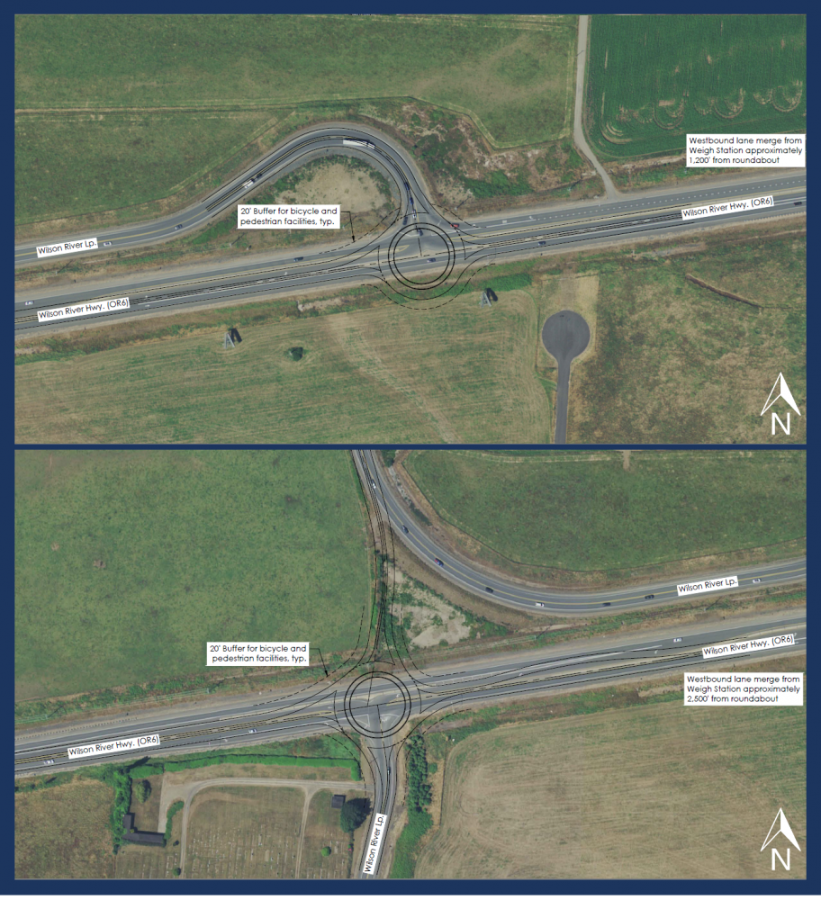
Complete an Intersection Control Evaluation and Install a Roundabout
About
To consider a roundabout, we'd need a full evaluation and analysis to see how many lanes and exact location best serves the long-term community needs. Options could include:
- Install the roundabout at the current OR 6 Wilson River Loop intersection.
- Realign Wilson River Loop and install the roundabout at the southern Wilson River Loop intersection.
Benefits
Making a stop-controlled intersection into a roundabout helps reduce injury crashes. Roundabouts help slow speeds.
Estimated Cost and Other Considerations
The current project helps address the types of crashes being reported at this intersection. A roundabout at this location may cause us to deal with other factors, like the weigh station just east of the intersection, which could cause additional cost and time. The estimated cost to install a roundabout in this area would be about $7.8 to $9.8 million.
Milepoint 31 to 35
This section of OR 6 has many curves, poor pavement conditions and unstable slopes.
-
This section had the highest number of severe crashes in the corridor, often between mileposts 33 and 34.
-
From 2016 to 2020, there were 65 reported crashes between mileposts 31 and 35.
-
Seven of the crashes had fatal or severe injuries.
-
12 were head-on or sideswipe crashes.
-
45% were during snow or ice events.
-
18% were on wet pavement.
-
37% were when it was dark, dawn or dusk.
-
-
There are several short passing lanes at sections with curves. Some of the passing lanes don't meet the current standards.
-
This area has more snow and ice-related reported crashes.
-
The pavement is in poor condition throughout a lot of this section.
-
Unstable slopes are common in this section.
Potential Solutions
Click on each tab below to learn more about potential solutions.
We don't have funding for these solutions as part of the study.
If funding became available, the cost and time it takes to implement would depend on the chosen solution.
Install Delineators and Recessed Pavement Markers and Repair Pavement
About
 We could:
- Install delineators and recessed pavement markers so drivers can see that they're approaching a curve.
- Repair the rough pavement with a type of pavement that is better for wet conditions.
- Correct settled roads and reinforce the pavement.
- Review the road at milepoint 30.5 to see if we can improve drainage.
Benefits
All of these improvements would make the area more visible, so drivers will better know what to expect and can slow down.
Estimated Cost and Other Considerations
The cost would vary.
Install a Weather Warning System and Modify Passing Lanes
About
We could install a weather warning system to inform drivers when snow and ice are present. We could also modify passing lanes, removing short lanes or making them longer.
Benefits
A weather warning system would alert drivers when they need to use caution and encourage them to drive at appropriate speeds. By modifying the passing lanes we'd help prevent higher speeds and quick merges.
Estimated Cost and Other Considerations
The cost would vary. As part of a project for this area, we'd look to see if the intersections to make sure they are wide enough for vehicles to turn on and off of the side streets.
Solutions We've Implemented
 We've made some progress on OR 6 recently, by:
-
Installing curve warning signs where they were missing.
-
Reviewing unstable slopes in the corridor. We found how much it would cost to repair and maintain and created a prioritized list for repairs.
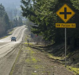
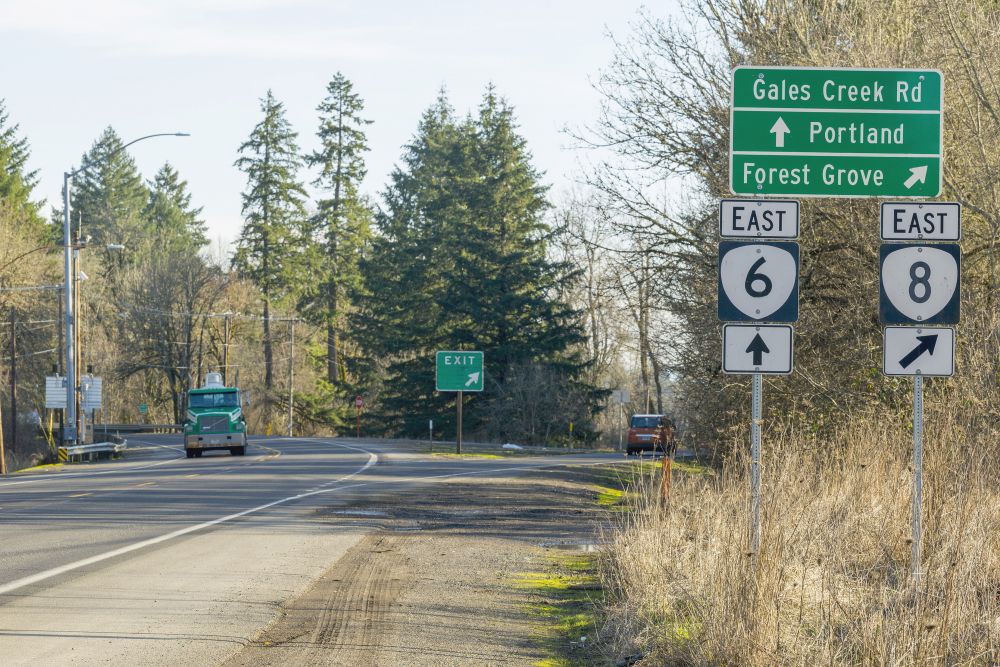
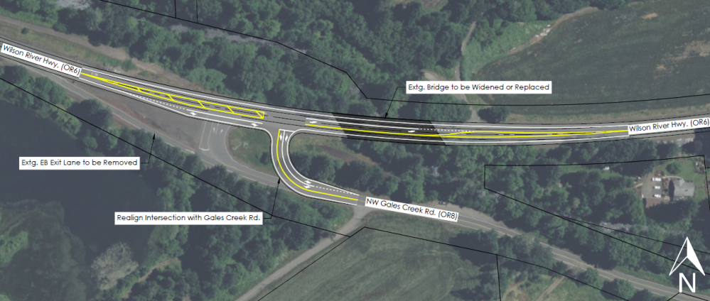
Gales Creek Road Intersection
There have been more crashes than we'd expect for this type of intersection.
Between 2016 and 2020, there were eight reported crashes:
-
None had fatalities or serious injuries.
-
Five crashes involved left turns. Four of these were northbound left turns, one was an eastbound left turn.
-
Four of the eight crashes were on wet pavement.
Based on the existing and projected traffic volume, there's a need for a westbound left turn lane. Constructing a westbound left turn lane would be challenging and costly because of:
-
The bridge over Gales Creek.
-
Limited sight distances, meaning how far ahead a driver can see.
-
Possible conflicts with Dorman Pond wetlands.
Potential Solutions
Click on each tab below to learn more about potential solutions.
We don't have funding for these solutions as part of the study.
If funding became available, the cost and time it takes to implement would depend on the chosen solution.
Install Delineators, Intersection Warning Signs and Striping and Improve Sight Distance
About
We could install delineators and improve intersection warning signs and striping. We could install more intersection-ahead warning signs and road name signs in advance. We could also install wider six-inch striping with recessed pavement markers to make the intersections more visible. We could also clear vegetation in the area to improve the sight distance so it's easier for drivers to see what is approaching.
Benefits
All of these improvements would make the intersection more visible, so drivers will better know what to expect and can slow down.
Estimated Cost and Other Considerations
The cost would vary. This work would be included as part of a larger project.
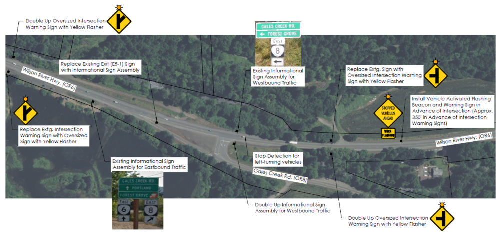
Install Intersection Warning System or Westbound Left Turn Lane
About
We could install an intersection warning system for drivers to know that there is traffic stopped on OR 6 waiting to turn onto Gales Creek Road or vehicles on Gales Creek Road are waiting to turn onto OR 6. We could realign NW Gales Creek Road and add a westbound left turn lane on OR 6.
Benefits
All of these improvements could help reduce crashes at the intersection.
Estimated Cost and Other Considerations
We estimate it would cost about $14.2 million.
Note: The costs listed are rough estimates and may change. They only include the cost to install, not ongoing maintenance.

Stay Connected
 You can always learn more about the project, find out about upcoming events and stay connected by visiting the project webpage.
 If you have not already, sign up to receive future updates about this project.

Contact
Caroline Crisp
Senior Transportation Planner
503-313-6812
caroline.crisp@odot.oregon.gov
Ken Shonkwiler
Project Manager
971-326-0232
kenneth.d.shonkwiler@odot.oregon.gov
Please help us spread the word about this online open house.
Feel free to share this with your friends and neighbors so that we can get their feedback.
Thank you for participating!