
Interactive Map of Construction Projects
To see where the work will be located, view the interactive map above. Click on the construction cones for more details.
Click and drag to explore the map. Click lines, shapes and icons for more information. Turn layers on and off and browse the list of projects by clicking the  button in the upper left of the map window. (You may need to turn off layers to select other objects underneath.) Map shapes and icons are provided for reference only, precise locations may vary.
Si desea obtener este información traducida al español, por favor llamar al 503-731-4128.
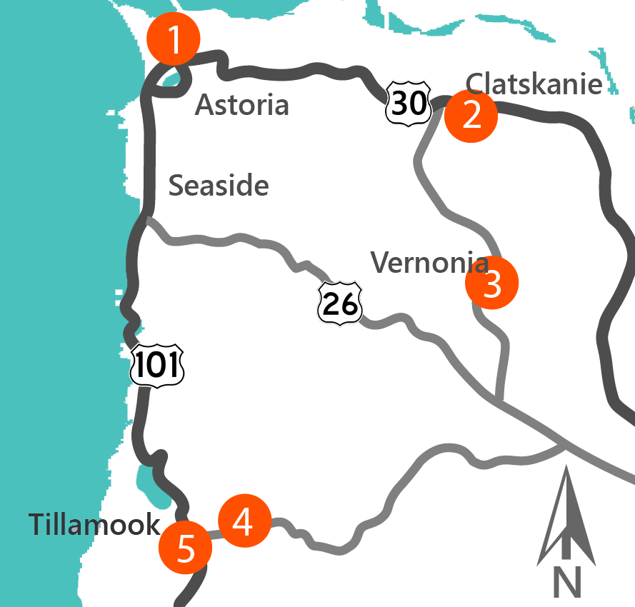
Stations


Learn more about the projects by clicking on each item below:
 About:
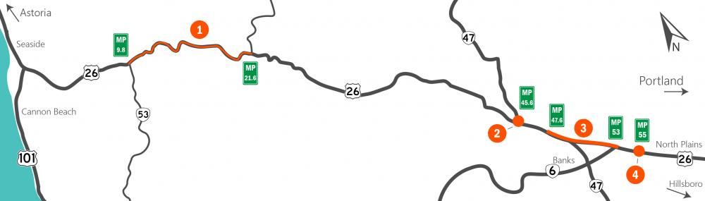
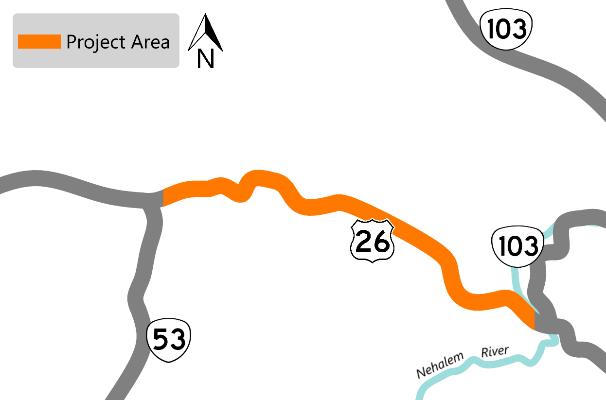
This section of the roadway between Necanicum Junction at OR 53 to the Nehalem River Bridge is in poor condition.
We will:
- Repave the highway.
- Install new striping and signs.
- Improve stormwater treatment.
- Install new guardrail.
- Modify the existing bridge rails.
Construction and Traffic Impacts:
We will not have full road closures, but expect delays and lane closures. Expect nightly closure of one lane from Sunday night through Friday morning 8 p.m. to 8 a.m. This nightly closure can be expected from milepost 9.80 to 9.85 and milepost 15.05 to 21.67 with no more than ½ mile impacted at one time.
More specific details will be determined after we have a contractor on board.
Timing:
Work is anticipated to start in May and continue through September 2021.
Location:
From mileposts 9.8 to 21.67
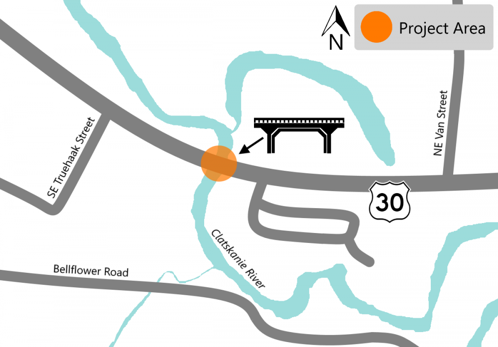
 About:
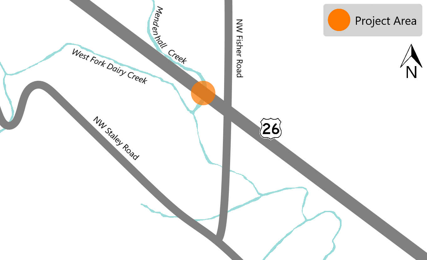
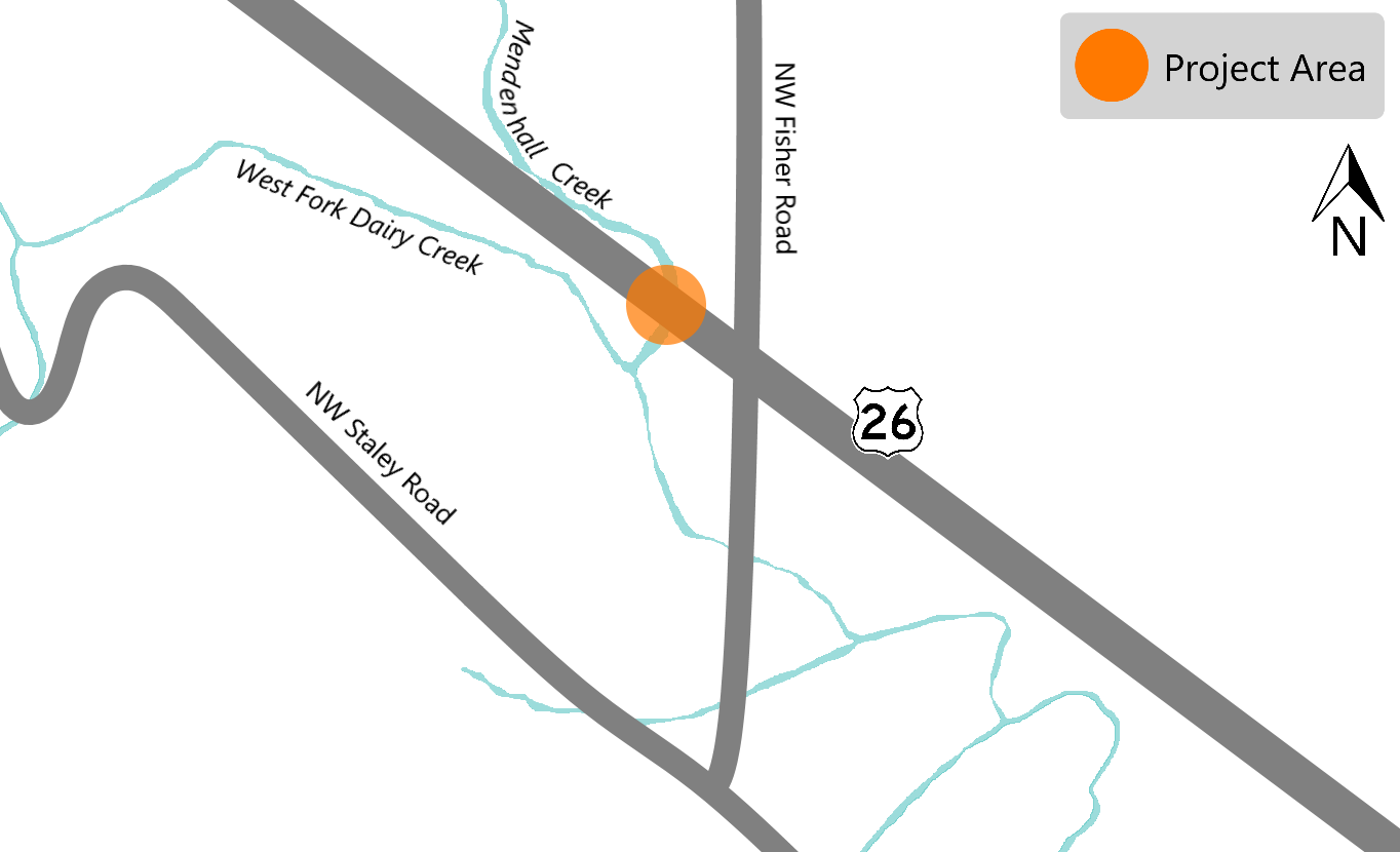
We are replacing the existing culvert with a single span concrete deck bridge. The new bridge will create an easier passage for native migratory fish like salmon and steelhead, some of which are listed as endangered species. Improving fish passages aligns with our commitment to the Oregon Plan for Salmon and Watersheds.
Project Details:
- Removal of the old culvert.
- Installation of a new single span bridge.
- Reconstruction of the streambed to encourage native fish migration.
Construction and Traffic Impacts:
During construction expect noise and cause short delays. We will maintain two lanes of traffic during construction.
Timing:
Construction will begin in 2021 and will continue through 2022.
Location:
Milepost 45.63
 About:
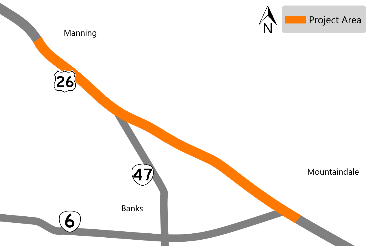
The section of roadway between Hayward Road to NW Mountaindale Road is in poor condition.
We are:
- Repaving the driving surface.
- Paving the ramps on OR 47.
- Apply permanent striping.
- Replace two bridge surfaces - including waterproof membranes under the asphalt to protect the bridge.
Construction and Traffic Impacts:
During construction expect delays up to 20 minutes. There will be lane closures with the work zone being controlled by flaggers. Work is expected to occur at night.
Timing:
Construction will begin in 2021.
Location:
From mileposts 47.6 to 53
 About:
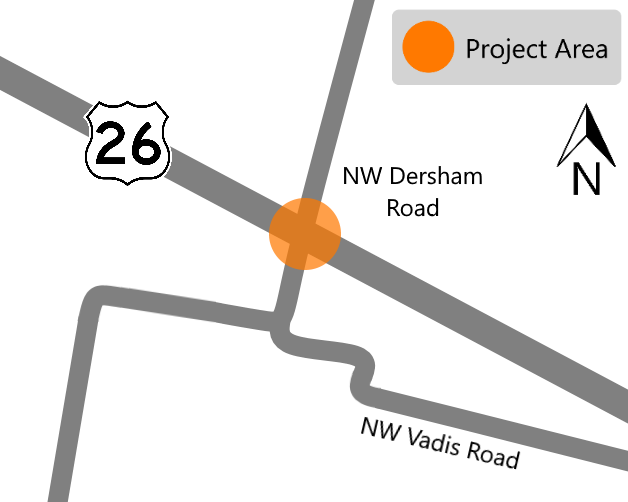
We will install protective bridge screening to help prevent objects from being dropped onto the roadway below. These falling objects could injure motorists and pedestrians or create road hazards.
Construction and Traffic Impacts:
We will need to close a lane on U.S. 26 under the section of the bridge where the crews are working. The lane closed will shift as the crews install the screening across the bridge. Work is estimated to be done at night.
Timing:
Construction will begin in 2021.
Location:
Westbound Exit 55 off U.S. 26
Learn more about the projects by clicking on each item below:
About:
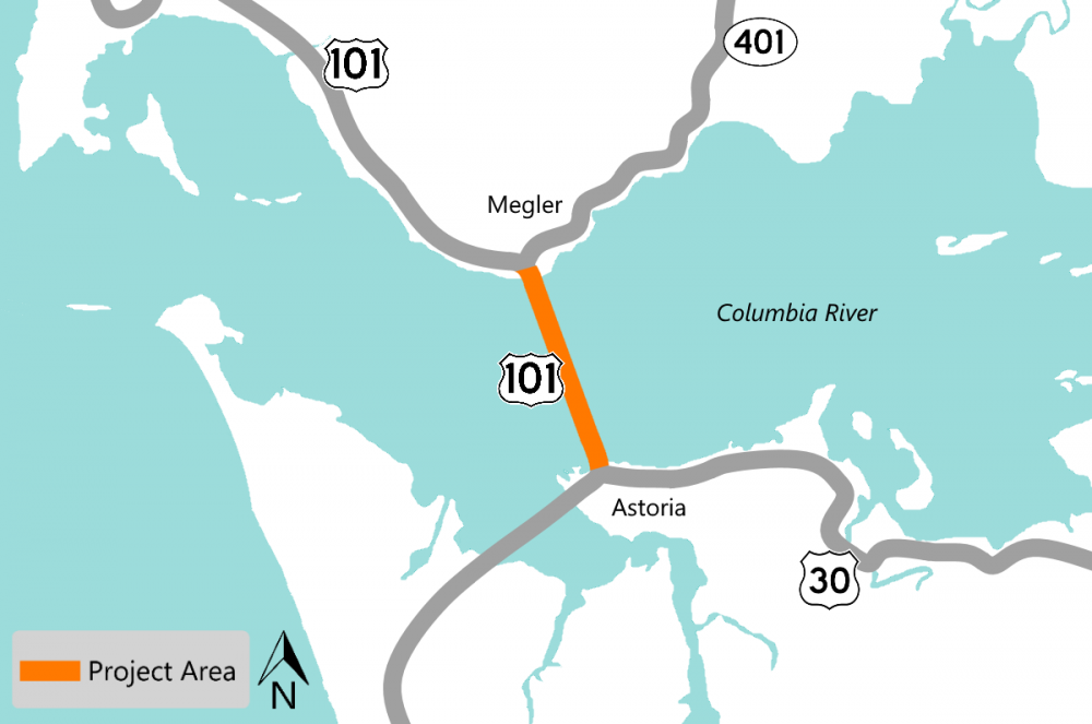 The Astoria-Megler Bridge is a multi-span bridge over four miles in length. The bridge was built back in 1966. Repairs and painting are necessary for the health and longevity of the bridge.
Work includes:
-
Removing the original paint that contains lead as well as any added paint.
-
Painting under the bridge deck.
-
Repairing damaged steel.
-
Making other repairs as needed.
We will also build structures to prevent or contain any paint and debris from falling into the Columbia River.
Construction and Traffic Impacts:
During construction, plan for single lane traffic with flaggers and up to 20 minute delays. Lane delays will be allowed anytime on weekdays. Travelers should drive through the area with caution. Oregon State Police will be enforcing the speed limit through the work zone.
TripCheck will have the most accurate construction impact information.
Timing:
Construction will begin in 2021.
Location:
Mileposts 1.78 to 3.32.
About:
 Several of the bridge footings are exposed and need to be repaired. If the erosion around the footings isn't repaired it could compromise the integrity of the bridge.
We will:
- Remove any sediment near the footings.
- Place rocks at locations along the footings to provide additional foundation support.
The bridge is located on a designated truck route and addressing the issues now will allow the bridge to remain in service following high water events.
Construction and Traffic Impacts:
During construction, most of the work will be done under the bridge. When lane closures are needed, the work zone will be controlled by flagging.
Timing:
Construction is estimated to begin in 2021.
Location:
Milepost 61.2
About:
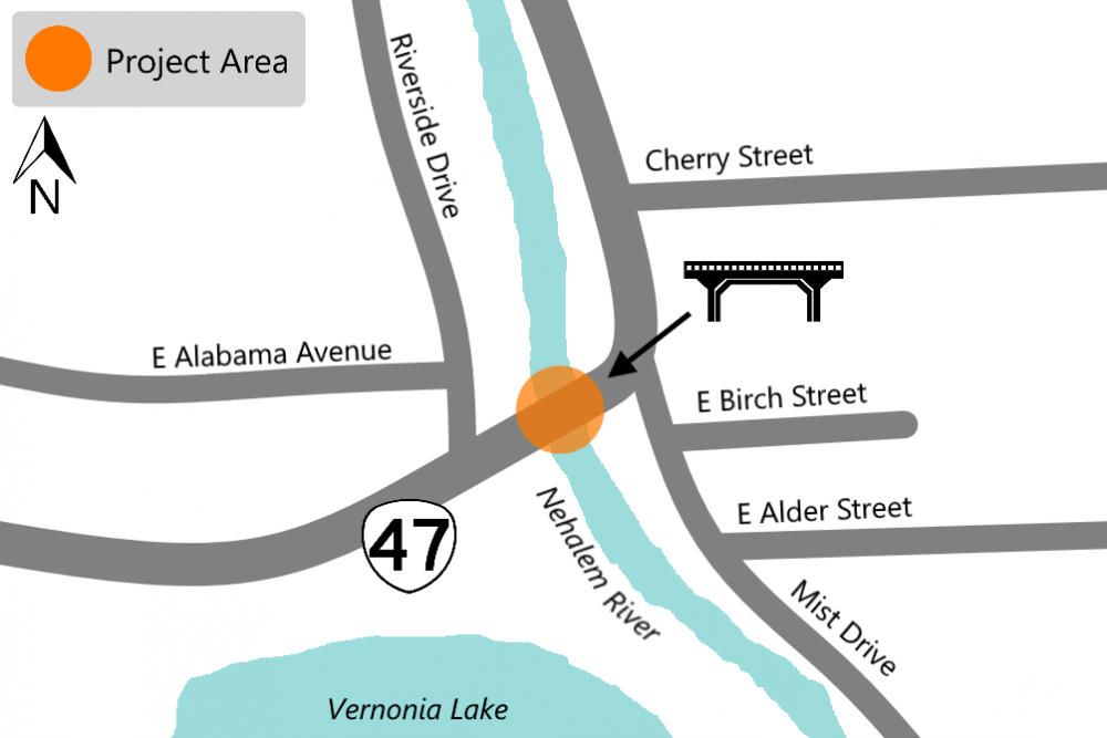 The Nehalem River Bridge is a historic bridge on OR 47 and needs to be repaired. Built in 1939, the repairs on the bridge are needed or it will continue to deteriorate and require costly maintenance.
As part of the project we will:
- Remove the rust that has built up between the steel plates.
- Replace damaged steel portal beams.
- Replace rusted rivets and bolts.
- Repaint the bridge to protect the bridge against the elements and future rust.
Construction and Traffic Impacts:
During construction expect noise and delays caused by lane closures.
Timing:
Construction is estimated to begin in 2021.
Location:
Milepost 61.2
About:
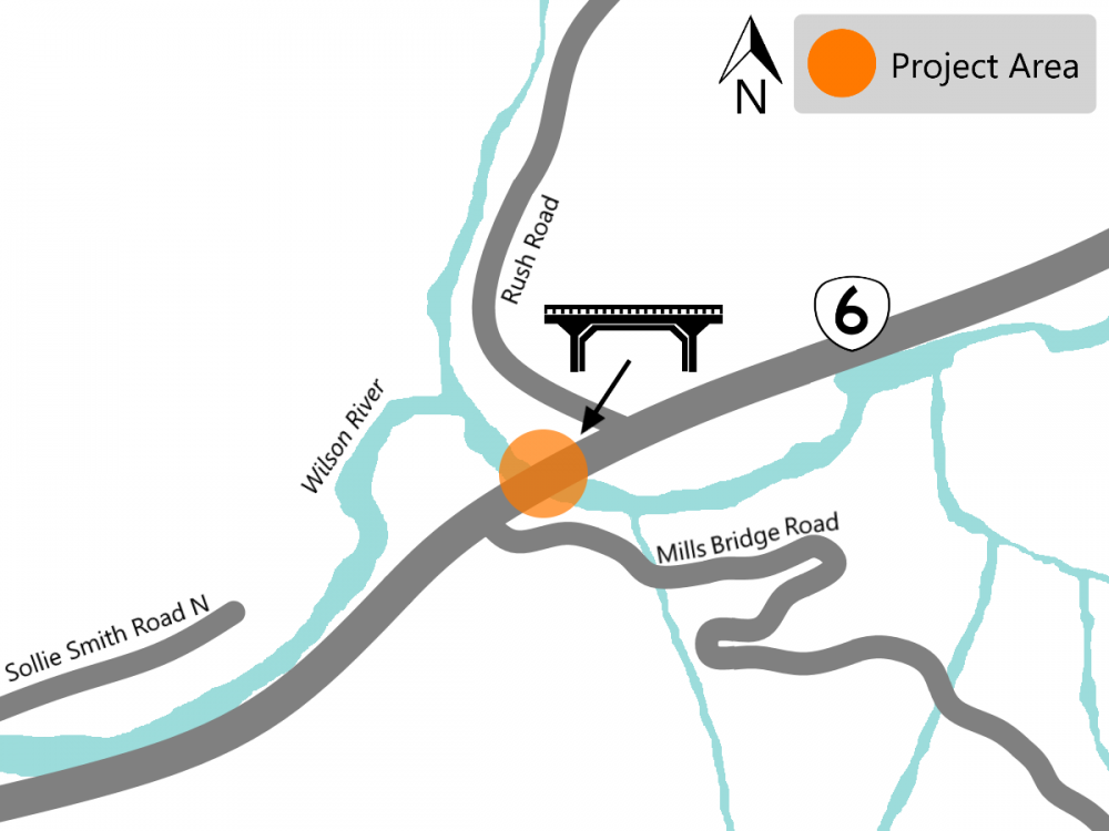 The Mills Bridge spans the Wilson River on OR 6 and needs to be repaired. If the issues are not addressed the bridge will continue to deteriorate and require costly maintenance.
As part of the project we will:
- Remove the rust that has built up between the steel plates.
- Replace around 100 rivets and bolts.
- Repaint the bridge to protect against the elements and future rust.
The bridge is on a designated truck route and fixing it now will avoid significant mobility impacts.
Construction and Traffic Impacts:
During construction expect noise and lane closures which will cause short delays.
Timing:
Construction will begin in 2021.
Location:
Milepost 5.7
About:
 Located in Tillamook County, this project will provide erosion repair to the existing bridge supports. Riprap, a type of large rock used for erosion control, will be placed at locations along the bridge supports.
Construction and Traffic Impacts:
During construction expect noise and lane closures which will cause short delays.
Timing:
Construction will begin in 2021.
Location:
Milepost 68
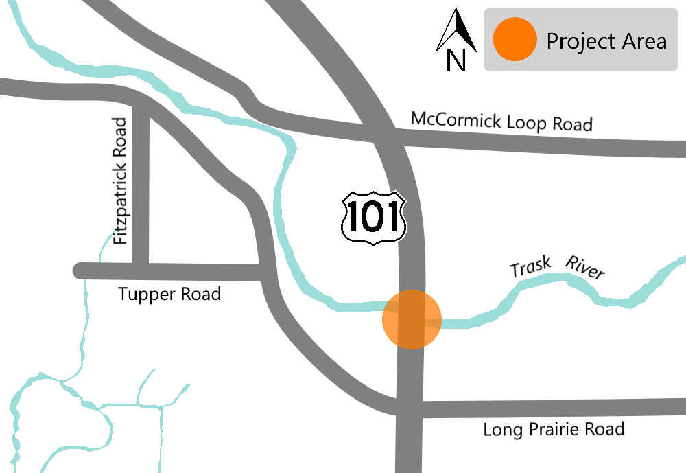
 About:
The project includes replacing the existing culvert. The new culvert will create an easier passage for native migratory fish like salmon and steelhead, some of which are listed as endangered species. Improving fish passage aligns with our commitments to the Oregon Plan for Salmon and Watersheds.
Project Details:
-
Removal of the old culvert.
-
Installation of a new culvert.
-
Reconstruction of the streambed to encourage native fish migration.
-
Roadway repairs, guardrail and striping within project limits.
Construction and Traffic Impacts:
There will be lane closures and delays up to 20 minutes during construction. We will maintain two way traffic will during the duration of the project. The projects will be done in stages to make sure that freight and passenger vehicles will be accommodated.
Timing:
Construction is estimated to begin in late 2021 or early 2022.
Location
Graham Creek at milepost 65.16
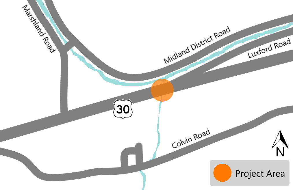
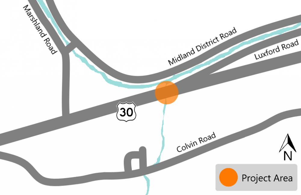
 About:
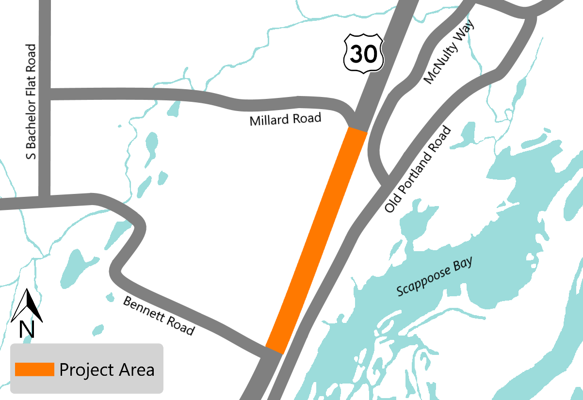

This project will improve the safety of U.S. 30 between Scappoose and St. Helens (from mileposts 25.7 to 27.2) in Columbia County by:
- Increasing the turning radius of the right turn lane from U.S. 30 onto Bennett Road by widening and restriping the roadway near the intersection.
- Restricting left turns onto U.S. 30 from Bennett Road by creating a median.
- Adding a traffic signal at U.S. 30 and widening Millard Road to provide protected access to U.S. 30 from Millard Road that will relieve traffic pressure.
- Upgrading the rail crossings at both Millard and Bennett Roads.
Construction and Traffic Impacts:
Expect delays and lane closures. Traffic on U.S. 30 will not be detoured. Only one intersection at a time will be impacted.
Timing:
Constructing estimated to begin in Spring or Summer 2021.
Location
U.S. 30 from 25.7 and 27.1
 About:
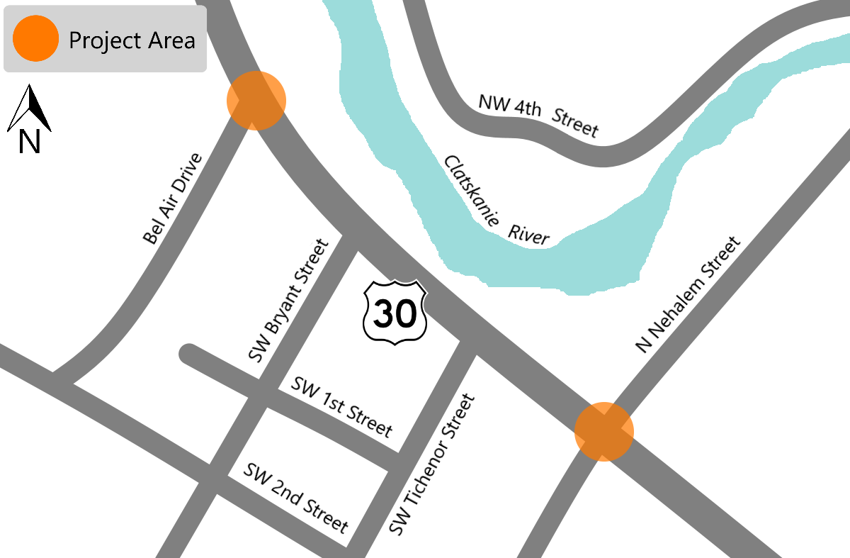
The project will make safety and ADA curb ramp upgrades at N Nehalem Street and Bel Air Drive where they intersect with U.S. 30.
At Bel Air Drive work will include removing the existing pedestrian ramps at all corners and installing new ADA compliant ramps.
At Nehalem Street, all the existing ramps will be removed and new compliant ramps will be installed. This intersection will also have new pedestrian signals and push buttons installed.
Construction and Traffic Impacts:
Expect minimal delays during construction, and:
- Only one corner of each intersection will be closed at a time.
- Work may occur at multiple intersections at the same time.
- Some work may require lane closures.
- Work is expected to be done during the daytime.
Timing:
Constructing estimated to begin in late 2021 or early 2022.
Location
Where U.S. 30 intersects with Bel Air Drive and Nehalem Street
To see where the work will be located, view the interactive map. Click on the construction cones for more details.
Click and drag to explore the map. Click lines, shapes and icons for more information. Turn layers on and off and browse the list of projects by clicking the button in the upper left of the map window. (You may need to turn off layers to select other objects underneath.) Map shapes and icons are provided for reference only, precise locations may vary.
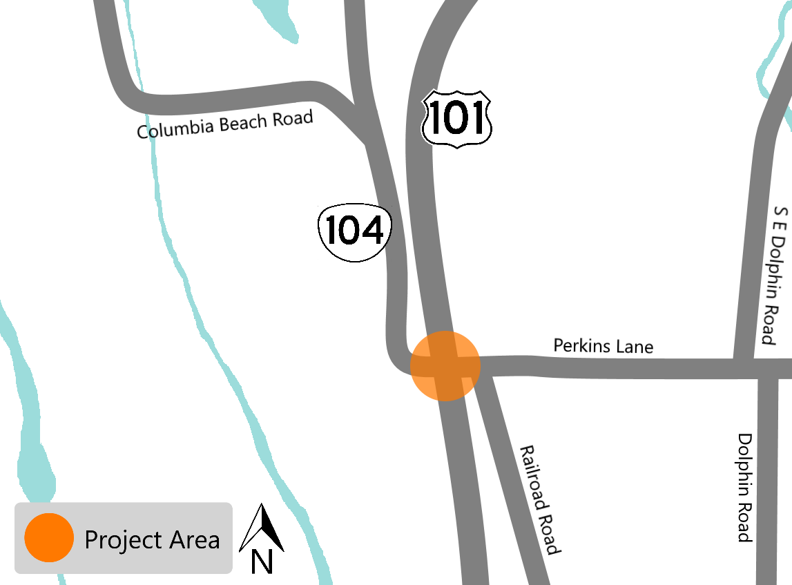 About:
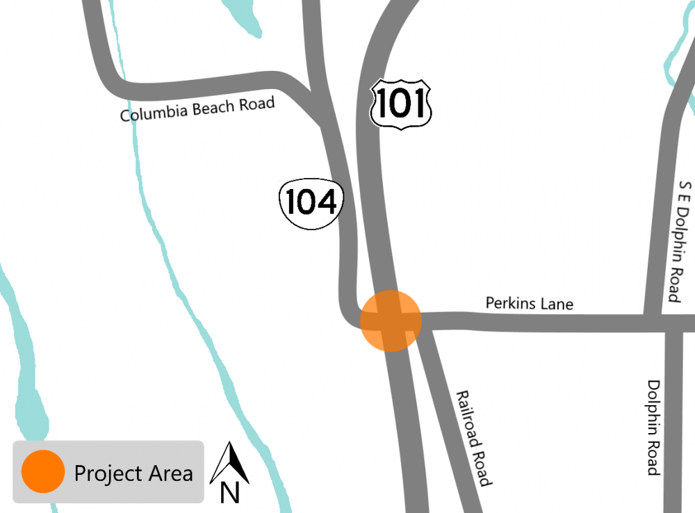
The intersection of U.S. 101 and Perkins Lane in Warrenton has frequent and severe crashes, most of which are caused by cars turning.
To reduce the potential and severity of the crashes, we will explore safety improvements including:
- Install left turn lane for northbound U.S.101 traffic, wanting to turn onto OR 104 to downtown Warrenton.
- Install a concrete separator.
- Install additional lighting at the intersection.
Construction and Traffic Impacts:
We plan for construction to take place at night. Travelers may experience traffic delays during construction times.
Timing:
Construction is estimated to start in late 2021 or in early 2022.
Location
Milepost 9.48 on U.S. 101
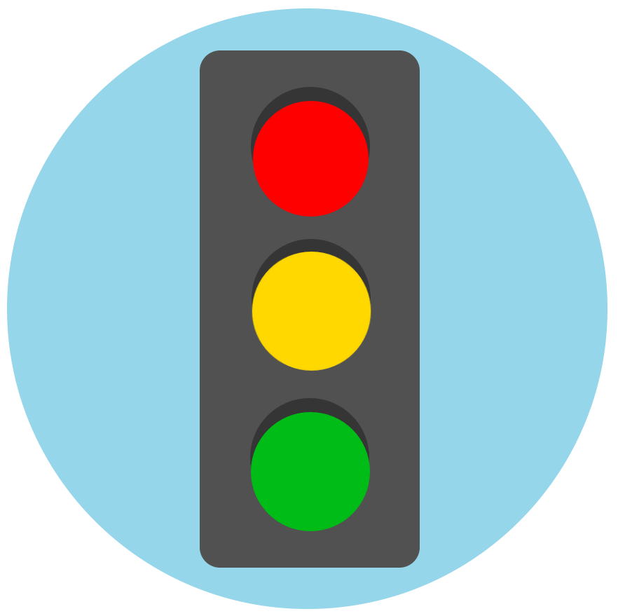 Improve safety by upgrading and making improvements to signals.
About:
 The purpose of this project is to reduce fatal and serious intersection crashes. This will be done by upgrading the equipment and using a combination of technology and visual enhancements.
We will be improving six intersections in Scappoose, five in St. Helens, one in Columbia City, two in Clatskanie, one in Rainier and five in Astoria.
At the identified intersections, we will:
- Replace signal heads where needed.
- Install reflective backplates behind the signal heads. This will draw the driver's eyes to the signal and increase their awareness and response to the traffic control device.
- Install advanced dilemma zone protection. This will enhance safety by adjusting the traffic control signal timing to reduce the number of drivers that may have difficulty deciding whether to stop or proceed during a yellow phase.
- Install video, thermal or radar detection at the intersections. This will adjust the timing of the signal from turning red while there are still cars in the intersection.
- Install new or modified lane use signs to help drivers navigate which lanes to use when approaching the intersection.
- Install new supplemental traffic signal heads –these are added to lights that do not currently have the lights with an arrow indicating it is okay to turn. These extra signal heads will mean drivers who want to turn and cross traffic at an intersection won't have to yield to oncoming traffic, they can turn at the prompt of a dedicated turn signal.
Construction and Traffic Impacts:
Periodic lane closures will be needed. The current plan is to:
- Keep one lane of traffic open in each direction when possible. There are times when the width of the road will mean closing one lane, at which time the work zone will be controlled by flaggers.
- Work on one traffic signal per intersection at a time.
- Work on one intersection on a corridor at a time.
Timing:
Construction will begin in 2021.
Locations:
Various locations in Astoria, Clatskanie, Columbia City, Rainier, St. Helens, Scappoose
 To create a more uniform and reliable curve warning system across the United States, the Federal Highway Administration (FHWA) has required that all curve signs meet the new standards.
About:
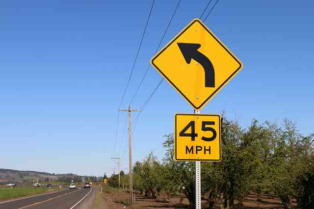
Over 50% of Oregon's curve warning and curve advisory speed signs do not meet current national standards. This is because of outdated technologies used in initial curve analysis, changes in driving habits, improvements in vehicle safety features and inconsistent curve advisory speed changes that have happened over the past several decades.
Upgrading and installing new signs will improve safety by having consistent curve advisory speeds and signs that meet the national standards.
Because many curves have posted advisory speeds that are lower than the current standards for safe driving, drivers often do not follow them. Instead, drivers travel five, ten, or more miles per hour over the posted advisory speed.
Construction and Potential Traffic Impacts:
Travelers can expect lane closures and delays up to 20 minutes where work is taking place.
TripCheck.com will have the most up to date information on where work is being done and what the traffic impacts may be.
Timing:
This project will be constructed in 2021.
Learn more about the projects by clicking on each item below:
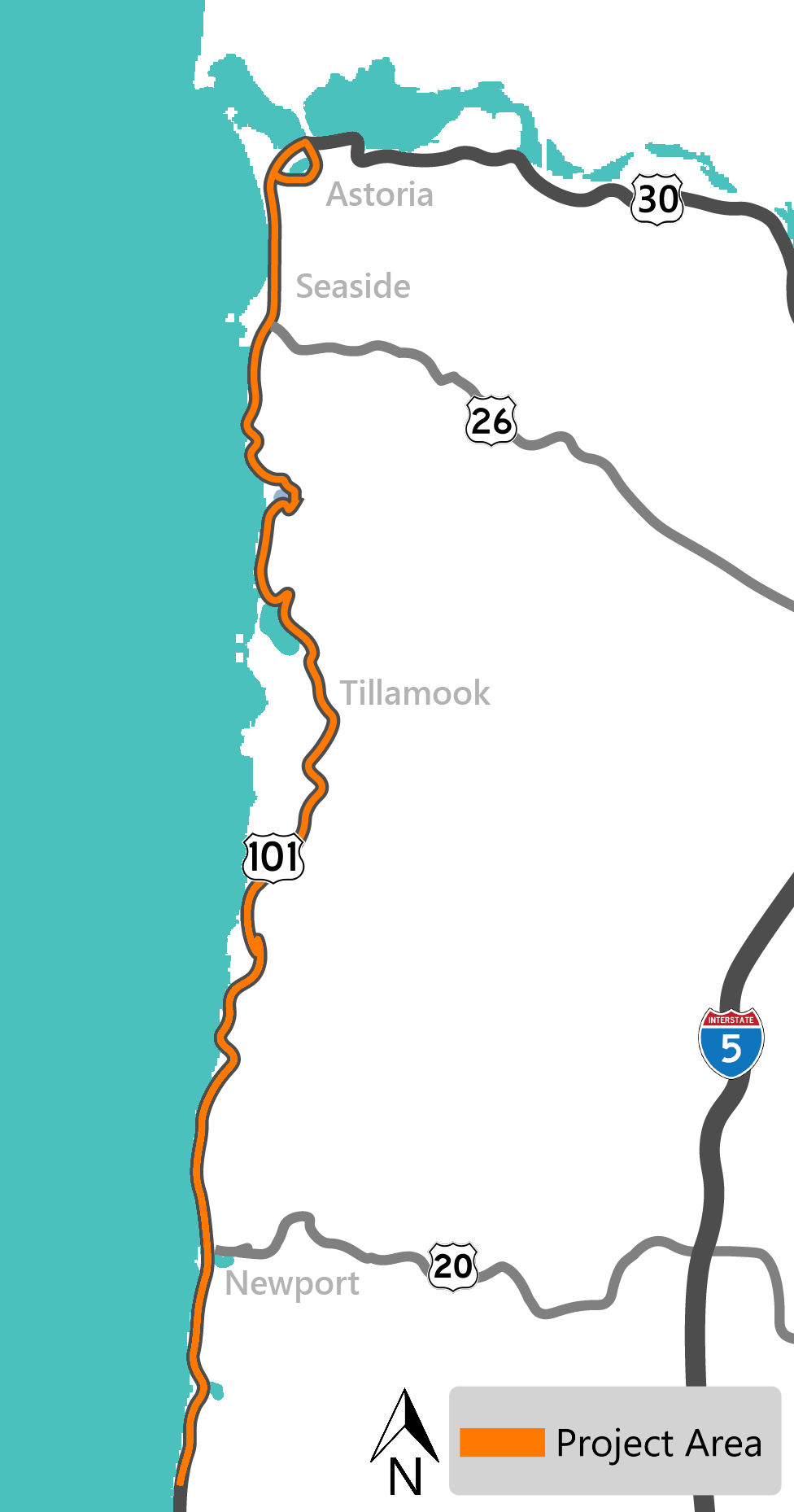
We will replace and add new signs at locations along U.S. 101 on the Oregon Coast.
Mileposts:
0 to 167
County:
Clatsop, Tillamook, Lincoln
Funding:
ARTS Program. $1,713,200
Click the map to enlarge.
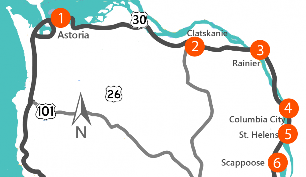
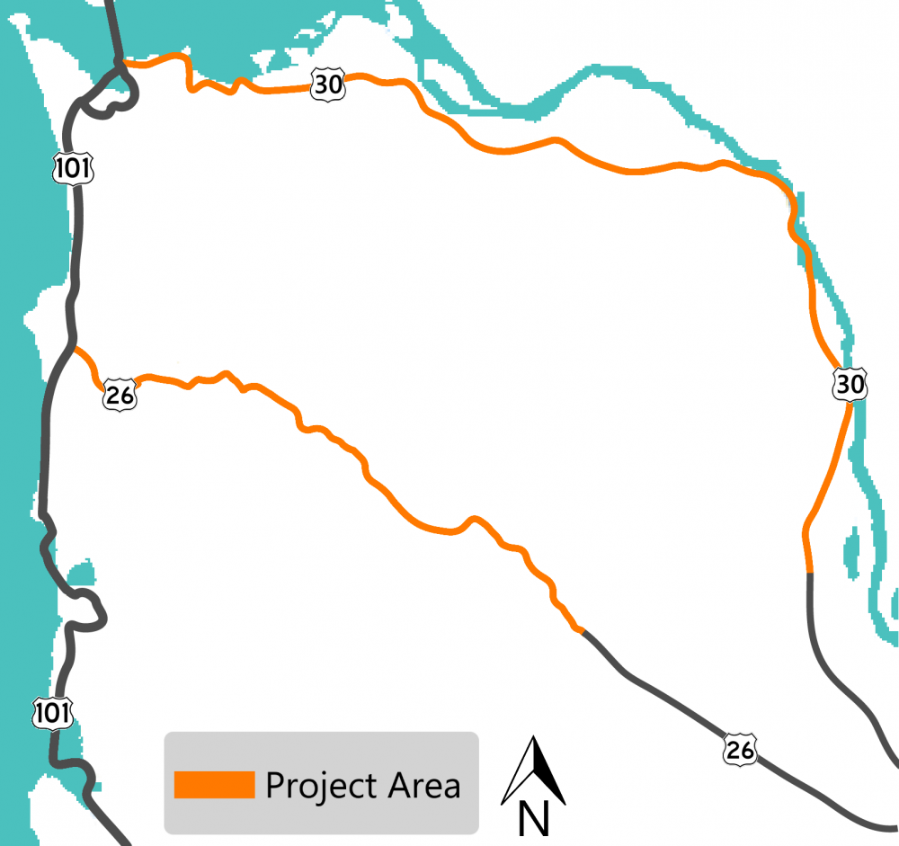 We will replace and add new signs on highways in the northern part of the Region.
Mileposts:
U.S. 30 – 18.37 to 99.34
U.S. 26 – 0 to 45.41
County:
Columbia, Clatsop, Washington
Funding:
ARTS Program. $1,809,509
Click the map to enlarge.
Curve Warning Projects on other highways in the region.

We will replace and add new signs at locations on Lincoln and Benton county highways.
Mileposts:
OR 34 – 0 to 58.6
OR 229 – 0 to 21.24
County:
Lincoln and Benton
Funding:
ARTS Program. $1,589,400
Click the map to enlarge.
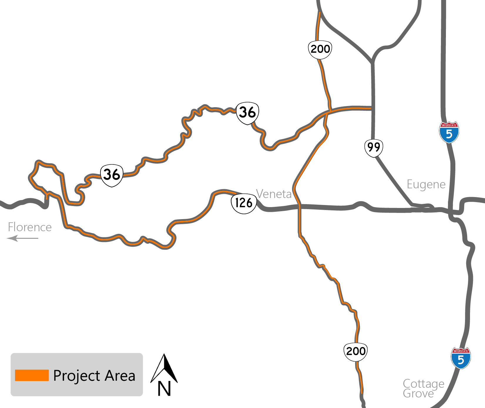
We will replace and add new signs along various highways in west Lane county.
Mileposts:
OR 126 – 14.37 to 41.07
Territorial Highway (OR 200) – .6 to 42.08
OR 36 – 0 to 51.59
County:
Lane
Funding:
ARTS Program, $1,004,400
Click the map to enlarge.
 There are two projects already under construction that will continue into 2021.
Learn more about the projects by clicking on each item below:
About:
 The bridge was built in 1963 and with heavy traffic usage, deterioration and direct exposure to the elements, and rapid changes in temperature, the bridge is in need of repair.
The project will:
- Repair damaged concrete
- Install cathodic protection
- Replace joints
- Bearing replacement
- Raise the lift span tower
Construction and Potential Traffic Impacts:
Most of the work that impacts the travel lanes will be done at night. There may be times when one lane closures occur to accommodate the equipment needed for the work and activities being done underneath the bridge.
A 14 day full night closure will occur in 2021 to replace the lift span bracing. During the night closures, traffic will detour onto the U.S. 101 Business route.
Timing:
This project is expected to be completed in late 2021.
Location:
U.S. 101 – New Youngs Bay Bridge
About:
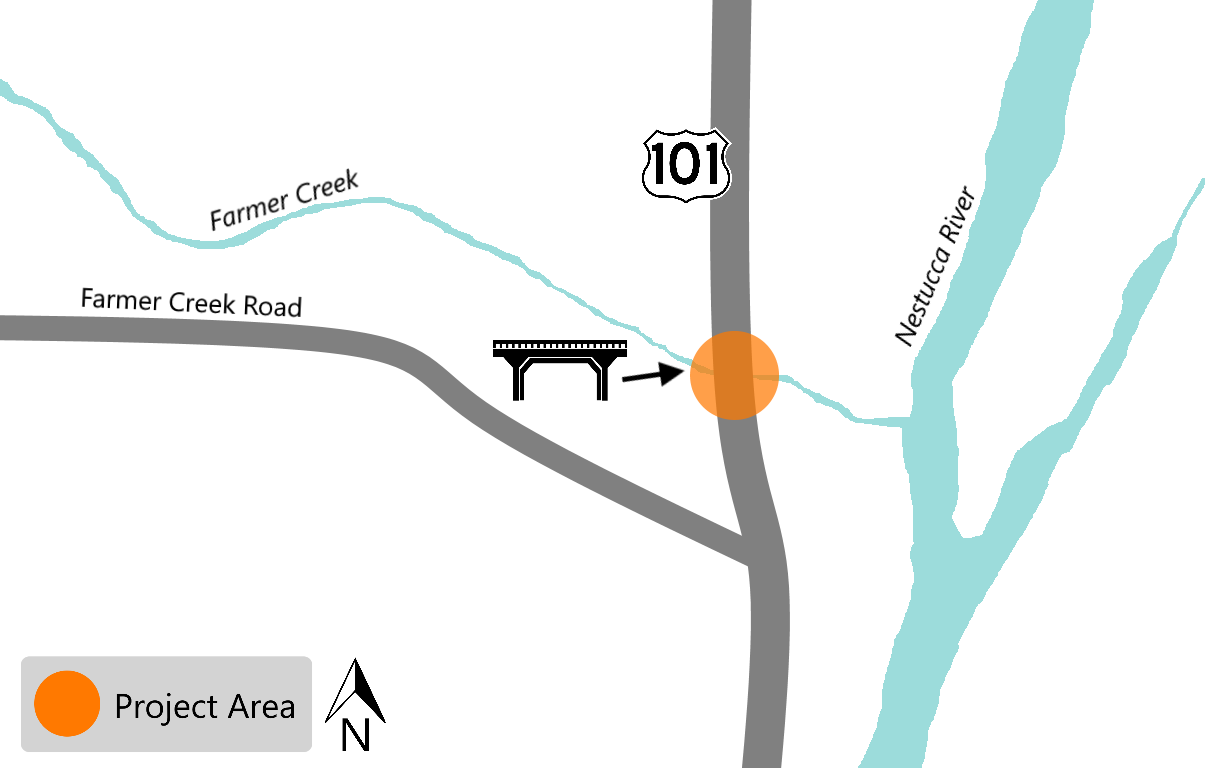
This project is to replace the more than 50 year old bridge whose timber deck is in poor condition. As part of the project, we will also realign and widen the existing roadway and provide new striping and traffic signs. New bridge guardrails and other improvements will be made to the wayside.
The road realignment will improve visibility for local residents, road and river users using Farmer Creek Road and coming in and out of the wayside.
Construction and Potential Traffic Impacts:
There will be lane restrictions and flagging for the duration of the project.
The wayside and boat launch will be CLOSED for stages during construction. Closure information and alternate boat launch information is posted at the wayside. During closures, river users will need to use alternate launches. To the north, use First Bridge Launch and to the south, you can use the Three Rivers Boat Ramp.
The most up to date traffic impacts and road closure information will be on TripCheck.com.
Timing:
This project is expected to be completed in late 2020 or early 2021.
Location:
U.S. 101 – Mileposts 82.9


Stay Connected
Visit Trip Check for the most up-to-date information and sign up to receive construction updates for Clatsop, Columbia, Tillamook and Washington counties.
![]()

Stay Connected
Visit Trip Check for the most up-to-date information and sign up to receive construction updates for Clatsop, Columbia, Tillamook and Washington counties.
![]()