
Additional Information
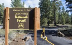
| ODOT is partnering with the Bend-Fort Rock Ranger District of the Deschutes National Forest to plan this project. This open house will be live until April 30, 2021. We value and invite your comments about the project after participating in the stations below. For additional information about the NEPA Analysis for this project and to submit comments regarding the project's environmental effects, please visit: https://www.fs.usda.gov/project/?project=57665. Thank you. |
Stations
= Page has questions.
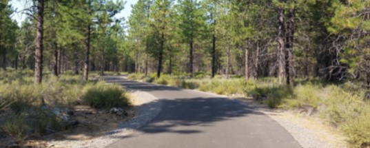
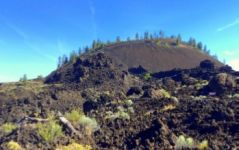
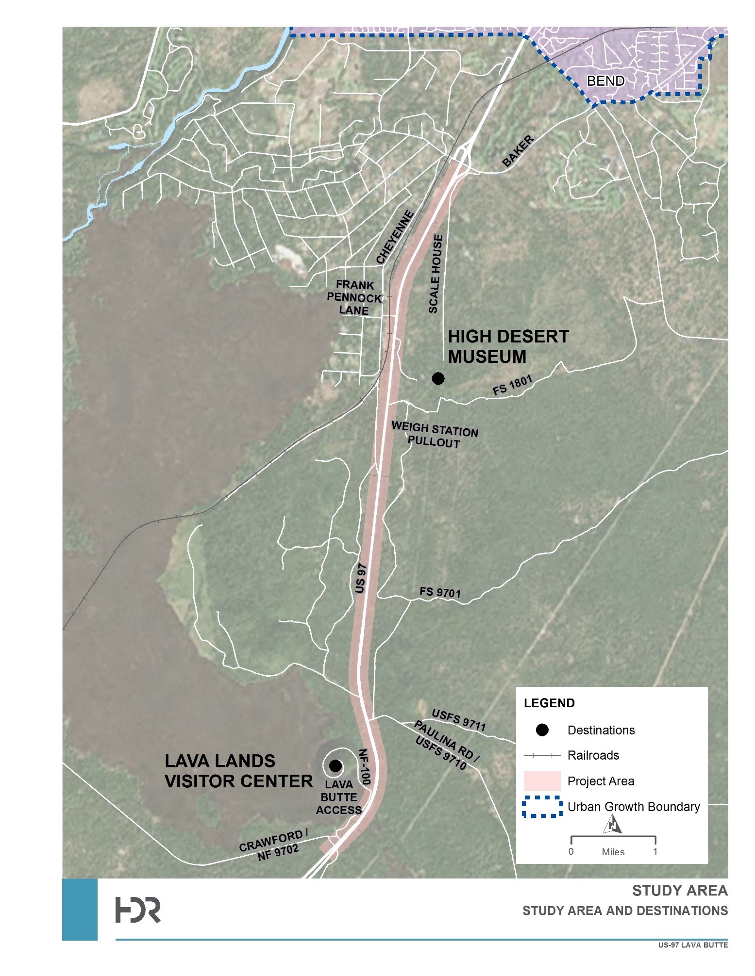
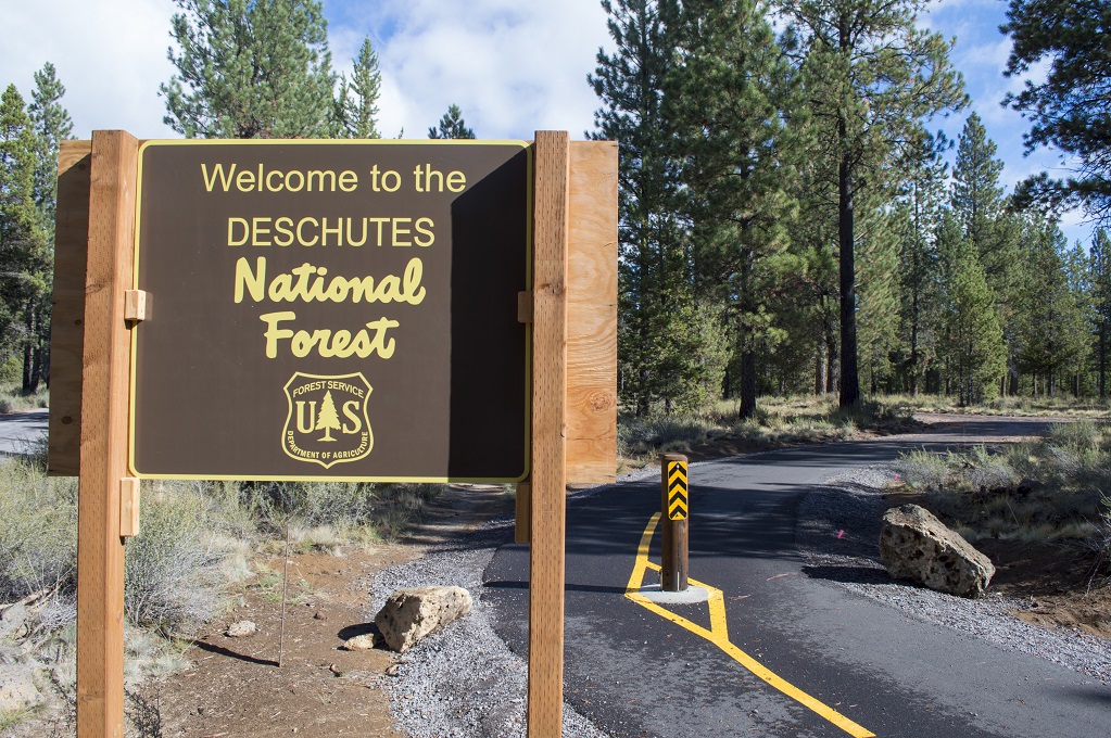
This project proposes to construct a multi-use paved path paralleling U.S. 97 south of the city of Bend. The path will provide access to the Deschutes National Forest and Newberry National Volcanic Monument and provide connections to the High Desert Museum, Sun Lava Trail and other recreation opportunities in the area.
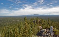
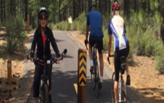
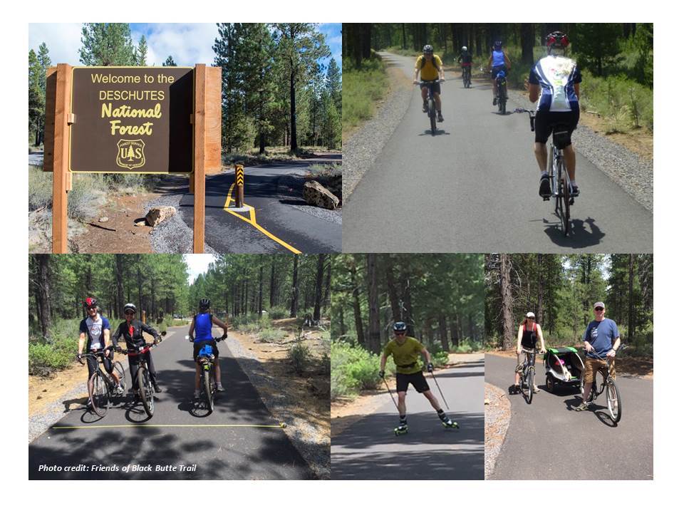
The trail is approximately six miles long, starting at the Baker Rd./Knott Rd. interchange and terminating at the Lava Lands Visitor Center at Lava Butte. The trail will weave through forest and the lava flows at Lava Butte, providing a unique user experience for all ages and abilities. The trail will be used by people walking, running, biking, etc. and would be closed to motorized use. The entire trail will comply with the Americans with Disabilities Act (ADA). Based on usage of similar nearby facilities, ODOT and the U.S. Forest Service estimate that more than 80,000 pedestrians and bicyclists will use the trail each year.
ODOT, in partnership by the U.S. Forest Service, received federal grants for the planning, design and construction of the U.S. 97 Multi-Use Trail. This project is currently in the planning phase. Construction of the multi-use trail is anticipated for 2023.
(Click to enlarge.)
 The city of Bend, Sunriver, Deschutes County and the U.S. Forest Service support promoting active transportation options with improved safety and access to trail networks close to their communities. The U.S. 97 Multi-Use Trail will provide connections between the communities of Bend and Sunriver and expand the quality and variety of active, outdoor recreation amenities available in the region.
Deschutes County and the city of Bend have experienced continued population growth and economic development, resulting in additional demands on the transportation infrastructure from a variety of uses – freight, residential, and commercial development, industrial activity, tourism, and active recreation. The project area serves as an interface between the city of Bend’s southern urban fringe and recreational opportunities provided on the Deschutes National Forest, specifically the Newberry National Volcanic Monument, the associated Lava Lands Visitor Center, and the private, nonprofit High Desert Museum. The project area also has significant potential to provide bicycle and pedestrian connections between the trail systems of the Bend Parks and Recreation District and Deschutes National Forest.
The Deschutes National Forest Alternative Transportation Study identified an opportunity for a multi-use path to connect southwest Bend to southern destinations. In an effort to connect recreational areas, a 5.5-mile paved path connecting Sunriver, Benham East Trailhead and Lava Lands Visitor Center was constructed in 2015. With the construction of that paved path, a significant gap in the regional trail network exists between the Knott/Baker Road interchange and the Lava Lands Visitor Center. Closing the 6-mile trail gap will accommodate access to destinations south of Baker/Knott Road and provide additional multi-modal options for growing demand in bicycle and pedestrian travel.
The corridor was further assessed in the Oregon Department of Transportation (ODOT) U.S. 97 Bend to Lava Butte Refinement Plan completed in 2017. One goal of the plan was to determine if there is a desire and need for a multi-use path to parallel U.S. 97 and how it would connect to the larger active transportation network and trail system. The plan identified this as a significant gap in the regional trail network in this area.
The US 97: Multi-Use Path is a major component of the broader Lava Lands Regional Trail System Concept. The Lava Lands Regional Trail System would provide connections between the proposed U.S. 97 Multi-Use Trail, starting at the U.S. 97/ Baker Rd./Knott Rd. interchange, and the Bend Parks and Recreation District Haul Trail and U.S. Forest Service Rimrock paved trails, that parallel Hwy 372/South Century Drive, southwest of Bend and into the Cascade Lakes Welcome Station. The trails would connect via Conklin Rd./FS41, providing a complete loop with access to the Deschutes River, Benham Falls Overlook, and Lava Lands Visitor Center and connect to the Sun Lava Trail that ties into the Sunriver path network.

(Click to enlarge.)
 Building on the recommendations of earlier planning and visionary documents, a feasibility study of two multi-use trail concepts was completed using a combination of stakeholder input, project goals and objectives, and the existing trail network within the proximity of the project area.
 The U.S. 97 Multi-Use Trail Alternatives Analysis evaluated the following alignments for the trail:
- One entirely on the west side of U.S. 97; and
- One on the east side of U.S. 97 starting at Knott Road, crossing under U.S. 97 to the west at the U.S. Forest Service (USFS), Deschutes National Forest boundary and continuing south on the west side of U.S. 97.
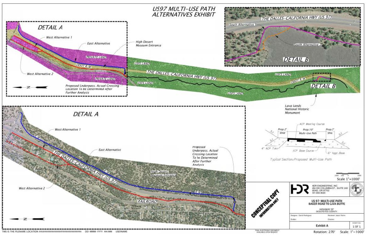
Because the center portion of the multi-use trail is the same for both alternatives through the Deschutes National Forest, the concepts were divided into a north and south concept. The north concept has an east alternative (blue alignment on map) and two west alternatives (red alignments) and the south concept, at Lava Butte, has two alternatives connecting to Lava Lands Visitor Center, one adjacent to U.S. 97 and one through the lava flow (orange and purple alignments).

(Click to enlarge.)
Alignments Analyzed
North Alignment Alternatives
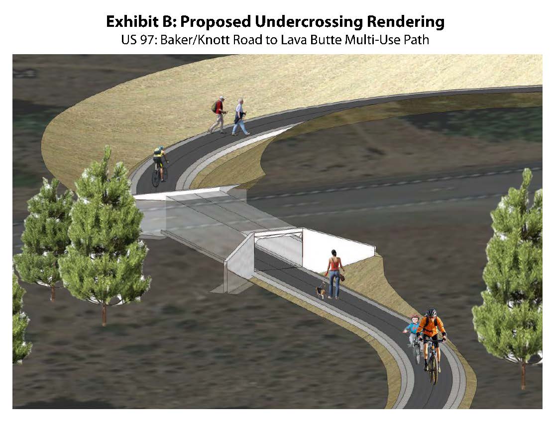
- East Alternative – The East Alternative begins at Knott Road and runs on the east side of U.S. 97 within ODOT right of way to the High Desert Museum. The connection at Knott Road provides linkages to the City of Bend’s Low Stress Bicycle Network and provides an opportunity to collaborate with Bend Parks and Recreation District for connectivity to a future trailhead. Between Knott Road and a proposed undercrossing near the High Desert Museum, the trail alignment is adjacent to U.S. 97 near the ODOT right-of-way boundary. At the proposed undercrossing the trail splits; one leg continues south to the High Desert Museum while another section connects users under U.S. 97 to the south concept on USFS land to the Lava Lands Visitor Center.
- West Alternative 1 – West Alternative 1 begins at Baker Road and travels south on the west side of U.S. 97 within ODOT right of way for approximately 1/2 mile. At this point, the West Alternative 1 will veer away from U.S. 97 to approximately 150 feet from the edge of U.S. 97 and continue south to the USFS boundary. At the proposed undercrossing the trail splits; one leg connects users under U.S. 97 to the High Desert Museum and the other leg continues south to the south concept on USFS land to the Lava Lands Visitor Center.
- West Alternative 2 – West Alternative 2 begins at Baker Road and travels on the west side of U.S. 97 adjacent to the BNSF railroad for approximately ½ mile south of Baker Road. At this point, West Alternative 2 veers away from U.S. 97 to approximately 150 feet from the edge of U.S. 97 and continues south to the USFS boundary. At the proposed undercrossing the trail splits; one leg connects users under U.S. 97 to the High Desert Museum and the other leg continues south on USFS land to the Lava Lands Visitor Center.
(Click to enlarge.)
South Alignment Alternatives
- South Alternative 1 - This alternatives travels through the limited space between the lava flow and U.S. 97. This section will likely require barrier or another means of separation between the trail and the highway to protect users from highway traffic.
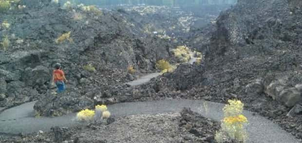
- South Alternative 2 – This alternative provides a unique user experience, traveling through the lava flow utilizing a paved trail. Only 40 feet of this alternative is adjacent to U.S. 97 and will not likely require barrier to shield users from highway traffic.
*The central portion of this trail on the Deschutes National Forest was chosen and analyzed by the U.S. Forest Service. This section of trail meets ADA Accessibility standards and protects sensitive resources on the National Forest. Only alternatives north and south of this section of trail were analyzed as part of the feasibility study.
Preferred Alignment
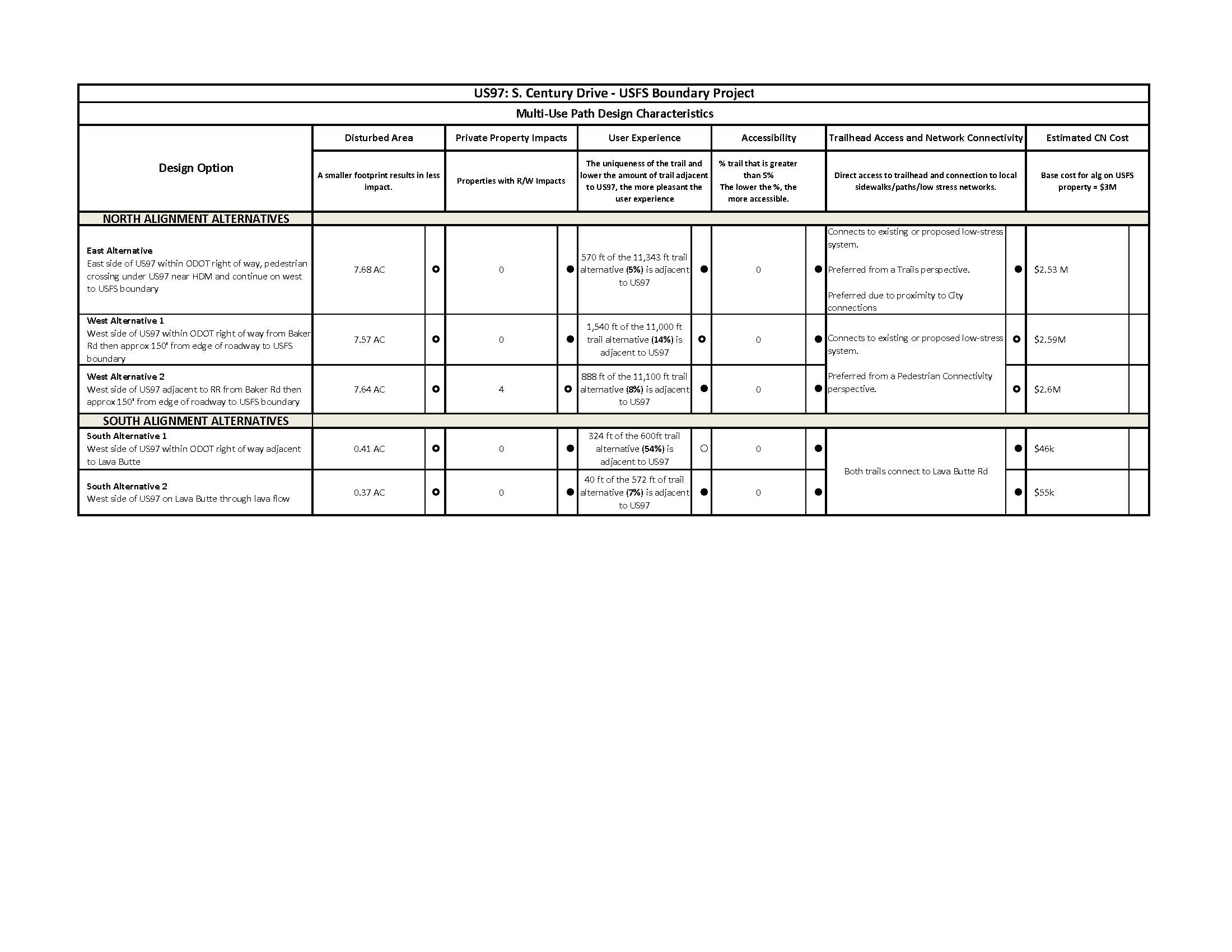
Scoring criteria were used to evaluate each of the potential trail alignments. These criteria included: disturbed area, private property impacts, user experience, accessibility, trailhead access and network connectivity.
Based on these criteria, the East Alternative and South Alternative 2 scored the highest. The East Alternative Alignment begins at Knott Road and runs on the east side of U.S. 97 within ODOT right of way to the High Desert Museum. The trail then crosses under U.S. 97 utilizing a pedestrian undercrossing and continues on a west side alignment to the lava flow. The South Alternative 2 Alignment travels through the lava flow, offset from U.S. 97, and terminates at Lava Lands Visitor Center. The southern alignment through the lava flow creates a unique experience for trail users within the National Monument.
The Alternatives Analysis was completed in December 2020. ODOT is currently vetting the preferred and non-preferred alignments and invites your comments in the next station of this Online Open House. To view the U.S. 97 Multi-Use Trail Alternatives Analysis and other information, visit the project website: https://www.oregon.gov/odot/projects/pages/project-details.aspx?project=20714.


 We value your participation and interest in this project. Please use the survey tool below to leave your thoughts and questions about the project. We encourage you to also view and comment on the Environmental Assessment documentation for the project being completed by the U.S. Forest Service at
 Our planning work is still underway. ODOT and the U.S. Forest Service are currently working through an Environmental Assessment and engaging stakeholders in the analysis of the preferred alignment. The Deschutes National Forest is leading the NEPA process to ensure consistency with the Forest Plan and to analyze the effects of the project. ODOT is also in the process of investigating trailhead parking in the Baker Rd./Knott Rd. vicinity and opportunities to integrate trailhead parking concepts with Cascade East Transit (CET) transit service to facilitate multi-modal user experiences.
We anticipate our NEPA process to be complete in Fall 2021. Following completion, ODOT will finalize design of the trail. Construction is anticipated for 2023.
We welcome your comments about the U.S. 97 Multi-Use Trail project. Please use the Question feature on this site for comments related to the trail alignment and overall project. To participate in the U.S. Forest Service, Bend-Fort Rock Ranger District Environmental Assessment process, please visit: https://www.fs.usda.gov/project/?project=57665. Here you can read more about the NEPA analysis for this project and submit comments regarding the project's Environmental Effects which will be captured in the NEPA documentation.
For other questions, please contact:
Rick Swart, ODOT Community Affairs Coordinator
541.388.6037
richard.swart@odot.state.or.us
63055 N Hwy 97, Bldg. M
Bend, OR 97703