For ADA (Americans with Disabilities Act) or Civil Rights Title VI accommodations, translation/interpretation services, or more information call 503-731-4128, TTY 800-735-2900 or Oregon Relay Service 7-1-1. Si desea obtener información sobre este proyecto traducida al español, sírvase llamar al 503-731-4128.
Additional Information
- Project Fact Sheet (PDF, 1.4 MB)
- Van Buren Bridge Repurposing Study (PDF, 18 MB)
Stations
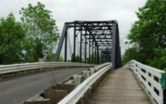

The existing bridge
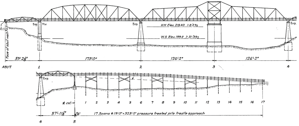
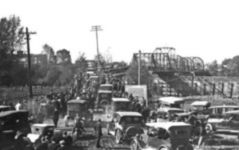
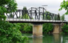
- Year completed: 1915.
- Design features: one lane of motor traffic and a pedestrian path.
- Annual average daily traffic: 10,800 vehicles per day.
- National Bridge Inventory sufficiency rating: 48.9 out of 100. (A score of 50 or less recommends replacement over repair.)
It is being replaced because:
- It’s too narrow to add lanes.
- It’s vulnerable to earthquakes.
- Its rails and transitions are substandard and raise safety concerns.
- A 1995 evaluation recommended it be replaced by 2005 because of steel fatigue (it is inspected bi-annually as a safety precaution.)
- Recent inspections have noted underwater erosion of its concrete piers and footings.
- Its construction and condition require vehicle height and weight restrictions.
What will happen to the existing bridge?
We will make the bridge available for sale to another agency or private party if they wish to remove the bridge to a different location. If a buyer can't be found, the bridge will be demolished.
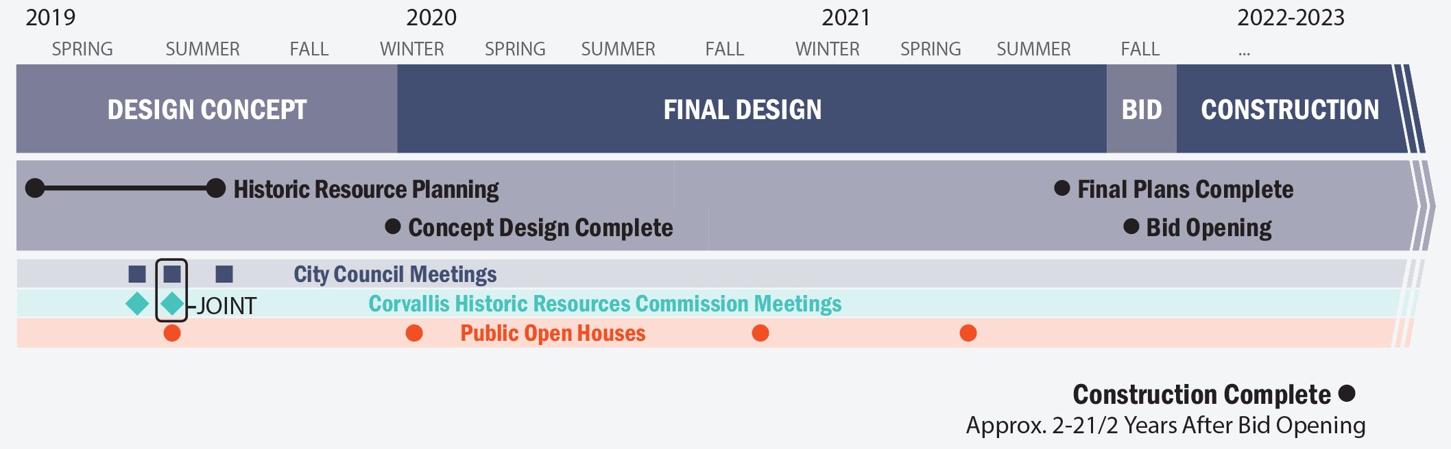
Project history
- 1979-1983: Final Environmental Impact Statement. This study was conducted to consider an alternate route for traffic to bypass the central business area of Corvallis.
- 2004: Plans are revived.
- 2005: Environmental Baseline Report: This environmental study assisted with determining requirements for the new Van Buren Bridge. Bridge and Roadway Alternatives Report: This design study was to assist in locating a new Van Buren Bridge.
- 2006-2007: Options include a new bridge parallel to the existing bridge; and a curved bridge between the old bridge and the Harrison Street Bridge. An additional option includes a bypass north to connect with OR 99W. There is still no funding available.
- 2008-2009: Existing Traffic Conditions Report: This document focused on conducting additional traffic studies.
- 2017: The State Legislature’s passage of House Bill 2017 provides more bridge funding and project planning begins again.
This project builds on this previous work.
Estimated cost:
- $9 million for design
- $60 million for construction
Funding:
- $69 million from Oregon’s Fix-It and HB 2017 bridge seismic funding
Construction Stages
(Shown in image below.)
- Construct temporary diversion (Spring 2022 - Fall 2022)
- Remove existing bridge (Fall 2022 - Summer 2023)
- Construct new bridge (Summer 2023 - Summer 2024)
- Remove work bridge and temporary diversion (Summer 2024)
- Contruction complete (Fall 2024)
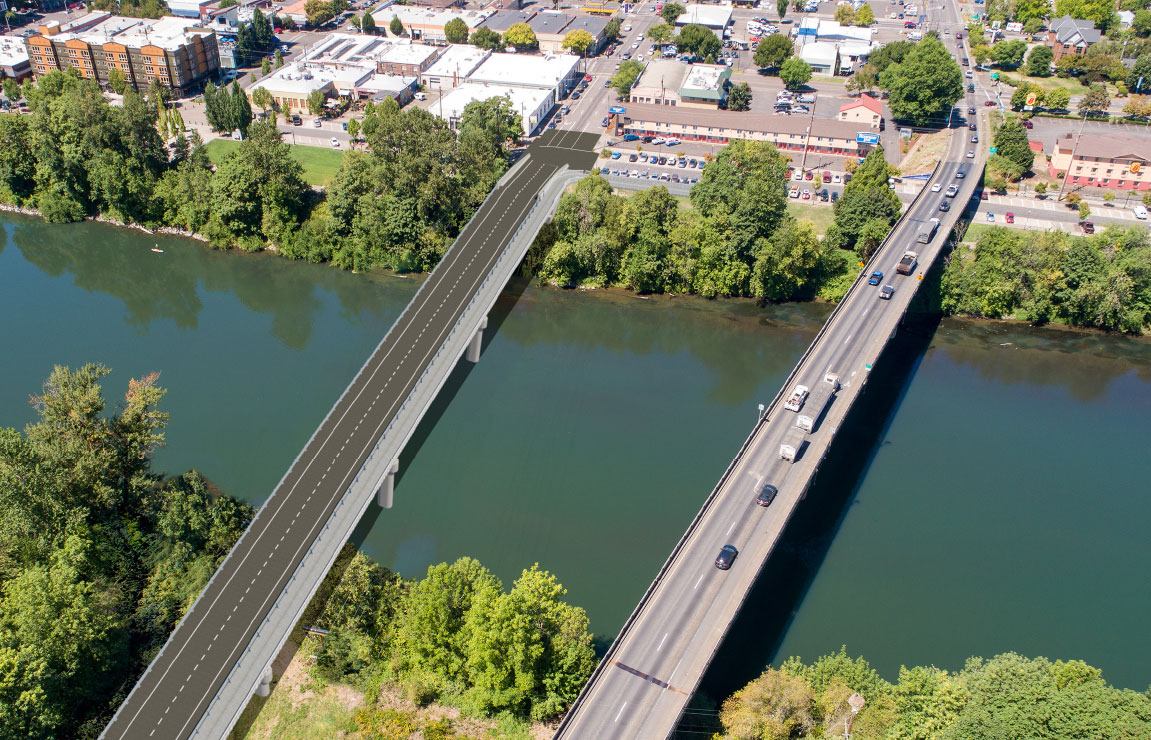
Simulated birdseye view of the new Van Buren Street Bridge.


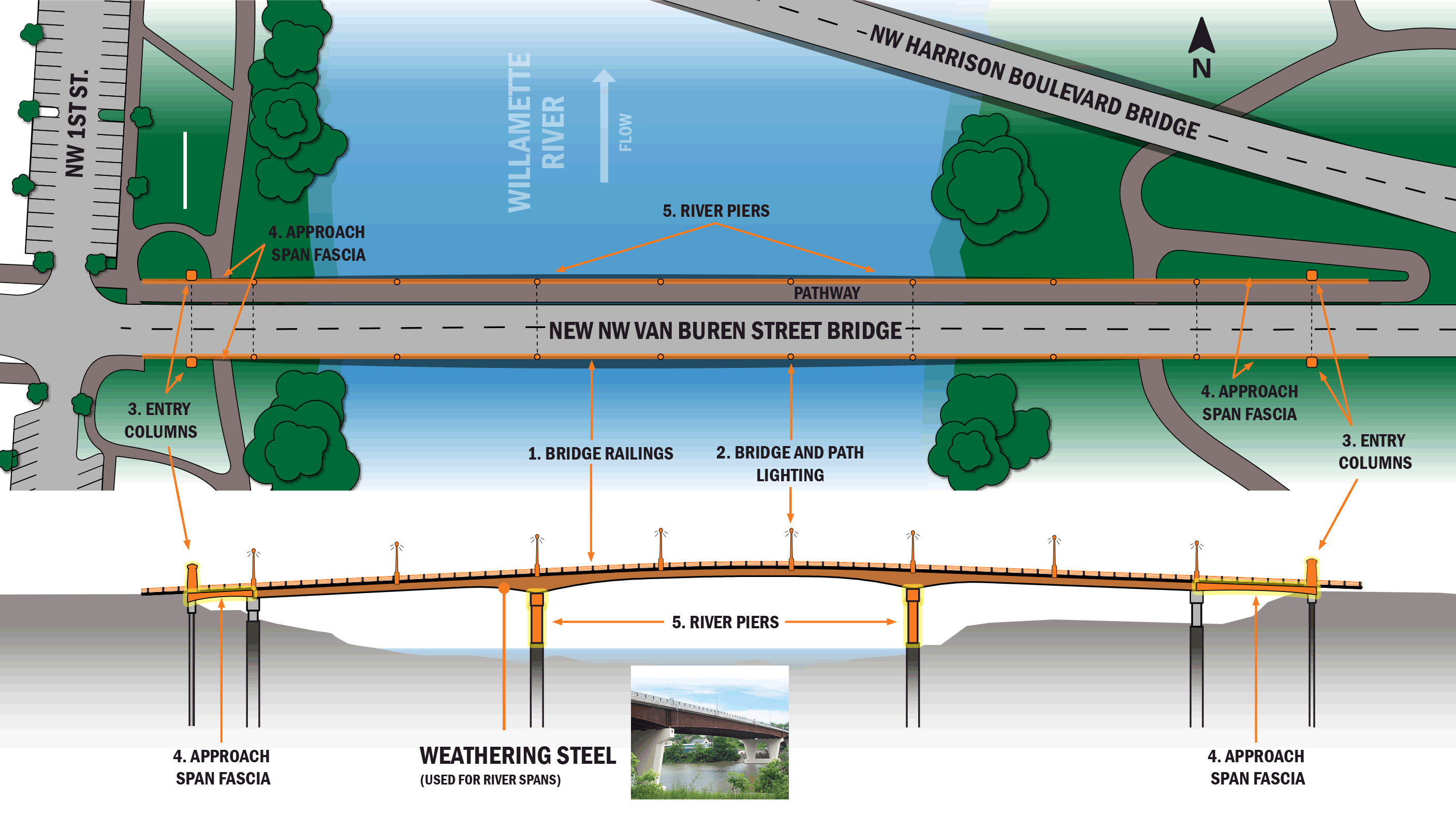
Potential Design Enhancements include:
- Bridge railings
- Bridge and path lighting
- Entry columns
- Approach span fascia
- River piers
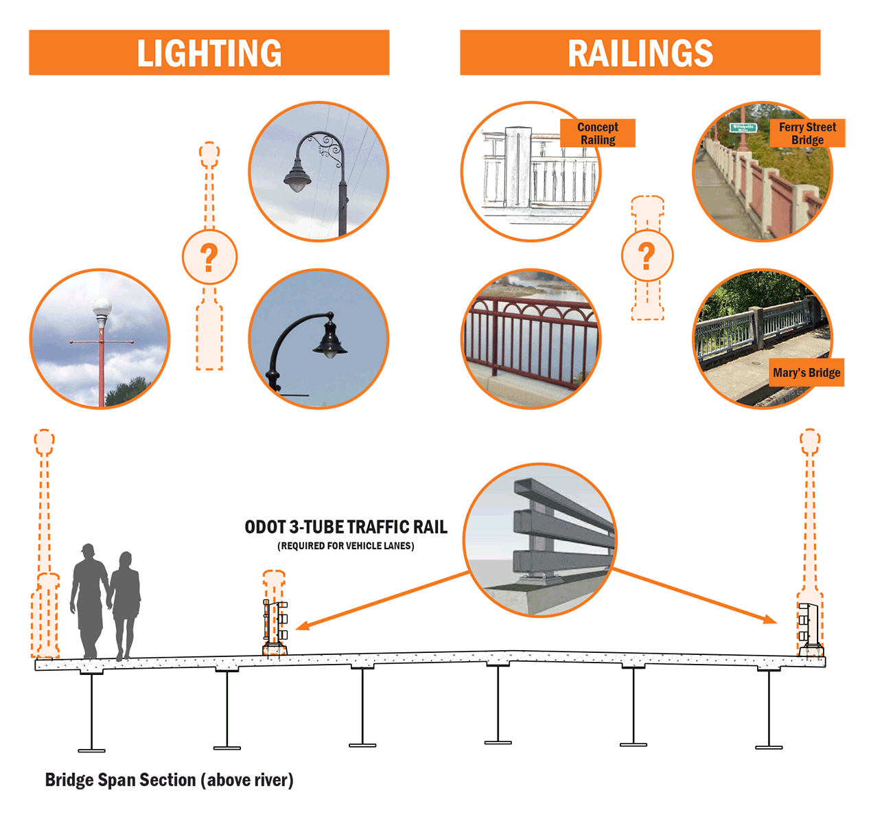
Bridge and Path Lighting
Overhead style lighting, or pathway lighting could be installed along the multi-use path handrail.
Bridge Railings
Decorative railing could be used along the multiuse path on the north side of the bridge. The railing could be designed to look similar to other local bridges and historic elements from the Downtown Historic District.
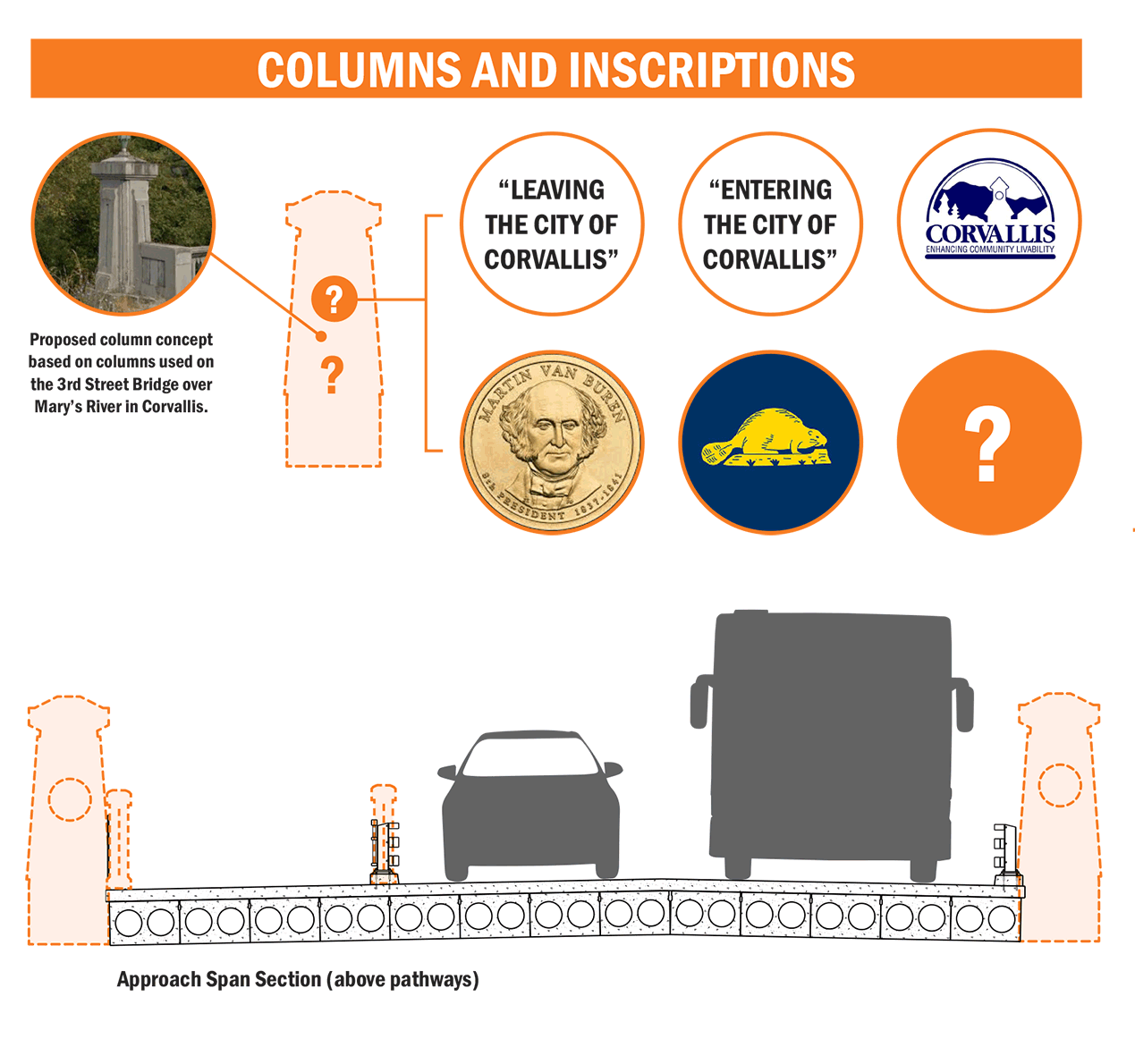
Columns
Columns that look like the ones at Mary’s Bridge could be installed at either end of the new bridge. The columns could be inscribed with an image of Martin Van Buren on one side and the beaver from the state flag on the other.
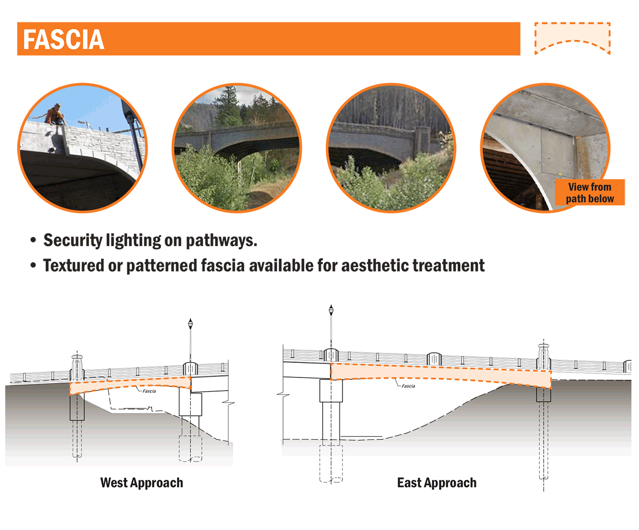
Fascia
Decorative patterned or textured concrete siding (fascia) could be installed under the bridge to look like historic stone.
Piers
The in-water bridge supports (piers) could be designed with arches that appear similar to local historic structures.

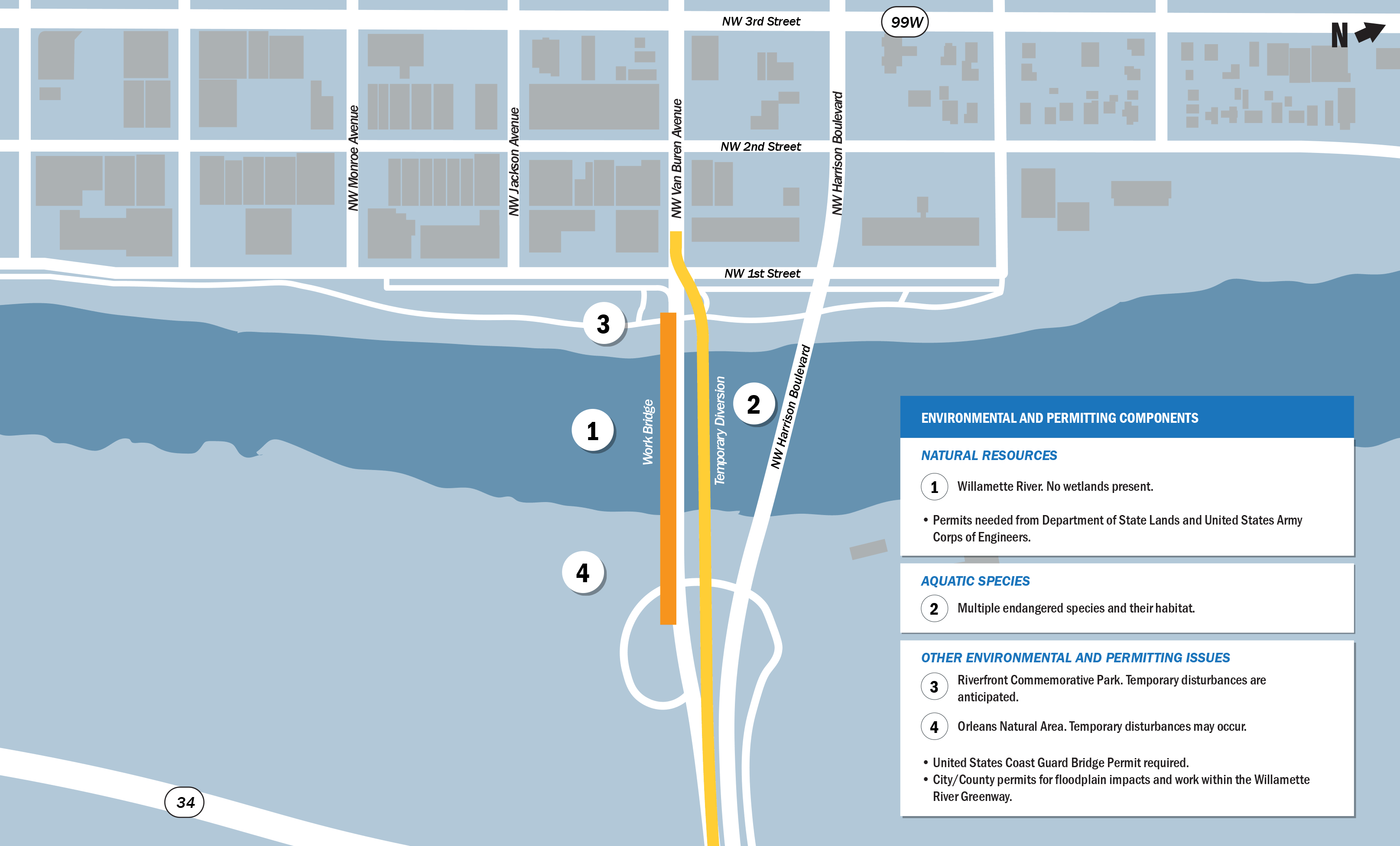
Natural Resources
1. Willamette River. No wetlands present.
Permits needed from Department of State Lands and United States Army Corps of Engineers.
Aquatic Species
2. Multiple endangered species and their habitat.
Other Environmental and Permitting Issues
3. Riverfront Commemorative Park. Temporary disturbances are anticipated.
4. Orleans Natural Area. Temporary disturbances 4 may occur.
United States Coast Guard Bridge Permit required.
City/County permits for floodplain impacts and work within the Willamette River Greenway.

Cultural Resources
Historic properties within the project will be identified through:
- Field survey and background research.
- Assessment of potential effects to identified historic properties.
Any identified adverse effects to historic properties will be avoided or minimized and mitigated where necessary.
We will consult with the Oregon State Historic Preservation Office, federally-recognized tribes, project consulting parties and the general public in
these efforts.
Investigations will also occur for the Corvallis Downtown Historic District. A Historic Resource Baseline Report was completed in June 2019 (see
map). The report will inform further identification of historic properties, to be completed in spring 2020.
More information
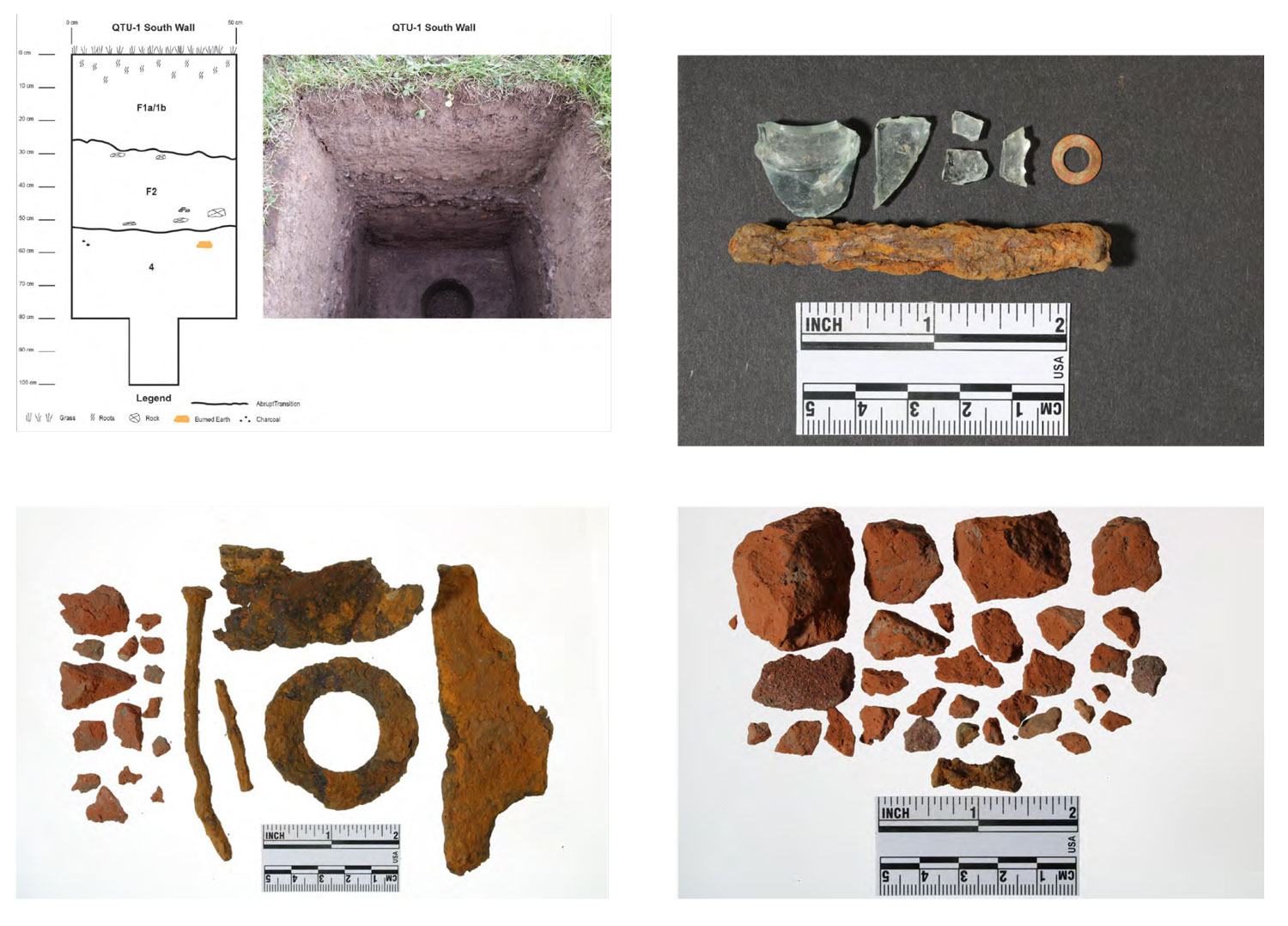
Archaeological Considerations
Four archaeological sites and the Orleans Townsite are within the project study area.
Additional fieldwork will focus on evaluating these sites and identifying new sites.
We encourage you to submit historical information to:
- Hayli Reff
ODOT Region 2 Architectural Historian
Hayli.reff@odot.state.or.us
503-986-2654 - Kurd Roedel
ODOT Archaeologist and Tribal Liaison
kurt.roedel@odot.state.or.us
503-986-6571
Historic Resources Map
Click and drag to explore the map. Click lines, shapes and icons for more information. Turn layers on and off and browse the list of projects by clicking the ![]() button in the upper left of the map window. (You may need to turn off layers to select other objects underneath.) Map shapes and icons are provided for reference only, precise locations may vary.
button in the upper left of the map window. (You may need to turn off layers to select other objects underneath.) Map shapes and icons are provided for reference only, precise locations may vary.
Learn more about the Historic Resources Baseline Report Survey Report Results.
Stay Involved
Complete the comment form below.
Visit the project website for more information.
Sign up for email updates.
Contact ODOT: Anna Henson
Timeline