
Stations
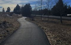
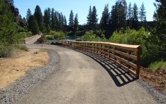
The route will loosely follow the north-south direction of U.S. 97, though it may be some distance from U.S. 97. At the north end, the route will join with the planned “Bend to Lava Butte Multi-Use Path” at the Lava Lands Visitor Center (scheduled to begin construction in 2024). At the south end, the route will connect with the “U.S. 97 Wickiup Jct to First Street Multi-Use Path” at Burgess Avenue in La Pine (in construction now). The route will be paved and ADA-compliant.
The multi-use path will provide outdoor recreation opportunities and transportation options to avoid the seasonal traffic and parking congestion in these popular areas.
The project is considering route options in the study area, outlined in the map below:
The goals were developed from previously passed plans, which include the Oregon Bicycle and Pedestrian Plan, the Deschutes County Transportation System Plan and the La Pine Transportation System Plan.
Draft project goals:
-
Safety: the trail will feel safe and comfortable for people of all ages and abilities.
-
Multimodal mobility: the trail will connect residential areas and destinations, establishing an attractive and efficient transportation route for walking, biking, and using a mobility device.
-
Equity: the trail will provide opportunities and choices for people of all ages, abilities, race, ethnicities, and incomes to bike or walk to reach their destinations and to access transportation options, assuring transportation disadvantaged communities are served and included in decision making.
-
Community and economic vitality: the trail will improve access to jobs, businesses, and other destinations, and will be an asset for residents, visitors, and businesses.
-
Coordination and collaboration: the trail will be planned in collaboration with agency partners to provide a consistent and seamless route that is consistent with adopted plans and goals.
-
Optimize investments: the trail will be strategically implemented to be cost-effective using of existing facilities, preferring public lands, and avoiding unnecessary costs.
The study area has large areas of public land, including Deschutes National Forest and Bureau of Land Management forest. The Little Deschutes River flows through the study area and the Deschutes River flows along the western edge. The study area is relatively flat.
Developed communities, including Sunriver, Three Rivers, and La Pine, make up much of the western and southern portions of the study area. Most of the study area's businesses, services, and destinations are located in La Pine or Sunriver.
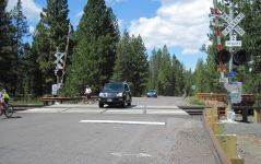
Transportation in the study area is primarily automobile-oriented. The primary road network is served by U.S. 97, an expressway for most of the study area, as well as a handful of other arterials and collectors, including Huntington Road, Century Drive, and La Pine State Recreation Road. These roads are generally high-speed and lack facilities for walking or biking. Local roads connect the residential areas of Sunriver, Three Rivers, and La Pine.
Dedicated facilities for walking and biking in the study area are primarily limited to Sunriver and La Pine. The Sunriver area is well-connected with a system of multi-use paths, including the Sun Lava Butte Trail connecting to Lava Butte. La Pine has sidewalks on many of its streets and striped bike lanes on a few streets.
We would like to know if there are specific locations in the study area that could be helpful or challenging for a new pedestrian and biking route. In the map below, please leave put a comment and description in locations with:
-
Popular destinations
-
Missing bike or pedestrian paths
-
Safety concerns
-
Other important locations
Stay connected!
Keep an eye out for more information on public input opportunities as the summer approaches by signing up for the project email list.
You can always learn more about the project, find out about upcoming events and stay connected by visiting the project webpage.