
Visit each information station (shown below) to learn about the improvements and then complete a comment form to share your thoughts or ask questions.
Stations
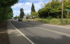
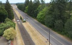
Problem
There are a lot of reasons for the high number of crashes along this stretch of highway:
- Increasing number of users on the highway.
- Vehicles traveling at high speeds.
- Vehicles turning at private driveways.
- Vehicles turning at local roads.
- Narrow shoulders.
- Poor sight distance due to highway curves, landscaping, and other vehicles.
- Changing land use near cities.
In some locations along the road, all of these occur.
Solutions
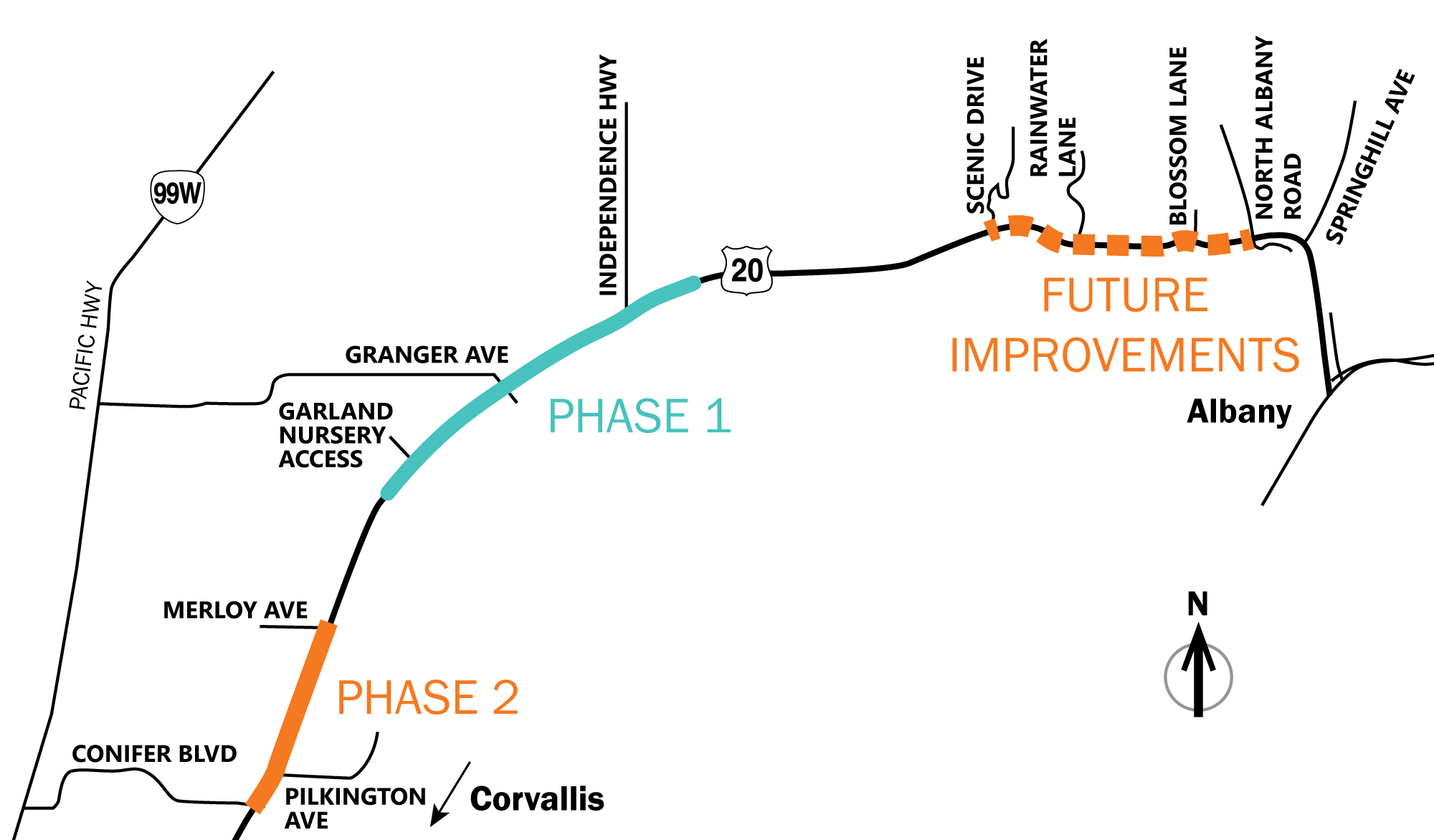
We completed the U.S. 20 Highway Safety Study in 2016 which evaluated various safety improvements along the corridor and included public outreach to get feedback on our ideas. We received funding to design and construct the highest priority improvements in the U.S. 20 corridor at the following locations:
- Independence Highway and Granger Avenue intersections.
- The vicinity of Garland Nursery.
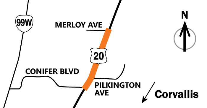
- Conifer Boulevard to Merloy Avenue.
- Scenic Drive to North Albany Road (design funding only).
We are planning to construct these improvements in phases. Construction will begin on Phase 1 improvements in early 2022. Construction of Phase 2 improvements are planned to start in 2023 and other future improvements are also being designed, but are not yet funded for construction.
You can learn more about these improvements on the following pages and then give us feedback.
Project Area
Click to enlarge.
Cost and Funding
The funding available for design and construction of the entire project is $28.2 million, through Keep Oregon Moving (House Bill 2017) and the Statewide Transportation Improvement Program (STIP).
Phase 1 Improvements
Watch the video simulation to see how cars will use the median acceleration lanes in the future. (1 min 9 sec.)
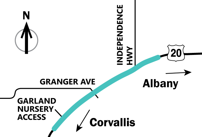
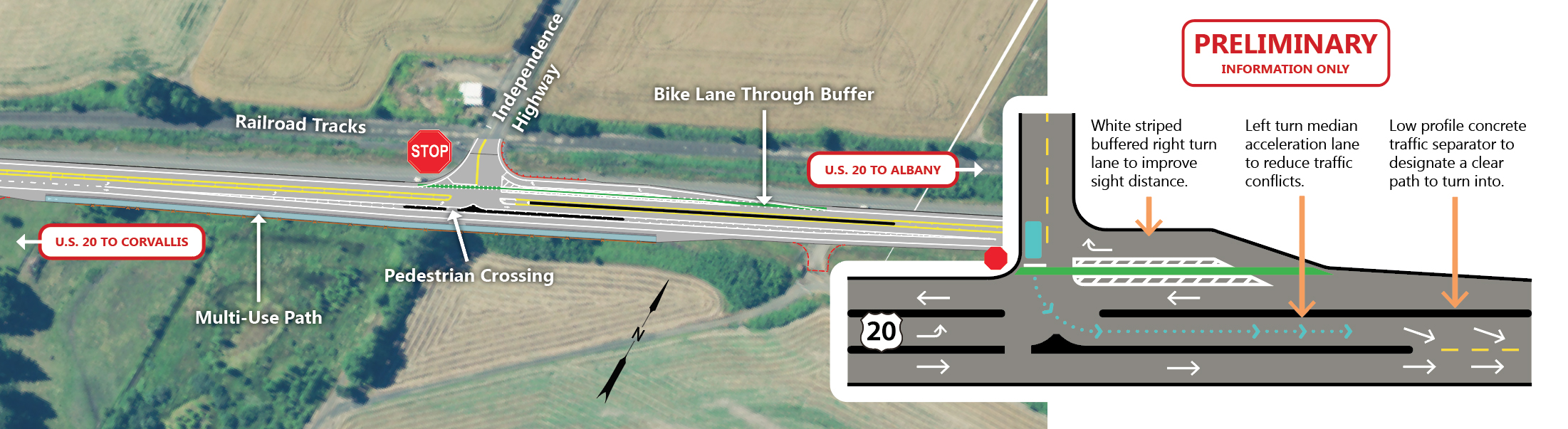
Granger Avenue and Independence Highway Intersections
Issues/Improvements
Key Issues
- High number of crashes from cars turning onto the highway.
- Increased traffic reducing the number of acceptable gaps/breaks in traffic for turning.
- Limited sight distance at county road intersections due to right turning vehicle queues.
- Limited distance between highway and railroad.
Proposed Improvements
- Installing a buffered right turn lane (westbound).
- Installing a median acceleration lane for left turning vehicles (eastbound).
- Adding striping and signing to guide bicycles through the intersections.
- Upgrading signing and striping for railroad crossings.
- Stormwater treatment.
- Building a short section of multiuse path above a new 20+ foot high retaining wall at Independence Highway for forward compatibility with the planned Benton County Bikeway.
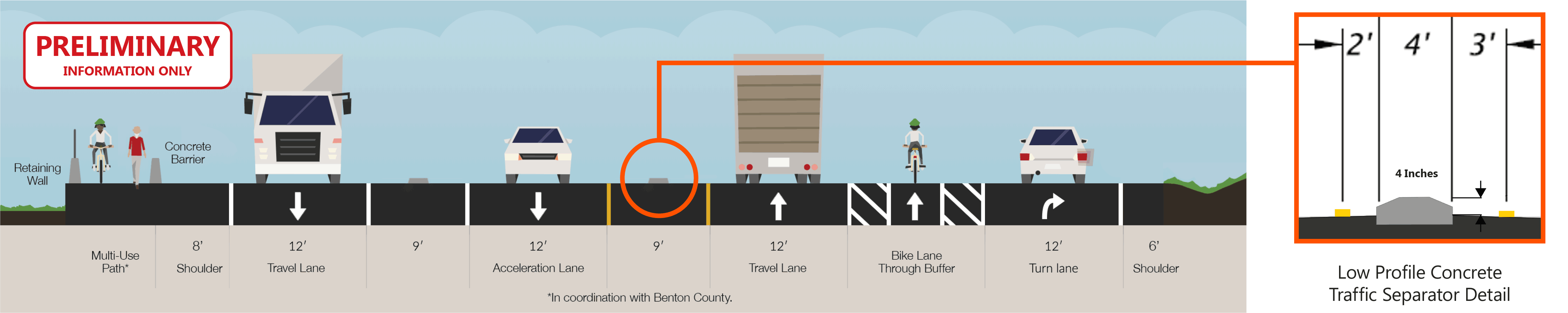
Intersection and Road Cross Section Graphics
Granger Avenue
Aerial
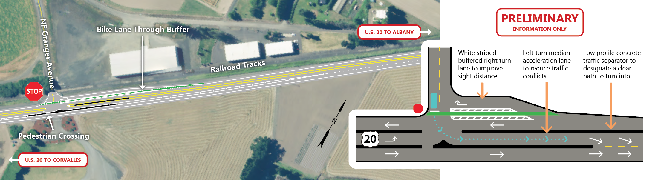
Intersection Cross Section at NE Granger Avenue Looking West
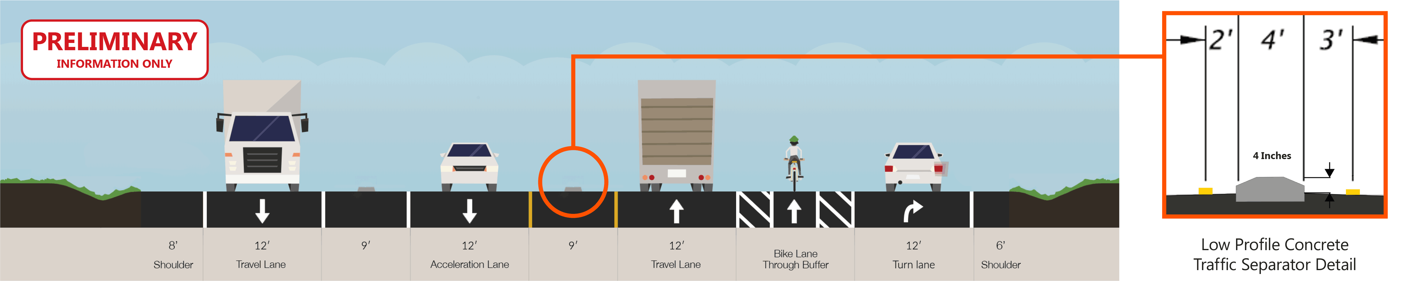
Click images to enlarge.
Independence Highway
Aerial

Intersection Cross Section at Independence Highway Looking West

Click images to enlarge.
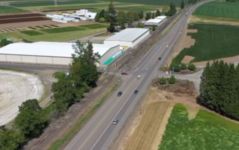
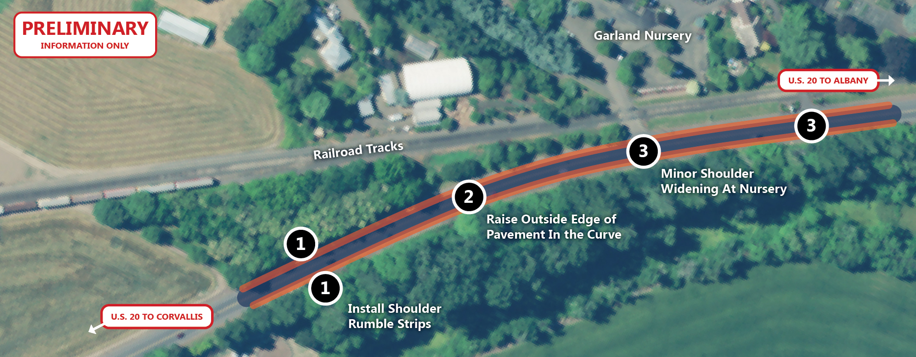
Near Garland Nursery
Issues/Improvements
Key Issues
- Vehicles heading westbound run off of the road at the outside edge of curve.
- Rear end crashes when vehicles slow down to enter the nursery.
Proposed Improvements
- Widening shoulders.
- Adding rumble strips.
- Raising the outside edge of pavement on the curve.
- Remove fixed objects (trees or poles) near the outside of the curve/north side of highway where possible.
Aerial Graphic
Near Garland Nursery Aerial

Click to enlarge.
Phase 1 Timeline

We are coordinating with Benton County on the location of bicycle and pedestrian improvements. You can learn more at the end of the open house.


Phase 2 Improvements
Overview
Issues/Improvements
Key Issues
- Rear end and turning crashes due to slowing vehicles and limited gaps.
- Large number of highway accesses/driveways.
Proposed Improvements
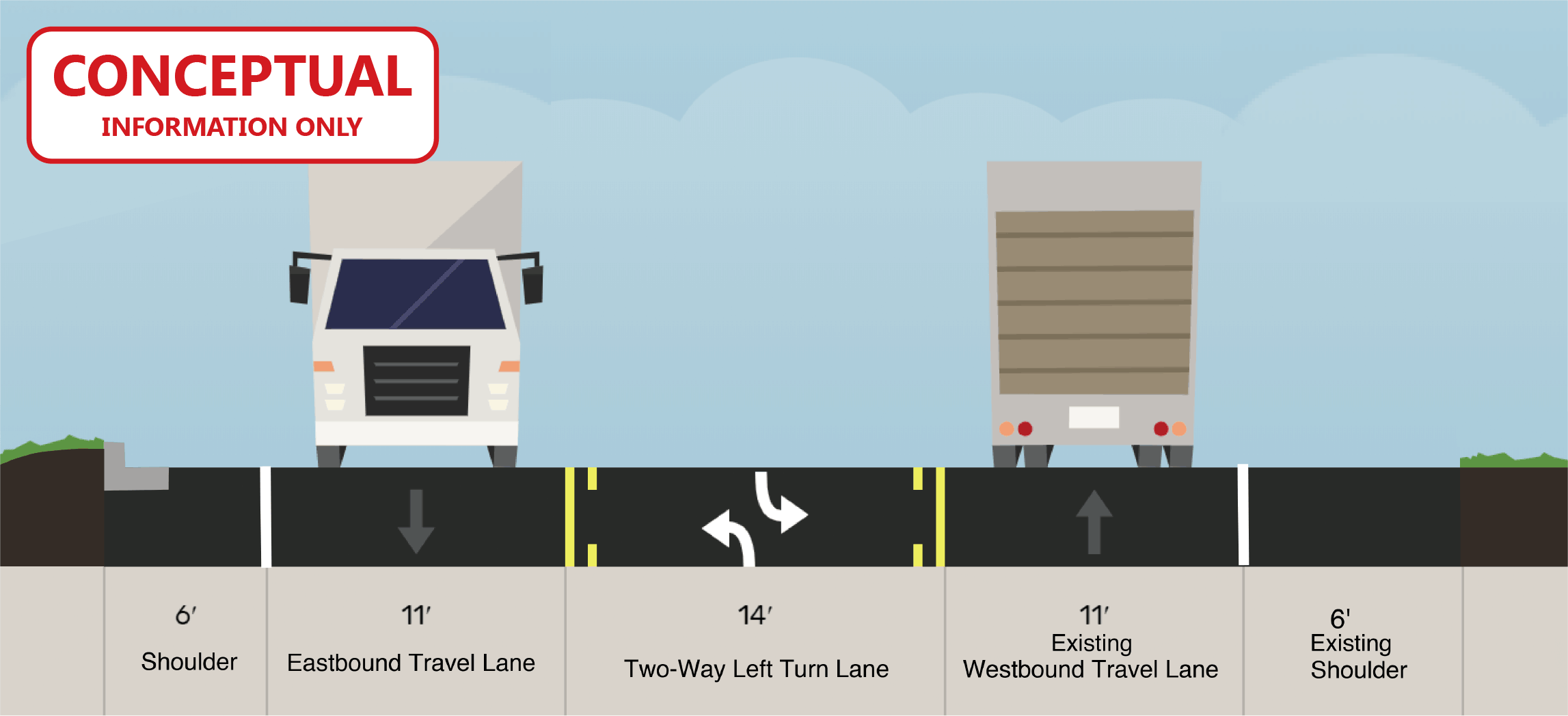
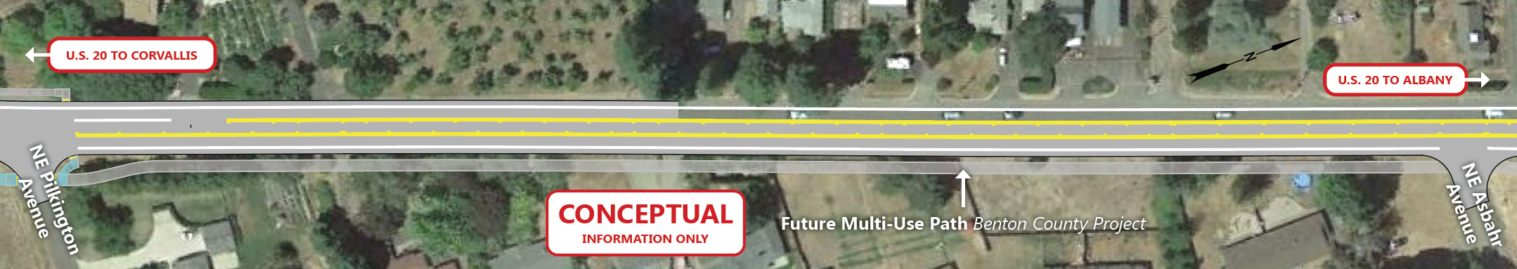
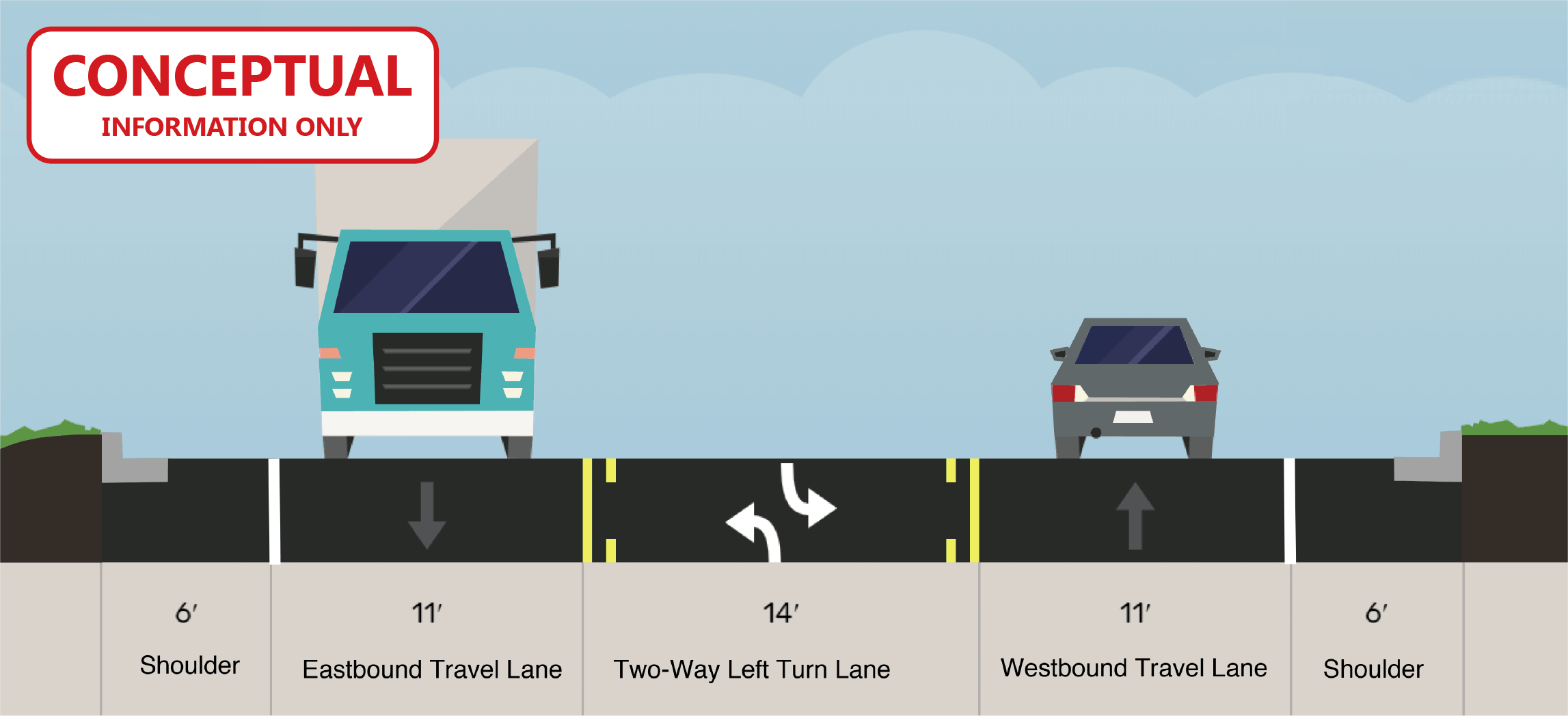
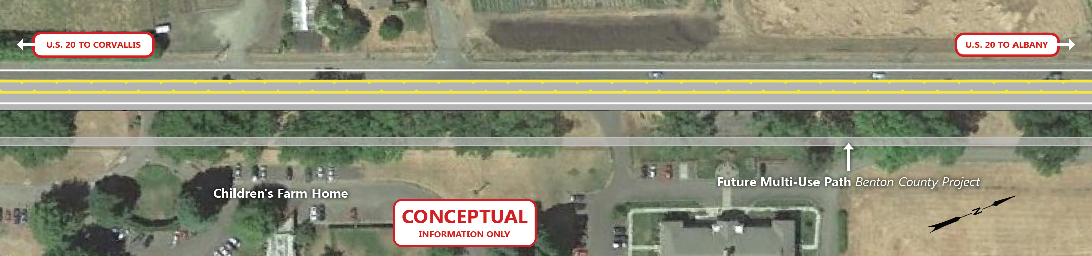
- Adding a center two way left turn lane.
- Treating stormwater runoff.
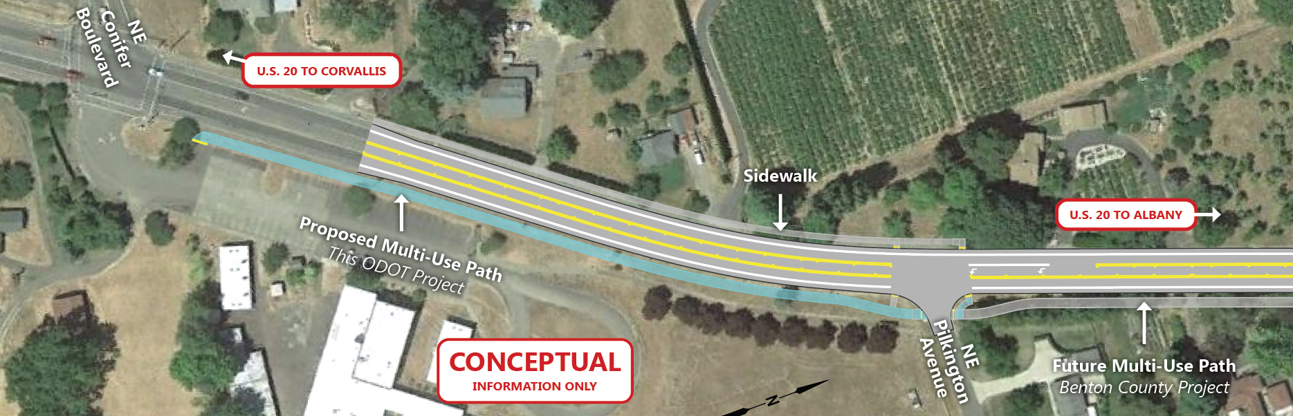
- Replacing sidewalk with a short section of multiuse path on the east side between Conifer Boulevard and NE Pilkington Avenue for forward compatibility with the planned Benton County Bikeway project currently in development.
Aerial and Road Cross Section Graphics
NE Conifer Boulevard to NE Pilkington Avenue
Aerial
Cross Section
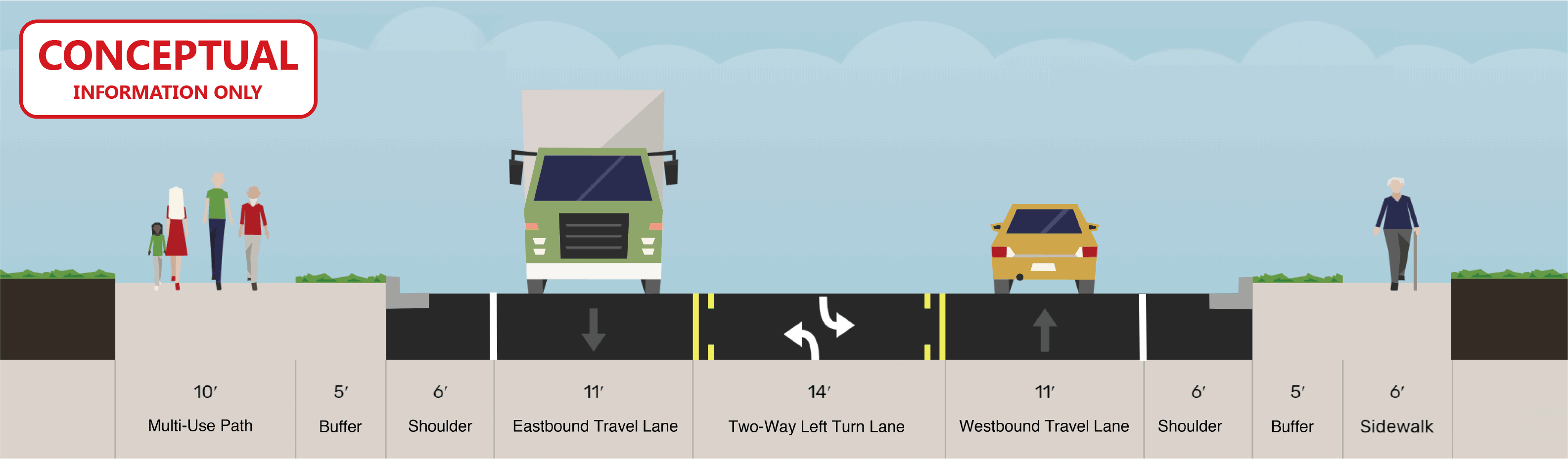
Click images to enlarge.
NE Pilkington Avenue to Asbahr Avenue
Aerial

Cross Section

Click images to enlarge.
NE Asbahr Avenue
Aerial
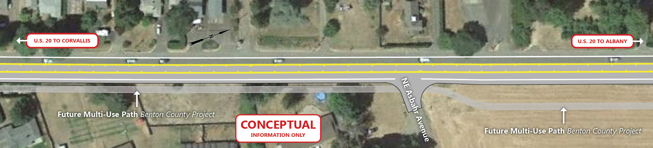
Cross Section
Click images to enlarge.
NE Asbahr Avenue to NE Merloy Avenue
Aerial

Cross Section

Click images to enlarge.
Phase 2 Timeline

We are coordinating with Benton County on the location of bicycle and pedestrian improvements. You can learn more at the end of the open house.


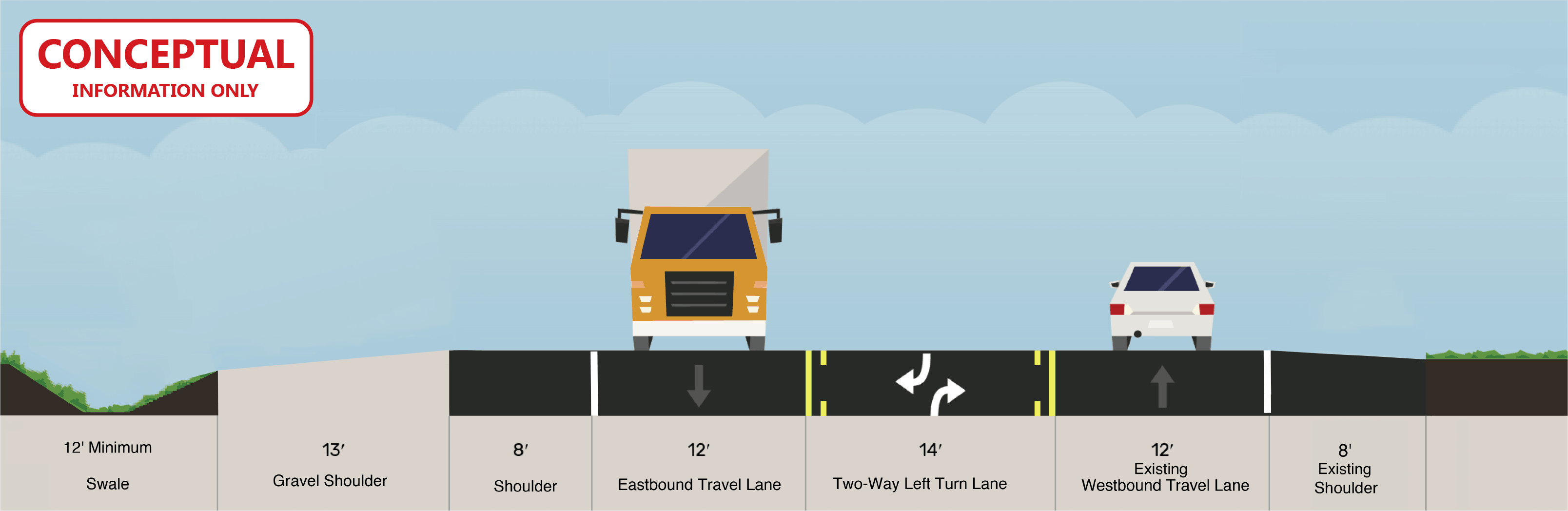
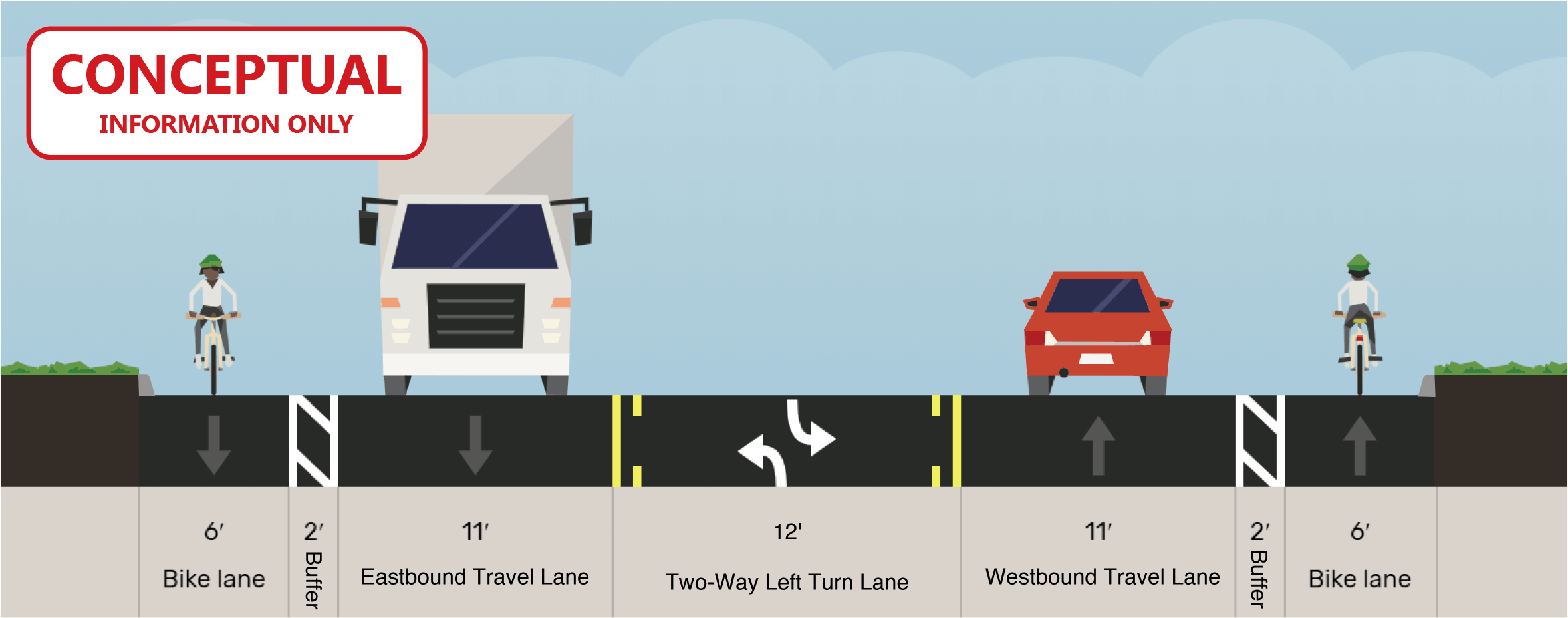
Future Improvements
Overview
Issues/Improvements
Key Issues
- Rear end and turning crashes due to slowing vehicles and limited gaps.
- Large number of highway accesses and local roads.
Proposed Improvements
- Adding a center two way left turn lane.
- Adding and replacing guardrail where needed.
- Widening shoulders.
- Bicycle and pedestrian improvement alternatives are being coordinated with the City of Albany and Benton County.
- Stormwater treatment.
- Upgrade signs and markings at railroad crossing.
Note: The Scenic Drive to North Albany Road portion of U.S. 20 is funded for preliminary design and evaluation of impacts. These steps will confirm future funding needs. No funding has been identified for final design or construction at this time.
Aerial and Road Cross Section Graphics
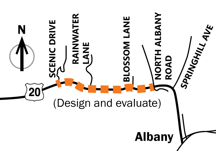
NW Scenic Drive to NW Rainwater Lane
Aerial
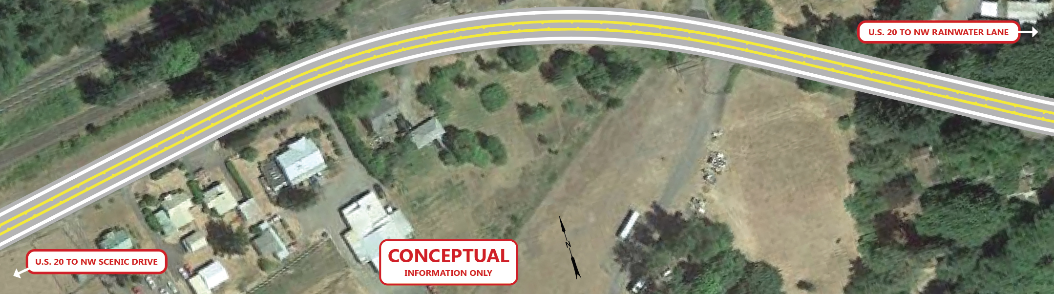
Cross Section

Click images to enlarge.
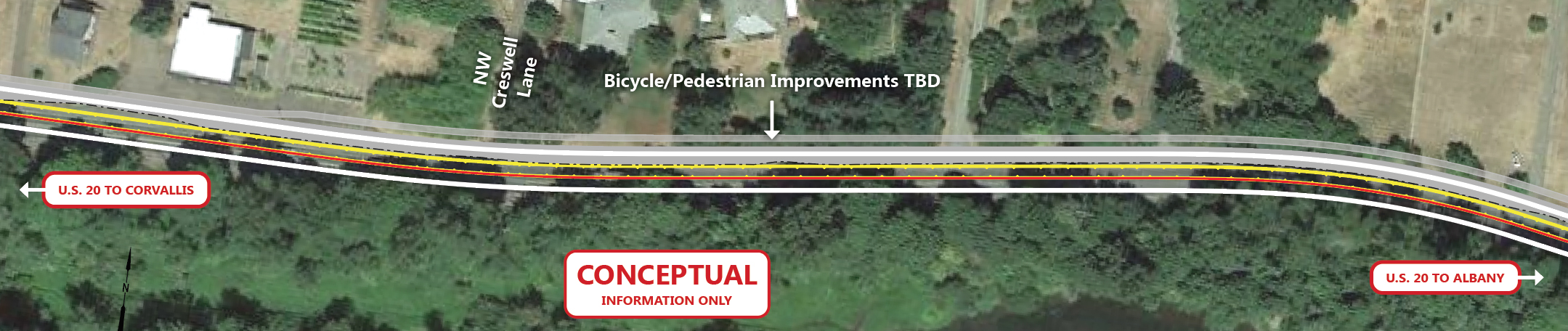
NW Rainwater Lane to N Albany Road
Aerial

Click images to enlarge.


How you can stay involved:
- Complete our comment form.
- Visit the project webpage.
- Visit the Benton County Bikeway website to learn more about future bicycle improvements.
- Sign up for email updates.
If you still have questions, please contact:
Julie GaNung
ODOT Project Manager
us20safetyupgrades@odot.state.or.us
541-726-2578