
Consistent with the requirements of 23 U.S.C. 168, the information on this website may be adopted or incorporated by reference into a future environmental review process to meet the requirements of the National Environmental Policy Act.
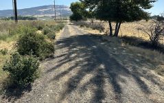
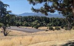
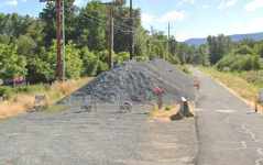
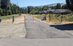
Stations
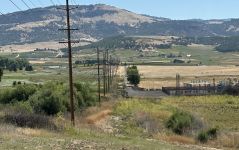

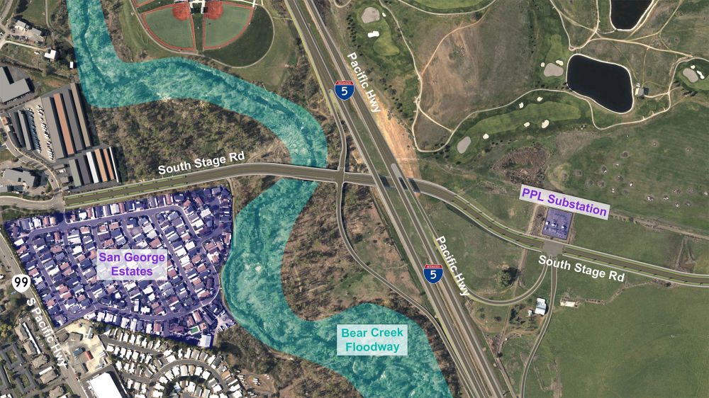
Project Overview
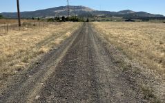
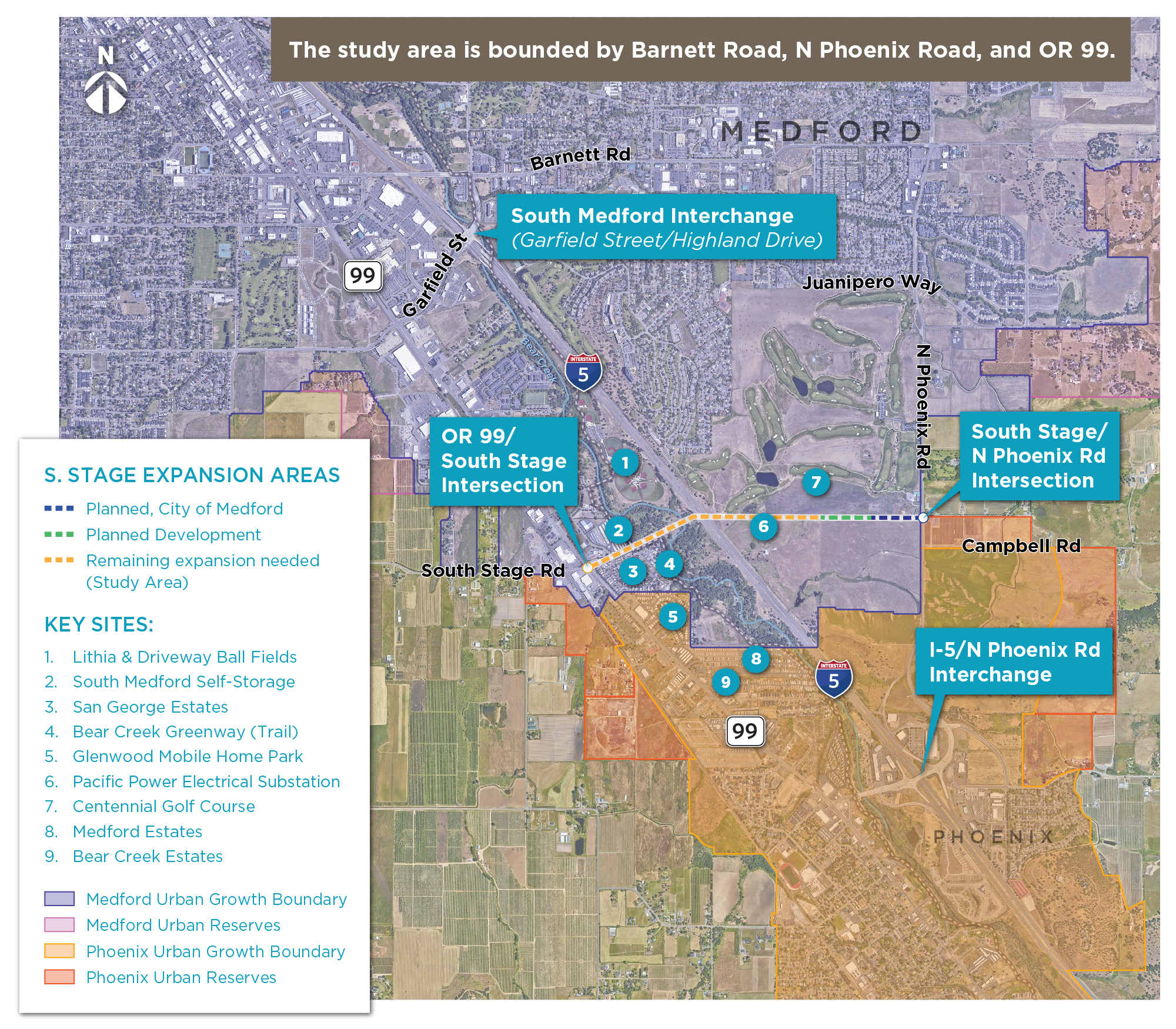
Currently, Bear Creek and I-5 limit east-west connectivity between south Medford and north Phoenix. The South Medford interchange regularly experiences congestion, and it’s expected to worsen in the future. The South Stage Extension Plan evaluates potential transportation improvements across I-5 between the Phoenix interchange (Exit 24) and South Medford interchange (Exit 27) to:
-
Improve east-west connectivity and safety.
-
Reduce congestion and prepare for future growth.
-
Improve emergency response.
-
Improve multimodal connections.
-
Decrease evacuation and recovery times.
-
Reduce travel times.
The plan evaluates transportation system improvements and potential options for a new overpass and/or interchange to reduce congestion at the busy South Medford interchange. ODOT and the City of Medford will identify the recommended alternative(s) to carry forward into the Facility Plan. The plan will require adoption by the City of Medford and the Oregon Transportation Commission.
Study Area Map
Project Schedule
The schedule below includes the major milestones and opportunities to provide feedback on the plan.

Purpose:
The purposes of the South Stage Road Extension Plan are to:
-
Reduce out-of-direction travel by improving east-west multimodal connectivity across Interstate 5 (I-5).
-
Reduce existing and projected congestion and related traffic safety issues in the vicinity of the I-5 interchanges with Garfield Street, North Phoenix Road, and the adjacent local street network,
-
Support local system improvements associated with current and planned land uses, as well as improved emergency preparedness in the rapidly urbanizing areas of South Medford and North Phoenix, Oregon.
Needs:
The following transportation needs (problems) have been identified:
-
I-5 creates a barrier to local east-west travel that limits local road connectivity, resulting in out-of-direction travel and poor east-west travel times.
-
Lack of east-west connectivity across I-5 is a primary contributor to congestion and traffic safety issues at the existing interchanges and the local roads accessing the interchanges.
-
Improved east-west arterial connectivity is needed to support planned growth in the Medford and Phoenix urban growth reserves.
Learn more - Technical Memo: Final Purpose and Need Framework
The transportation system will improve safety for users of all modes of transportation and be a public resource that supports public health in the community.
Objectives:
-
Transportation improvement projects and transportation management decisions shall be evaluated to reduce risk to the traveling public, and improvement projects and management decisions shall strive to enhance safety for the traveling public.
The transportation system shall enhance economic development and vitality within the City of Medford and throughout the Region.
Objectives:
-
Provide transportation options that support existing and planned land uses, consistent with the City’s Comprehensive Plan.
-
Maintain and improve the efficiency of the movement of freight and goods by ground, rail, air, pipeline, and transmission infrastructure.
-
Increase resilience of the local freight and logistics network to natural disasters.
Design and construct transportation facilities to enhance the livability of the City's neighborhoods and business centers.
Objectives:
-
The City will balance transportation system objectives to improve mobility against objectives to avoid disruption of existing neighborhoods and nonresidential districts and minimize impacts to individual properties.
Achieve connectivity appropriate for planned land uses in the area for all modes which is well connected to the regional system.
Objectives:
-
The City of Medford will strive to develop and maintain a well-connected transportation system for all modes and users.
Optimize funding resources so that transportation investments are fiscally sound and economically sustainable.
Objectives:
-
Systematically and regularly plan and predict the need for the acquisition of needed public right-of-way in order to implement the adopted Functional Classification Map.
-
Support the development of stable and flexible transportation financing that provides adequate funding sources for Medford’s transportation system while supporting the Transportation System Plan’s economic development goal.
Reduce environmental impacts from transportation.
Objectives:
-
Reduce environmental impacts of the transportation infrastructure.
-
Adopt policies designed to reduce per capita Vehicle Miles Traveled, reliance on Single Occupant Vehicle trips, and roadway congestion.
-
Reduce emissions of atmospheric pollutants including greenhouse gas emissions and particulate matter.
Learn more - Technical Memo: Goals, Objectives, and Evaluation Criteria
Safety Focus Areas

The following locations currently experience above average crash rates. All other crash rates in the study area are below statewide averages.
-
Barnett Road/Golf View Drive – exceeds average crash rate
-
Garfield Street/Center Drive – exceeds critical crash rate relative to study area
-
Barnett Road/Golf View Drive – exceeds critical crash rate relative to study area
The ODOT Safety Priority Index System (SPIS) identifies sites along state highways where crash history may warrant further investigation. It identifies locations by considering crash frequency, crash rate and crash severity. Sites identified within the top 5% are investigated by ODOT staff and reported to the Federal Highway Administration (FHWA). The following intersections were identified in the top 15 percent of SPIS scores in the SPIS 2021 list:
-
OR 99/Stewart Avenue
-
OR 99/Garfield Street
-
I-5/Garfield Street Interchange
Operation Focus Areas

-
All study intersections meet operating standards under existing conditions with the exception of the I-5/Garfield Street interchange, which experiences traffic volume exceeding ODOT’s standards for the interchange’s relative capacity during the weekday AM peak hour.
-
All freeway segments operate within standards.
-
Queues from both the southbound and northbound ramp of the Garfield interchange are reported to back up onto I-5 for portions of the weekday AM peak hour.
Learn more - Technical Memo: Current Conditions
To understand future needs for the transportation system in the study area, the project team used population and employment projections for the year 2045 to develop 20-year transportation demand estimates. Technical Memo: Future Conditions documents this estimated demand in the “No-Build” conditions analysis, which shows how the existing system would function in the year 2045. Using that estimated demand, this analysis identifies anticipated transportation needs (gaps and deficiencies) within the study area.
Pedestrian, Bicycle, and Transit Access
The study area has limited bicycle, pedestrian, and transit facilities, particularly east of I-5. Only four pedestrian/bicycle crossing opportunities exist, with a 2.65-mile gap between the Bear Creek Greenway undercrossing and the Phoenix interchange. This gap is six times greater than desired by the City of Medford code and three times greater than the average spacing of pedestrian/bicycle crossings of I-5 between Central Point and Phoenix. Transit users have a 2.75-mile gap in east-west crossings of I-5 and Bear Creek.
Freeway Segments, Intersections, and Interchange Ramps
Currently, the South Medford interchange (also known as the I-5/Garfield Street interchange) experiences congestion. Traffic backups occur at the north and southbound ramps at times on weekday mornings, posing safety concerns. The Year 2045 No-Build scenario indicates congestion will exceed current standards at this interchange, along with several other intersections in the study area, including:
-
OR 99/Garfield Street
-
OR 99/N Phoenix Road/Bolz Road
-
Barnett Road/Black Oak Drive
-
Juanipero Way/Golf View Drive
Out-of-Direction Travel
Motorists on South Stage Road west of OR 99 travel up to 3.8 miles out of their way to reach destinations along N Phoenix Road. Data shows they already travel out of their way between these two roads, which will continue in the Year 2045 No-Build scenario, and with longer predicted travel times.
Travel Times
During the peak evening commute, it takes almost 6 minutes to travel between South Stage Road/OR99 and the future intersection of Phoenix Road/South Stage Road via the southern route and almost 14 minutes via the northern route. In the Year 2045 No-Build scenario, the travel time for the southern route is estimated to increase to a little over 7 minutes and to almost 16 minutes for the northern route.
Emergency Response Access
Limited detour options for emergency vehicles can cause congestion and disruptions during emergencies. In the Year 2045 No-Build scenario, the lack of alternate routes, together with increased travel times and congestion, will lead to increased response times, especially to/from medical providers along the Barnett Road.
Crash History
Several locations experience average or above-average crash rates, including Barnett Road/Golf View Drive, Garfield Street/Center Drive, and intersections at OR 99/Stewart Avenue, OR 99/Garfield Street, and the South Medford interchange. Without mitigation or changes in driver habits, crashes may worsen in these locations in the Year 2045 No-Build scenario.
Learn more - Technical Memo: Future Year Background Traffic Analysis
Initial Alternatives Development and Screening

Define Overarching Solution Scenarios
To address the project study area's safety, operations, and connectivity needs, the project team began with three overarching solution scenarios:
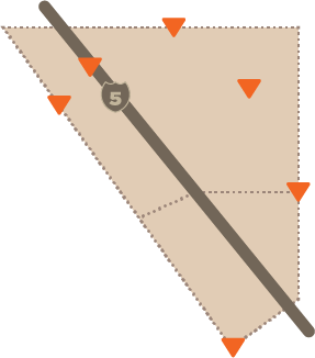
Existing System Enhancement |
This scenario would improve existing transportation facilities to address gaps or deficiencies. |
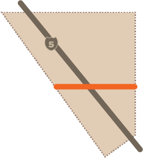
South Stage Overpass or Underpass |
This scenario would build an overpass or underpass connection across I-5 and Bear Creek between the South Medford and Phoenix interchanges, and include improvements to the existing transportation facilities to address gaps or deficiencies. |
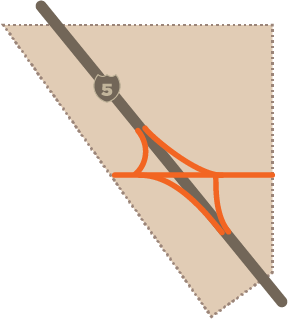
I-5/South Stage Interchange |
This scenario would build a connection across I-5 and Bear Creek, add a new I-5 interchange between the South Medford and Phoenix interchanges, and include improvements to the existing transportation facilities to address gaps or deficiencies. |
Screen Overarching Solution Scenarios
To determine which scenarios would best meet the project's purpose and needs, the project team screened these three scenarios according to a series of evaluation criteria based on the Project's Purpose and Need. Based on this screening, Scenario 1 (Existing System Enhancement) was removed from further consideration because it would not sufficiently meet the project study area’s safety, operations, and connectivity needs independently.

Develop Alternatives within Feasible Solution Scenarios
From the two remaining scenarios—Scenario 2: South Stage Overpass or Underpass and Scenario 3: I-5/South Stage Interchange—the Project Development Team, Project Advisory Committee, Project team, and community identified 8 initial alternatives for each scenario (16 total alternatives).
Alternative O-1: South Stage Alignment

Alternative O-2: South Stage Southerly Realignment (Option 1)

Alternative O-3: South Stage Southerly Realignment (Option 2)

Alternative O-4: South Stage Underpass (Option 1)

Alternative O-5: South Stage Underpass (Option 2)

Alternative O-6: South Stage Northerly Realignment

Alternative O-7: Lower I-5 NB Travel Lanes

Alternative O-8: Glenwood Road Alignment

Alternative I-1: South Stage Alignment

Alternative I-2: South Stage Southerly Realignment (Option 1)

Alternative I-3: South Stage Southerly Realignment (Option 2)

Alternative I-4: South Stage Underpass Interchange

Alternative I-5: South Stage Diverging Diamond

Alternative I-6: I-5 South Stage Left Lane Merge for NB On-Ramp

Alternative I-7: I-5 South Stage Single Point Interchange

Alternative I-8: I-5 South Stage Partial Split-Diamond Interchange

Learn more - Technical Memo: Transportation Analysis Screening
Learn more - Technical Memo: Range of Alternatives
Screen Alternatives According to Technical Feasibility
The project team reviewed each alternative using their conceptual horizontal and vertical alignments and found that Alternatives O-5, O-8, and I-6 would not be technically feasible.
Alternative O-5: South Stage Underpass (Option 2)
-
This alternative would tunnel under I-5 and Bear Creek, but there is not enough road length to tunnel under I-5 and Bear Creek and to connect to OR99 with an acceptable grade. The road would either overshoot OR99 or be too steep.
Alternative O-8: Glenwood Road Alignment
-
Glenwood Road has limited utility due to its proximity to the Phoenix interchange.
-
This alternative would break the east-west continuity of the South Stage corridor and create a new intersection along OR99.
-
This alternative would require right-of-way from environmental justice properties north and south of Glenwood Road east of OR99.
Alternative I-6: I-5 South Stage Left Lane Merge for Northbound On-Ramp
-
Because it may confuse drivers, the left-lane merge for the northbound on-ramp at South Stage Road will not meet FHWA and ODOT guidance for on- and off-ramps.
-
This location introduces a short, challenging, and likely unsafe weaving section for vehicles that enter from South Stage on the left side and then want to exit at the right-side South Medford Interchange.
Screen Alternatives According to Economic Feasibility
Five alternatives were screened out because they were more expensive and either provided infrastructure that exceeded the need and/or did not create additional benefits compared to other feasible alternatives:
-
Alternatives I-5, I-7, and I-8 introduced added interchange characteristics that exceeded the project needs but would not outperform other more feasible alternatives.
-
Alternatives O-7, I-5, I-7, and I-8 provided excess capacity well beyond the forecasted year 2045 traffic demand and would not outperform other more feasible alternatives.
-
Alternative O-6 would require the most right-of-way (ROW) (more than 860,000 square feet) and would impact three existing building structures. It would also require a new rail crossing west of OR99 and not outperform other more feasible alternatives.
Overcrossing Alternative Economic Factors

Interchange Alternative Economic Factors

Assess Alternatives According to Environmental Impacts
Technically and Economically Feasible Alternatives shown below were preliminarily assessed according to environmental impacts. This assessment is summarized below.
Alternative O-1: South Stage Alignment

Alternative O-2: South Stage Southerly Realignment (Option 1)

Alternative O-3: South Stage Southerly Realignment (Option 2)

Alternative O-4: South Stage Underpass (Option 1)

Alternative I-1: South Stage Alignment

Alternative I-2: South Stage Southerly Realignment (Option 1)

Alternative I-3: South Stage Southerly Realignment (Option 2)

Alternative I-4: South Stage Underpass Interchange


Evaluate and Refine Feasible Alternatives
Based on community input in Open House #2, the Project Team identified that the eight technically and economically feasibility alternatives should continue forward for further refinement and environmental screening to develop preliminary recommendations for alternative(s) to be documented in the draft Facility Plan. Review the following sections and provide input on the draft recommended alternatives.
Learn more - Technical Memo: Transportation Analysis Screening
Learn more - Technical Memo: Range of Alternatives

Screening of Overpass/Underpass and Interchange Alternatives
The transportation analysis shows that an overpass/underpass is sufficient to meet the Purpose and Need of the South Stage Extension Facility Plan and that an interchange is not needed within the 2045 planning horizon. However, The City of Medford and community members emphasized the importance of considering potential needs beyond the 2045 planning horizon. Therefore, the project team screened and refined alternatives with a phased approach: identify a Phase 1 Overpass/Underpass Alternative that has forward compatibility with a Phase 2 Interchange Alternative. Forward compatibility in this sense is the design of an Overpass/Underpass that, in the future when warranted by the 20-year traffic forecast, could be converted to an interchange with relatively minor disturbance to the existing facility. Both Phase 1 and Phase 2 could be developed in the near term when funding is available for completing environmental review. However, Phase 2 will need to be justified according to a 20-year traffic forecast to proceed through design and construction.
Learn more:
- Technical Memo: Transporation Analysis Appendix
- Transportation Analysis Attachments
- Initial Alternative Magnitude of Cost Opinion Ranges Appendix
Environmental Screening
The environmental screening provided a more detailed evaluation of the technically and economically feasible alternatives.
-
Alternatives O-1 and O-3 would require right-of-way needs from the Centennial Golf Course and planned commercial development to the north of the South Stage Extension to preserve the five-lane right-of-way footprint. The southerly alignments of O-2 and O-4 avoid these impacts.
-
Alternatives O-1 and O-3, which are located north of the electrical substation, would require moving high voltage power lines.
Learn more: Technical Memo: Environmental Screening Analysis Appendix
Overpass vs. Underpass Alternative Comparison
The Overpass (O-2) and Underpass (O-4) Alternatives do not have significant differences in cost opinions given the contingencies. This finding is also true for the compatible Interchange Alternatives (I-2/I-4). The Overpass (O-2) and Underpass (O-4) Alternatives follow the same alignment to minimize affects to the Bear Creek floodway and Bear Creek greenway.
The Overpass and Underpass Alternatives have distinct tradeoffs: The Overpass could have greater visual and/or noise impacts to the surrounding community while the Underpass could have potential construction challenges that need to be further evaluated.
Therefore, the project team preliminarily recommends including both the Overpass (O-2) and Underpass (O-4) Alternatives, along with their compatible Interchanges (I-2/I-4), in the Facility Plan.
Learn more:
The Recommended Overpass and Underpass Alternatives with Compatible Interchanges are shown below. Modifications were made to the original horizontal and vertical alignments to minimize potential environmental impacts, ensure constructability, and minimize construction costs.
Overpass and Underpass Alternatives
Modified Overpass Alternative (O-2) Plan View

Modified Overpass Alternative (O-2) Perspective View

Modified Underpass Alternative (O-4) Plan View

Modified Underpass Alternative (O-4) Perspective View

Compatible Interchange Alternatives
Modified Overpass Interchange Alternative (I-2) Plan View

Modified Overpass Interchange Alternative (I-2) Perspective View

Modified Underpass Interchange Alternative (I-4) Plan View
Modified Underpass Interchange Alternative (I-4) Perspective View

Recommended Transportation System Improvements
The Recommended Overpass and Underpass Alternatives with Compatible Interchanges also include the following transportation system improvements to nearby intersections to support projected growth in traffic and changes to travel flow.
-
I-5/South Medford Interchange: Implement the transportation projects identified in the Exit 27 Interchange Area Management Plan (IAMP), including widening the southbound off-ramp to allow 1,000-foot dual left-turn lanes and extending the ramp to 3,000 feet to accommodate queuing, widening the northbound off-ramp to accommodate a 1,000-foot left-turn lane, and installing ramp metering.
-
OR 99/Garfield Street: Adopt an alternative mobility standard for traffic development.
-
OR 99/N Phoenix-Bolz Road: Construct separated right- and left-turn lanes on the west leg of the intersection. The Overpass/Underpass Alternatives also include a secondary northbound right-turn lane.
-
Juanipero Way/Golf View Drive: Convert the intersection from two-way to all-way stop control.
-
Future South Stage Road/N Phoenix Road: Convert the intersection to a roundabout.
- Golf View Drive/Barnett Road: Construct separate eastbound and westbound left-turn lanes.
-
Golf View Drive/Future South Stage Road: Convert the intersection from two-way stop control to a roundabout.
-
OR99/South Stage Road: Construct a separate westbound right-turn lane and sidewalk on the southside of the east leg of the intersection.
-
South Stage Road/Samike Drive–Devonshire Lane: Convert the intersection to a traffic signal when warranted according to the Manual of Uniform Traffic Control Devices.
Additional details, including cost opinions and conceptual drawings of the projects, are included here: South Stage Road Extension Plan - Project Sheets.
Cost Opinions for Recommended Overpass and Underpass Alternatives with Compatible Interchanges
The cost opinions for the overpass/underpass, interchange alternatives, and other transportation projects were added together to create cost opinions. The table summarizes these costs and provides a comparison range.
|
Modified Overpass O-2 |
Modified Overpass O-4 |
Modified Overpass Interchange I-2 |
Modified Underpass Interchange I-4 |
|
|---|---|---|---|---|
|
Description |
South Stage Southerly Realignment Modified |
South Stage Underpass Modified |
South Stage Southerly Realignment Modified |
South Stage Underpass Interchange Modified |
|
Overpass/Underpass/Interchange |
$147.5M |
$199.1M |
$189.3M |
$242.2M |
|
Other Transportation |
$16.8M |
$16.8M |
$15.9M |
$15.9M |
|
Total Cost Opinion - Low1,2 |
$164.3M |
$215.9M |
$205.2M |
$258.1M |
|
Total Cost Opinion - High (+30%) |
$213.6M |
$280.7M |
$266.7M |
$335.5M |
1Costs are rounded to the nearest million dollars. However, this rounding introduces visual discrepancies in table summations because the estimated values were added before rounding.
2Cost Opinions are based on complete construction of the identified alternative (i.e., the interchange cost options do not assume a staged approach).
Learn More: Technical Memo: Most Promising Alternative Summary
Next Steps
Based on community input, the project team will incorporate the Recommended Overpass and Underpass Alternatives with Compatible Interchanges in the draft Facility Plan. The draft Facility Plan will be presented to and reviewed by the Project Development Team, Project Advisory Committee, and community later this fall.
Based on additional feedback, the Project Management Team will recommend the Facility Plan to be considered by the City of Medford for adoption into the Medford Transportation System Plan.
If you have questions, please contact:
-
Lisa Cornutt, ODOT Principal Planner: Lisa.Cornutt@odot.oregon.gov
-
Karl MacNair, City of Medford Transportation Manager: karl.macnair@cityofmedford.org