Links to other sites - a disclaimer
This site provides links to other websites as a convenience to our customers. These include links to websites operated by other government agencies, nonprofit organizations and private businesses. When you use one of these links, you are no longer on this site and this Privacy Notice will not apply. When you link to another website, you are subject to the privacy policy of that site.
When you follow a link to one of these sites neither the State of Oregon, nor any agency, officer, or employee of the State of Oregon warrants the accuracy, reliability or timeliness of any information published by these external sites, nor endorses any content, viewpoints, products, or services linked from these systems, and cannot be held liable for any losses caused by reliance on the accuracy, reliability or timeliness of their information. Portions of such information may be incorrect or not current. Any person or entity that relies on any information obtained from these systems does so at his or her own risk.
Information collected when you browse state web pages
If you browse or download information during your visit to this website, we collect and store only the standard data collected by all web server software. That information is:
- The Internet Protocol (IP) address used for your connection (but not your email address). The IP address is a numerical identifier assigned either to your internet service provider or directly to your computer. We use the IP address to respond to your browser request. Example: 122.125.36.42
- The domain name assigned to your IP address (if there is one). Example: somename.com
- The type of browser and operating system used. Example: Mozilla/4.0 (compatible; MSIE 4.01; Windows NT; IE4WDUS-1998101501)
- The date and time you visited this site
- The web pages or services you accessed at this site
- The website you visited prior to coming to this website. (Note: this is included so that summary analysis can be done on how visitors get to our site, i.e., from a search engine, from a link on another site, etc.)
We do not track individual user navigation choices. We do, however, summarize the information listed above to determine:
- What organizations are our most frequent users (item 2 above) to better target our content for the audience
- What browsers are being used on our site to determine what techniques we should use to develop pages that will work with different browsers (item 3 above).
- How often our pages are being visited (item 5 above)
- The traffic from organization names such as search engines that direct people to the site (item 6 above)
For site security purposes and to ensure that this service remains available to all users, this site may monitor network traffic to identify unauthorized attempts to upload or change information, or otherwise cause damage. If security monitoring reveals evidence of possible abuse or criminal activity, system personnel may provide the results of such monitoring to appropriate officials. Except for authorized law enforcement investigations, no attempts are made to identify individual users or their usage habits. Unauthorized attempts to upload information or change information on this service are strictly prohibited and may be punishable under state law and federal statutes, including the Computer Fraud and Abuse Act of 1986 and the National Information Infrastructure Protection Act of 1996.
Public disclosure
All information on this site is a public record unless an exemption in law exists. ORS Chapter 192 contains the Oregon Public Records Law.
In the state of Oregon, laws exist to ensure that government is open and that the public has a right to access appropriate records and information possessed by state government. At the same time, there are exceptions to the public's right to access public records based on the privacy of individuals. Both state and federal laws provide exceptions. We may request personally identifiable information from you in order to provide requested services, but such information is handled as it would be for an in-person visit to a governmental office.
Personal information and nondisclosure
"Personal information" is information about a person that is readily identifiable to that individual, such as an individual's name, address and telephone number. Such personal information may be exempt from disclosure if disclosure would constitute an unreasonable invasion of privacy under the circumstances. A domain name or Internet Protocol (IP) address is not considered personal information. Most information collected by state government is assumed to be open to the public unless specifically exempted. ORS Chapter 192 contains the Oregon Public Records Law. Under this law, individuals are permitted to request that public officials not disclose a public record that contains their home address and telephone number under certain circumstances. ORS 192.445 specifies how to request non-disclosure.
Email
All information collected at this site becomes a public record unless an exemption in law exists. ORS Chapter 192 contains the Oregon Public Records Law.
See public disclosure section above for more information on email privacy.
Requesting personal information inspection
You have the right to review information collected about you by this site. Contact the agency that provides the service you requested.
Secure transmission
This site uses the industry standard encryption software Secure Socket Layer (SSL) to enable secure transmission of data. The URL in your browser will change to "HTTPS" instead of "HTTP" when this security feature is invoked. Your browser may also display a lock or key symbol on its task bar to indicate invoked secure transmission. If these indicators are not present, information may be susceptible to interception by other parties. Most internet email communication is not considered secure. If you are communicating sensitive information, consider sending it by postal mail or contacting the agency by phone.
Cookies
A cookie is a small text file created by a web server and stored on your computer hard drive. Cookies save unique information that the web server can access while you are browsing our website. Typically, cookies save information such as your site preferences, the date you last looked at a specific page, or a random number used to identify your particular web session. Cookies help us measure how many visitors come to our web site and how many of these visitors are new or returning.
Cookies placed on your computer by our web management tools are written so they can only be used by our web tools, and they only retrieve specific information. We do not gather information from you, from other cookie files, or access any other information on your computer.
Most web browsers allow you to deny or accept the cookie feature (refer to your browser's help function for details). You can control the use of cookies on your computer, and even eliminate them. However, eliminating cookie use may interfere with the function of some Oregon.gov website services.
Privacy and disclosure
Oregon DMV privacy and information disclosure notice
https://www.oregon.gov/ODOT/DMV/pages/web/privacy.aspx
Advertising disclaimer
Oregon.gov prohibits advertising by private entities on its websites. Oregon.gov does not endorse or sponsor the products, services or information appearing on privately owned websites.
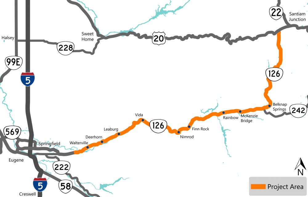
 You can always learn more about the project, find out about upcoming events and stay connected by visiting the project webpage.
 If you have not already, sign up to receive future updates about this project.
