We want to hear from you.
Our goal for this online open house is to see if you support or have concerns about the proposed projects. If you have concerns about any of the proposed projects and their possible impacts, we want to hear about them.
Together we can make sure we're designing and constructing the right projects for our communities. Thank you for taking the time to explore the proposed projects, be sure to share your thoughts in our interactive map.
Stations


Click on each question below to learn more.
STIP stands for Statewide Transportation Improvement Program.
This is our capital improvement plan for state and federally-funded projects. As we develop the STIP, we coordinate with interested parties and community members.
The Oregon Transportation Commission (OTC) is in the final steps of identifying where to spend more than $3 billion to preserve and improve the state's transportation system.
Every three years, the commission puts together the Statewide Transportation Improvement Program, also known as the STIP, that lays out where we will invest federal and state money in the transportation system - everything from roads and bridges to public transportation to bike paths and sidewalks. Along with the commission, we develop the STIP with a wide variety of participants, including cities, counties, many other partners and the public.
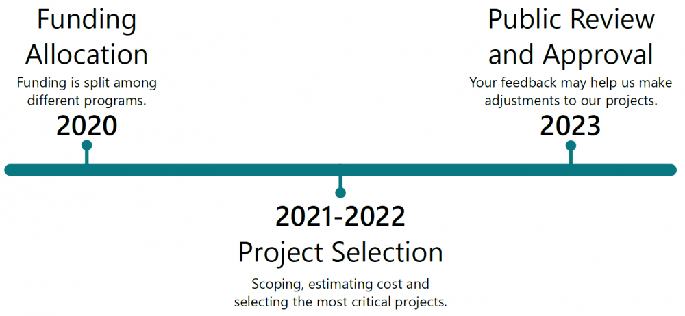
This STIP looks ahead at funding projects in 2024 through 2027. The commission started developing the STIP in 2020, by deciding how to split state and federal funding among different areas, like bridge and pavement preservation, expanding roads and interchanges, public and active transportation, and local government programs. We’ve spent the last two years selecting the most critical projects and now have a draft list of proposed investments to get your feedback on.
The Oregon Transportation Commission (OTC) began work on the 2024-2027 STIP in 2020.
There are three steps to developing the 2024-2027 STIP:
After we hear from you during the formal comment period, the OTC will adopt a revised STIP and forward it for review and approval by the Federal Highway Administration and Federal Transit Administration.
-
Funding allocation: The OTC split funding among different programs such as enhance highway, fix-it, safety, ADA curb ramps and local programs.
-
Project selection: The OTC reviewed the considerations that guide project selection. We created preliminary project lists and estimated costs and schedules. We then narrowed our list down to the proposed projects shown in the draft STIP.
-
Public review and approval: The OTC put the draft STIP out for your feedback during a formal public comment period.
You can learn more about the proposed projects in the 2024-2027 STIP by looking at the interactive map and our fact sheets.
Or check out the full list of proposed projects in the draft STIP.
The STIP has more than $3.3 billion in total state and federal funding. This comes from House Bill 2017 and the federal infrastructure bill.
If a project isn't showing construction funding in the draft STIP, it could mean:
-
The project is a "shelf project". This means we'll design the project to a certain point and then pause, or "put it on the shelf", until construction funding is available. By having some shelf projects, if more funding becomes available, we can usually start construction pretty quickly.
-
We're planning to construct, but the construction funding is being held in reserve or a "funding bucket". As projects finish design, we'll have a better understanding of how much construction will cost based on current market conditions and can assign a more accurate amount of funding from the bucket.
How the funding is split among programs

Learn more about each funding category by clicking on the tabs below.
Fix-it

The Fix-It category of the STIP funds projects that fix or preserve the state's transportation system, including bridges, pavement, culverts, traffic signals, etc.
We use data about the conditions of these items to choose the highest priority projects.
In recent STIPs, the OTC has allocated the most funding to Fix-It programs.
You can learn more about the Fix-It program by viewing the process document.
Safety
![]()
The safety program's goal is to reduce deaths and injuries on Oregon’s roads. This includes the All Roads Transportation Safety program (ARTS), which selects projects through a data-driven process to ensure resources have maximum impact on improving the safety of Oregon’s state highways and local roads.
One way we do this is by using the safety priority index system (SPIS) to look at crash data as a way to score or prioritize sites. You can learn more about the SPIS by reading our fact sheet.
Focusing on reducing fatal and serious injury crashes.
Enhance highway

The enhance highway program funds projects that enhance or expand and upgrade the state highway system. It's usually a smaller slice of the STIP budget.
Enhance projects can include a wide range of investments like new lanes and interchange improvements.
You can learn more about the enhance highway program by reading the program outline approved by the Oregon Transportation Commission.
Public and active transportation
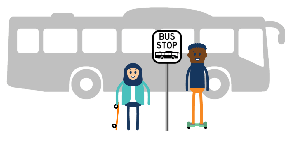
We strive to build and maintain an equitable, accessible and climate friendly multi-modal public and active transportation network across the state.
By increasing Oregonians’ access to public transportation and promoting biking and walking as a means of travel, we can improve community connection, public health and our environment.
This program includes bicycle, pedestrian, public transportation and other transportation options. You can learn more by reading our program fact sheet.
Local government programs

We manage programs that fund or support projects on local roadways. This funding goes to cities, counties and others for priority projects.
You can learn more about local government funding on our webpage.
ADA curb ramps
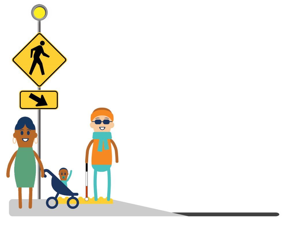
We want to make sure our highways work whether you drive, ride, walk or roll. Part of that is constructing curb ramps to make sidewalks accessible for everyone.
In 2017, we began work to bring 25,000+ curb ramps into compliance with Americans with Disabilities Act (ADA) standards over the next fifteen years.
You can learn more about our ADA program on our webpage.
Other

The other program includes planning and data collection, workforce development and administrative programs funded using federal money.
This includes transportation and facility plan work that is done by our planning program with local jurisdictions.
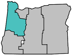
Learn more about the proposed projects by touring our interactive map:
Map lines and dots are provided for reference only, precise locations may vary.
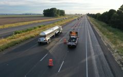
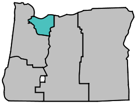
Highlighted proposed projects in Washington, Multnomah, Hood River and Clackamas counties:
- OR 224: SE 17th to Rusk Road (Key number: 21598).
- I-84 (Westbound): Union Pacific Railroad Bridge (Key number: 21683).
- I-405: Fremont Bridge (Willamette River) West Ramps (Key number: 22603).
- I-5: Capitol Highway - OR 217 (Key number: 22719).
- U.S. 30B: (N Lombard Street) at Peninsula Crossing Trail (Key number: 22770).
- OR 224 at OR 211 and SE Burnett Road (Key number: 22771).
- I-84: I-5 to Hood River (Key number: 22773).
- OR 8: SE 10th Avenue at SE Walnut Street (Key number: 22863).
- OR 99E Canemah Rockfall Phase 2 (Key number: 22865).
- U.S. 26 Active Traffic Management (Key number: 22869).
- OR 99E: (SE Mcloughlin Boulevard) SE Risley Road - Gloucester Street (Key number: 22953).
- U.S. 26: E Salmon River Road – E Lolo Pass Road (Key number: 23049).
- OR 8: Tualatin Valley Highway at SW 142nd Avenue and SW 214th Avenue (Key number: 23050).
- OR 99W: (Barbur Boulevard) SW 26th Way - SW 26th Avenue (Key number: 23051).
- OR 141: Hall Boulevard at SW Hemlock Street (Key number: 23052).
Use the project key number to identify which project you'd like to comment on.
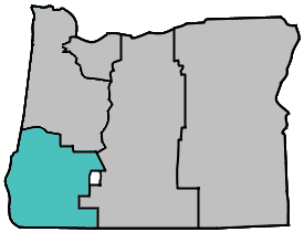
Learn more about the proposed projects by touring our interactive map:
Map lines and dots are provided for reference only, precise locations may vary.
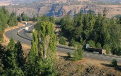
Highlighted proposed projects in Clatsop, Columbia, Western Washington, Tillamook, Yamhill, Polk, Marion, Lincoln, Benton, Linn and Lane counties:
- OR 126: Linn County Line to Old McKenzie Highway (Key number: 21545).
- OR 6: Roadside Barrier Upgrades (Key number: 22509).
- OR 18: SE Lafayette Highway to SE Ash Road (Key number: 22707).
- OR 99W at Bethel Road (Key number: 22708).
- Ehlen Road NE at Butteville Road NE (Key number: 22725).
- OR 6: Milepoint 4.4-9.0 (Key number: 22787).
- U.S. 20: milepoint 71.5 to 74.5 and OR 126 milepoint 0 to 13 (Key number: 22789).
- I-5: Cottage Grove - Martin Creek (Key number: 22938).
- Corvallis and U.S. 20 ADA Curb Ramps (Key number: 22985).
- Cottage Grove ADA Curb Ramps (Key number: 23029).
- Newberg ADA Curb Ramps (Key number: 23031).
- Springfield ADA Curb Ramps (Key number: 23044).
Use the project key number to identify which project you'd like to comment on.
Learn more about the proposed projects by touring our interactive map:
Map lines and dots are provided for reference only, precise locations may vary.
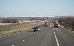
Highlighted proposed projects in Douglas, Coos, Curry, Josephine, Jackson and Southwest Klamath counties:
- U.S. 101: Anderson Rockfall (Key number: 21698).
- OR 42: U.S. 101 to Cedar Point Road (Key number: 21719).
- Garden Valley Road at Melrose Road Roundabout (Key number: 22914).
- N Columbus Avenue at W Jackson Street Roundabout (Medford) (Key number: 22846).
- I-5: Stage Road Pass MP 79 to 80.7 (Key number: 22987).
- OR 62 at OR 234 Roundabout (Key number: 22947).
- OR 99: Rogue River Bridge - Gold Hill Spur (Key number: 22630).
- U.S. 199: Elliot Creek Road Turn Lane (Key number: 23005).
Use the project key number to identify which project you'd like to comment on.
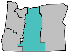
Learn more about the proposed projects by touring our interactive map:
Map lines and dots are provided for reference only, precise locations may vary.
Highlighted proposed projects in Wasco, Sherman, Gilliam, Jefferson, Wheeler, Crook, Deschutes, Klamath and Lake counties:
- S 6th Street (OR 39) Signal Replacement at Homedale (Klamath Falls) (Key number: 22922).
- U.S. 20 at Locust Street Intersection (Sisters) (Key number: 22072).
- U.S. 97 at O'Neil Hwy (Redmond) (Key number: 22777).
- U.S. 97: Redmond to Bend Phase 2 (Key number: 22776).
- Malin Safe Routes to School (Key number: 23101).
- U.S. 97 at NE Chestnut Street (Madras) (Key number: 23055).
- U.S. 97: Veterans Way - SW Yew Avenue (Redmond) (Key number: 21166).
Use the project key number to identify which project you'd like to comment on.
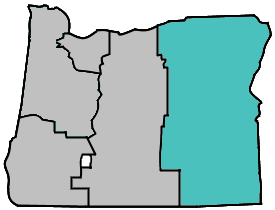
Learn more about the proposed projects by touring our interactive map:
Map lines and dots are provided for reference only, precise locations may vary.
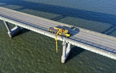
Highlighted proposed projects in Morrow, Umatilla, Union, Wallowa, Grant, Baker, Harney and Malheur counties:
- U.S. 95: MP36 - McDermitt (Key number: 21641).
- U.S. 395: Baggett Lane Safety and Sidewalk Improvements (Hermiston) (Key number: 22069).
- I-84: Farewell Bend - N Fork Jacobsen Gulch (Key number: 22919).
- U.S. 30: Snake River Bridge and Interstate Bridge (Ontario) (Key number: 22926).
- I-82/I-84: Freight and Congestion Improvements (Key number: 22942).
- I-84: Roadway Illumination Project (Key number: 22994).
- Echo Multi-use Pedestrian Path (Key number: 23046).
Use the project key number to identify which project you'd like to comment on.
Highlighted Programs
Click on each program name below to learn more.
The Oregon Safe Routes to School (SRTS) program includes education, construction, planning and equity work. We work with our partners and community members to promote livable, vibrant communities that increase physical activity, social connections and educational opportunities around walking and rolling.
Our SRTS program provides grant funding and technical assistance to communities across Oregon. Its success relies on partnerships between public, private and non-profit organizations at the local, regional and state levels.
Great Streets is a funding program that addresses safety improvements and increases access to walking, biking and transit.
Focusing on "main streets" in communities around the state, proposed projects must improve safety and multimodal access (walking, biking and transit) on state highways.

Join us at online and in person meetings around the state
Click on each meeting type below to find out how you can participate.
 We hope you can join us at one of our two virtual public comment sessions that will be hosted by our assistant director for finance, Travis Brouwer.
At the meeting you can learn more about the STIP and give us your feedback. Each participant can provide up to three minutes of public comment.
-
Thurs., April 6 from 6-7 p.m. | Join using Microsoft Teams.
-
Thurs., April 13 from 2-3 p.m. | Join using Microsoft Teams.
If you need accommodations to join, contact Jill Pearson at 503-930-6193 at least 48 hours in advance.
Join us at one of our in person meetings to learn more about the draft STIP:
-
Columbia County | March 9, 4-6 p.m. at Healy Hall (1054 Oregon Street, St. Helens OR 97051). If you need accommodations to attend the meeting, contact Caroline Crisp at 503-313-6812 at least 48 hours in advance.
-
Rogue Valley Area Commission on Transportation | March 14, 9-11:10 a.m. at the Grants Pass City Council Chamber (101 NW A Street, Grants Pass, OR 97526). If you need accommodations to attend the meeting, call Naomi Birch at 541-986-3510 at least 48 hours in advance.
-
Central Oregon and Lower John Day Joint Meeting (Wasco, Gilliam, Sherman, Wheeler, Jefferson, Crook and Deschutes Counties) | March 15, 4-5 p.m. at the ODOT Bend Office in the Baney Conference Room (63055 N. Highway 97. Building M, Bend, OR 97701). Or you can call into the meeting at 1-971-277-1965, conference ID: 360 956 360#. Or join the meeting virtually using Microsoft Teams. If you need accommodations to attend the meeting, contact Robert Townsend at 541-388-6252 at least 48 hours in advance.
-
Northeast and Southeast Area Commissions on Transportation Joint Meeting (Morrow, Umatilla, Wallowa, Union, Baker, Malheur, Grant and Harney Counties) | March 16, 9 a.m. - 12 p.m. at the ODOT Region 5 Headquarters (3012 Island Avenue, La Grande. OR 97850) or at the Burns Community Center (484 N. Broadway, Burns, OR 97720). Or you can call into the meeting at 11971-277-1965, conference ID: 426 626 370# . Or join the meeting virtually using Microsoft Teams. If you need accommodations to attend the meeting, contact Sheri Folsom at 541-388-6252 at least 48 hours in advance.
-
Clatsop County | March 22, 4-6 p.m. at Astoria ODOT Office, Bridgeview Conference Room (350 W Marine Drive, Astoria, OR 97103). If you need accommodations to attend the meeting, contact Caroline Crisp at 503-313-6812 at least 48 hours in advance.
-
Tillamook County | March 23, 4-6 p.m. at the Port of Tillamook Bay, main conference room (4000 Blimp Boulevard Tillamook, OR 97141). If you need accommodations to attend the meeting, contact Caroline Crisp at 503-313-6812 at least 48 hours in advance.
-
Lane County | March 23, 5-6:30 p.m. at the Springfield ODOT Office, Mt. Pisgah conference room (2080 Laura Street, Springfield, OR 97477). If you need accommodations to attend the meeting, contact Region 2 Communications at 541-744-8080 at least 48 hours in advance.
-
Clackamas County | April 3, 4:30-6 p.m. at the Clackamas County Development Services Building in the auditorium (150 Beavercreek Road, Oregon City, OR 97045). If you need accommodations to attend the meeting, call 503-731-4128 at least 48 hours in advance.
-
Mid-Willamette Valley Area Commission on Transportation (Marion/Yamhill/Polk Counties) | April 6, 3:30 p.m. (check the agenda for the specific topic time) at the MWVCOG Offices, second floor (100 High Street SE, Suite 200, Salem, OR 97301). If you need accommodations to attend the meeting, contact Mike Jaffe at 503-540-1606 at least 48 hours in advance.
-
Washington County | April 8, 11 a.m. - 1 p.m. at the Beaverton Library (12375 SW 5th Street, Beaverton, OR 97005). If you need accommodations to attend the meeting, call 503-731-4128 at least 48 hours in advance.
-
Lane County | April 10, 5-6:30 p.m. at the Springfield ODOT Office, Mt. Pisgah conference room (2080 Laura Street, Springfield, OR 97477). If you need accommodations to attend the meeting, contact Region 2 Communications at 541-744-8080 at least 48 hours in advance.
-
Hood River County | April 25, 4:30-6:30 p.m. at the Hood River Taylor Fire Station in the community room (1785 Meyer Parkway, Hood River, OR 97031). If you need accommodations to attend the meeting, call 503-731-4128 at least 48 hours in advance.
-
Cascades West Area Commission on Transportation (Linn/Benton/Lincoln Counties) | April 27, 5 p.m. (check the agenda for the specific topic time) at the Albany COG Office (1400 Queen Avenue SE, Albany, OR 97322). If you need accommodations to attend the meeting, contact Nick Meltzer at 541-924-8474 at least 48 hours in advance.
Stay connected
 You can learn more about the 2024-2027 draft STIP, see a full list of the proposed projects, read commonly asked questions and more by visiting our webpage.
 If you have not already, sign up to receive future updates about the STIP.
Please help us spread the word about this online open house.
Feel free to share this with your friends and neighbors so that we can get their feedback.
Thank you for participating!