
Stations

The Port of Cascade Locks and Oregon Department of Transportation are planning for a future bike and pedestrian path network within Marine Park that will be accessible for everyone. The proposed Marine Park Trail would connect Marine Park from end to end and run the length of Thunder Island. At the southwest end of Marine Park, the trail would connect to the future park entrance for people walking, biking, and rolling to enter from Wa Na Pa Street (U.S. 30).
The technical team will be developing a plan to understand the construction costs, environmental and cultural implications of building the trail, and understand any other risks tied to construction. This planning-level project should be completed by early 2022. Funding for the trail construction has not been set aside, but the Port of Cascade Locks is developing a funding strategy.
This project is tied to a previous project that examined a new entrance from Wa Na Pa Street near the post office that would allow people walking, biking or using mobility devices to safely cross the railroad tracks and enter Marine Park. The design for that crossing will not be considered as part of this project.
More information about this previous project can be found at: https://portofcascadelocks.org/marine-park-entrance/
Trail Alternatives
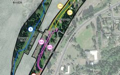
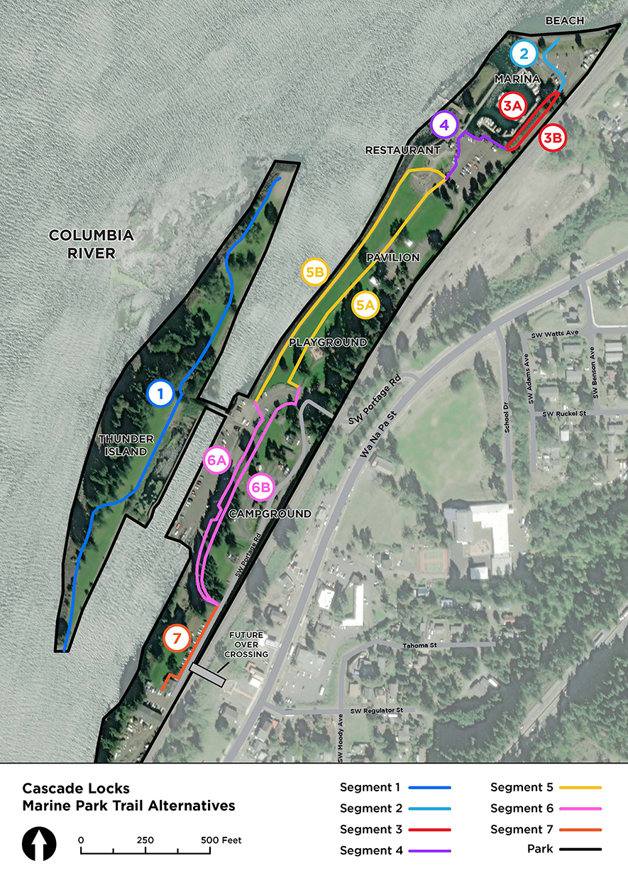 The Marine Park Trail is divided into seven segments for this alternatives analysis. Four of the segments have a single alignment, and three segments have two design alternatives under consideration.
-
Segment 1: Thunder Island Trail
-
Segment 2: Marina Parking Lot
-
Segment 3A/3B: Marina Fire Lane
-
Segment 4: Restaurant/Visitor Center Parking Lot
-
Segment 5A/5B: Central Lawn
-
Segment 6A/6B: Campsites
-
Segment 7: SW Portage Road West End
We want your feedback about the segments that have more than one design option (bolded above). We will ask for your feedback on each alternative for those three segments (Segment 3, 5 and 6). If you would like to learn more about the segments with a single alignment option (Segment 1, 2, 4 and 7), please view the trail alternatives executive summary on the project website.
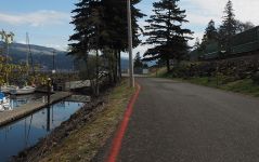
These photos show views of the fire lane adjacent to the marina today. The railroad tracks (located up the embankment) are too close to be able to extend the roadway in that direction. Both alternatives 3A and 3B would expand out toward the water, and both would impact the trees located on the slope. Because the Union Pacific Railroad (UPRR) owns much of the road right of way in this segment, the project team would need to minimize impact to UPRR property.
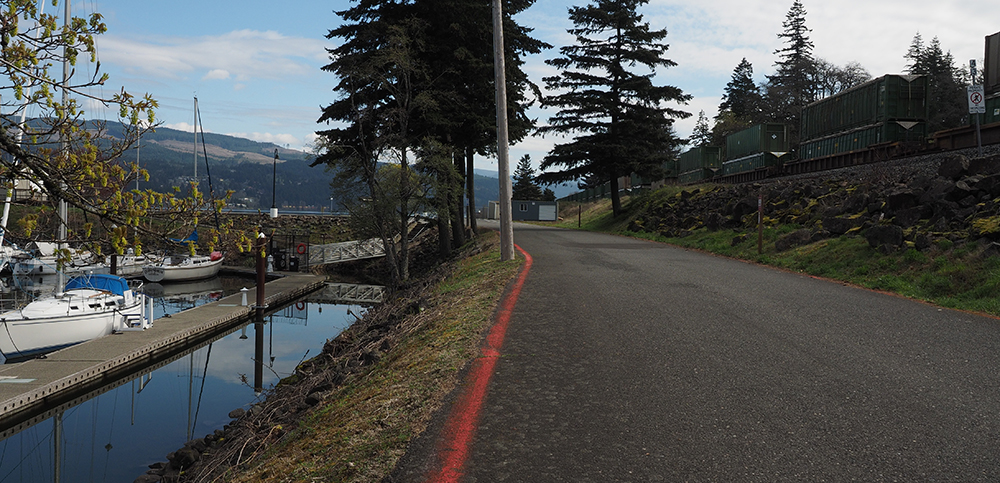
The marina and fire lane today.
Expanded Roadway Design (Alternative 3A)
The Expanded Roadway Design (alternative 3A) features a trail running next to the existing roadway separated by striping. The roadway surface will extend toward the water with a retaining wall or structure.
A visual of what the Expanded Roadway Design (alternative 3A) might look like.
Opportunities and challenges:
-
The trail extension would provide a dedicated space for trail users on the same level as the roadway.
Cost estimate: $744,000
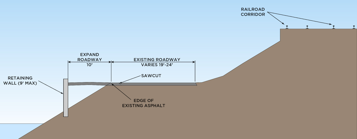 A cross section of the Expanded Roadway Design (Alternative 3A) showing the dimensions and details of the design.
Boardwalk Design (Alternative 3B)
This design features a separate boardwalk built over the water at the marina's southeastern edge.
A visual of what the Boardwalk Design (alternative 3A) might look like.
Opportunities and challenges:
-
This design keeps the current fire lane width and avoids impacts to UPRR property and right-of-way.
-
The current design involves tree removal, however placement of the boardwalk is flexible. If preserving trees is a priority, the boardwalk could be located further down toward the water. (This adjustment to the design would require two piles instead of one.)
-
Dedicated space for trail users would be grade separated (at a different height from automotive traffic).
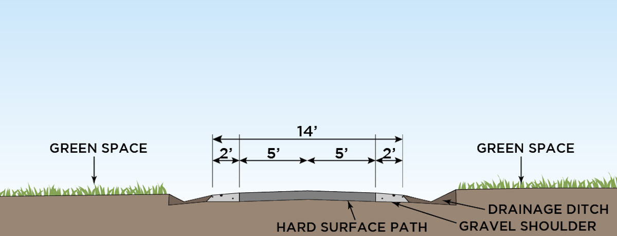
Cost estimate: $1,237,000
A cross section of the Boardwalk Design (Alternative 3A) showing the dimensions and details of the design.
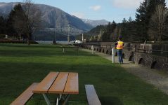
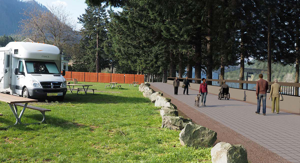
This photo shows the central lawn area today looking from the east toward the Bridge of the Gods. Trail alternative 5A follows the middle of the central lawn to avoid impacts to electrical and water hook-ups. Trail alternative 5B runs along the stone seawall where there is an existing gravel path.
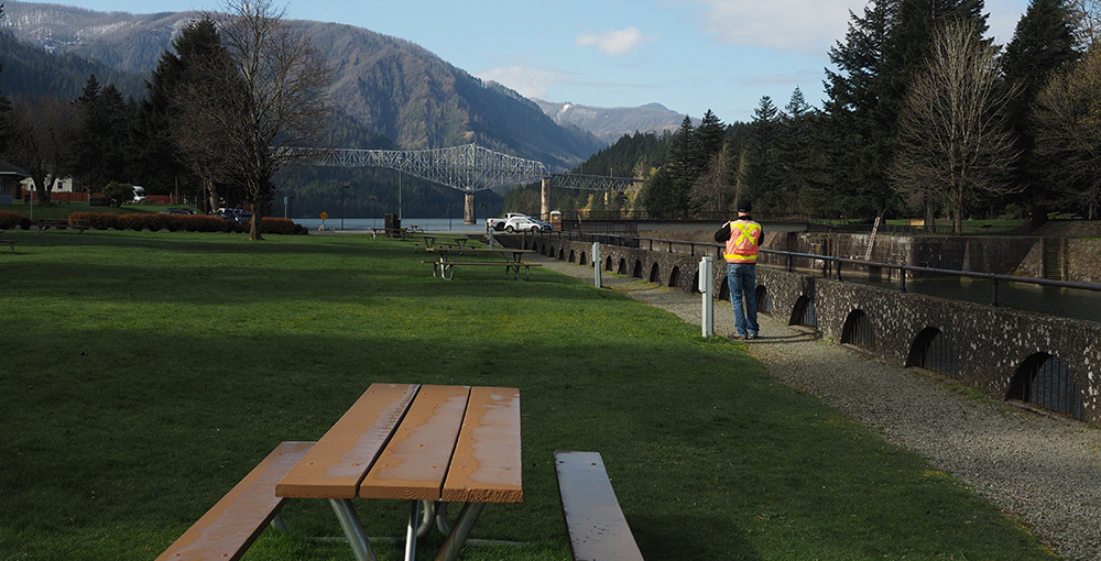
The central lawn area today.
Central Route (Alternative 5A)
The Central Route (alternative 5A) would travel through the center of the central lawn to avoid impacts to water and electrical hook-ups near the seawall. At the northwest end of this segment, the trail would cross SW Portage Road at the roundabout.
Opportunities and Challenges:
-
Central route would provide a second path through this area of the park; the gravel path along the seawall would remain in place.
-
Provides off-street, ADA-accessible route to the pavilion.
-
Reduces lawn space.
Cost estimate: $165,000
A cross section of the Central Route (Alternative 5A) showing the dimensions and details of the design.
Seawall Route (Alternative 5B)
The Seawall Route (alternative 5B) would follow the existing gravel trail along the stone seawall. At the northwest end of this segment, the trail would travel alongside SW Portage Road at the northern edge of the roundabout.
Opportunities and Challenges:
-
Seawall alternative would require relocating or removing electrical and water hook-ups.
-
Minimal impacts to lawn space.
Cost estimate: $305,000
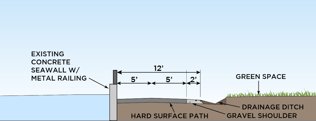
A cross section of the Seawall Design (Alternative 5B) showing the dimensions and details of the design. This cross section is shown with the water on the left, as if you are looking toward the east with your back to the Bridge of the Gods.
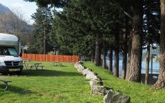
These photos show the lower parking lot and the campsite area today. The trail in the Lower Route (alternative 6A) would travel along the bottom of the bluff, while the trail in the Upper Route (alternative 6B) would follow the top edge of the bluff, along the campsites.
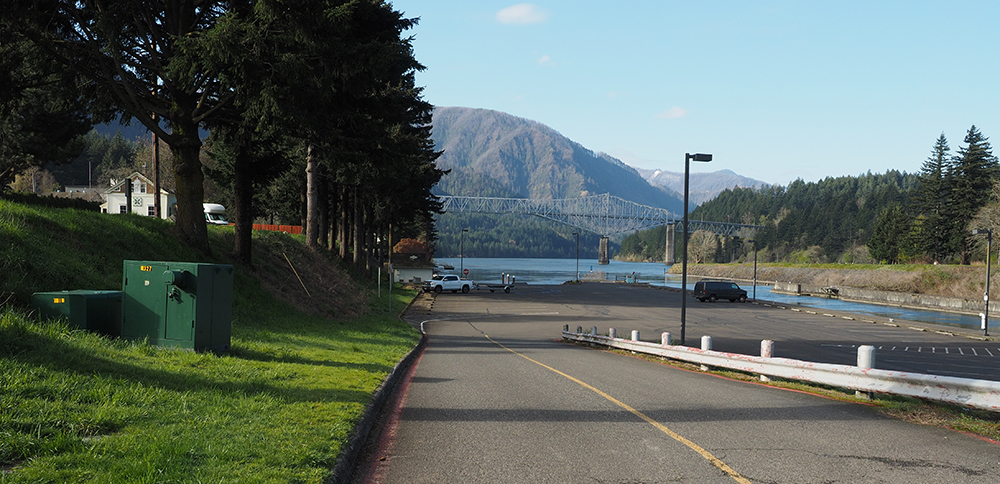
The parking lot today.
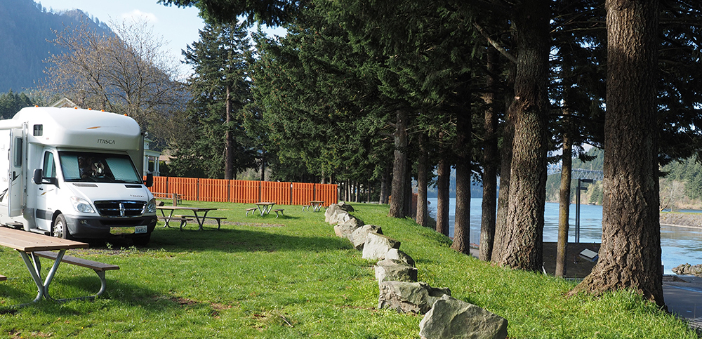
The campsite area today.
Lower Route Trail (Alternative 6A)
The Lower Route (alternative 6A) would follow the bottom of the bluff, alongside the roadway and parking area. The trail would need to go around an existing restroom building. Terracing the proposed retaining wall over several levels could help it appear less imposing.
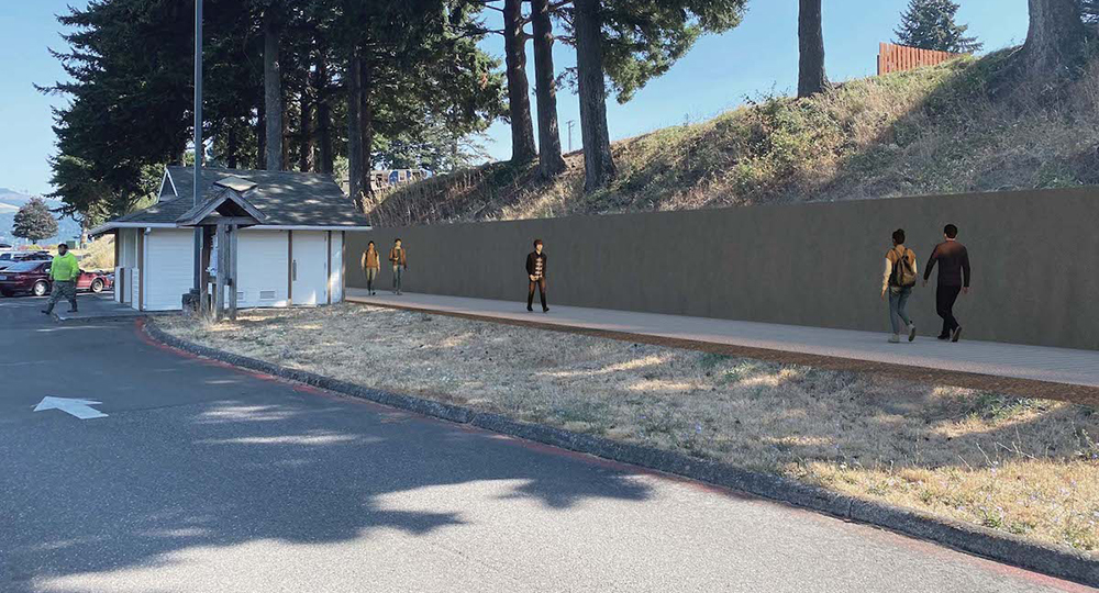
A visual of what the Lower Route (alternative 6A) might look like. The current restrooms are pictured in the upper left of this rendering and the campsites are at the top of the bluff. A tall retaining wall lines one side of the path at the bottom of the bluff.
Opportunities and challenges:
-
Lower Route would need a retaining wall.
-
Avoids impacts to campsites.
-
Likely to require some tree removal on the slope.
Cost estimate: $1,233,000
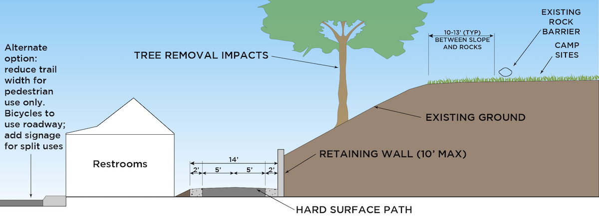
A cross section of the Lower Route (Alternative 6B) showing the dimensions and details of the design.
Upper Route (Alternative 6B)
The Upper Route (alternative 6B) would follow the top edge of the bluff next to the campsites. This option would need a retaining wall and likely a fence because of the steep slope. Building a low fence on the other side could help provide privacy for the campsites.
A visual of what the Upper Route (alternative 6B) might look like. The path passes between the top of the bluff and the campsites.
Opportunities and challenges:
-
Upper Route would likely impact campsites with loss of space, increased noise, loss of privacy, and loss of a visual connection to the Columbia River.
-
Likely to require some tree removal on the slope.
Cost estimate: $720,000
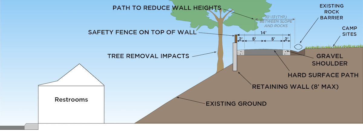
A cross section of the Upper Route (Alternative 6B) showing the dimensions and details of the design.