
Stations

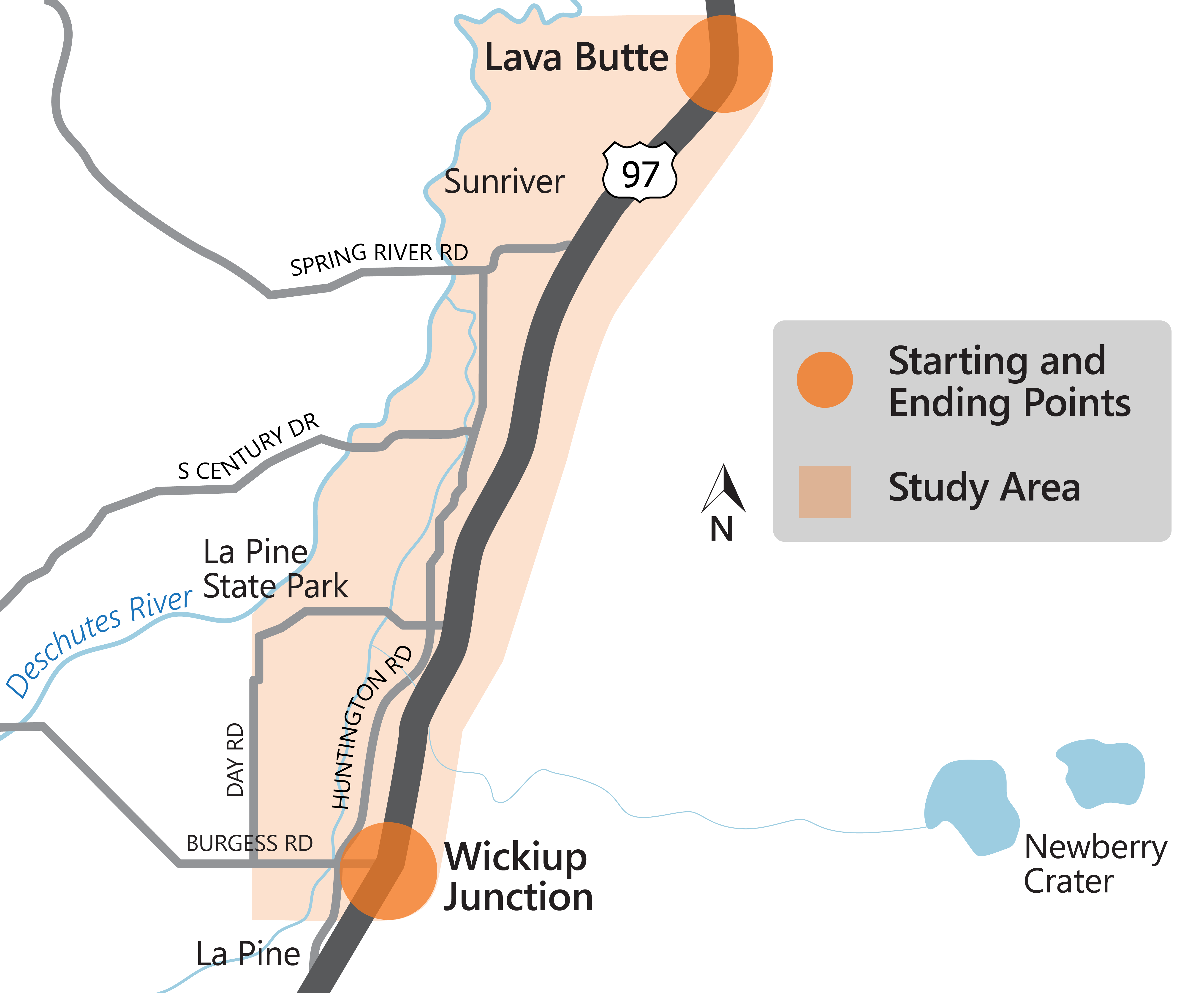
Project Area Overview
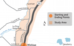
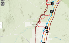
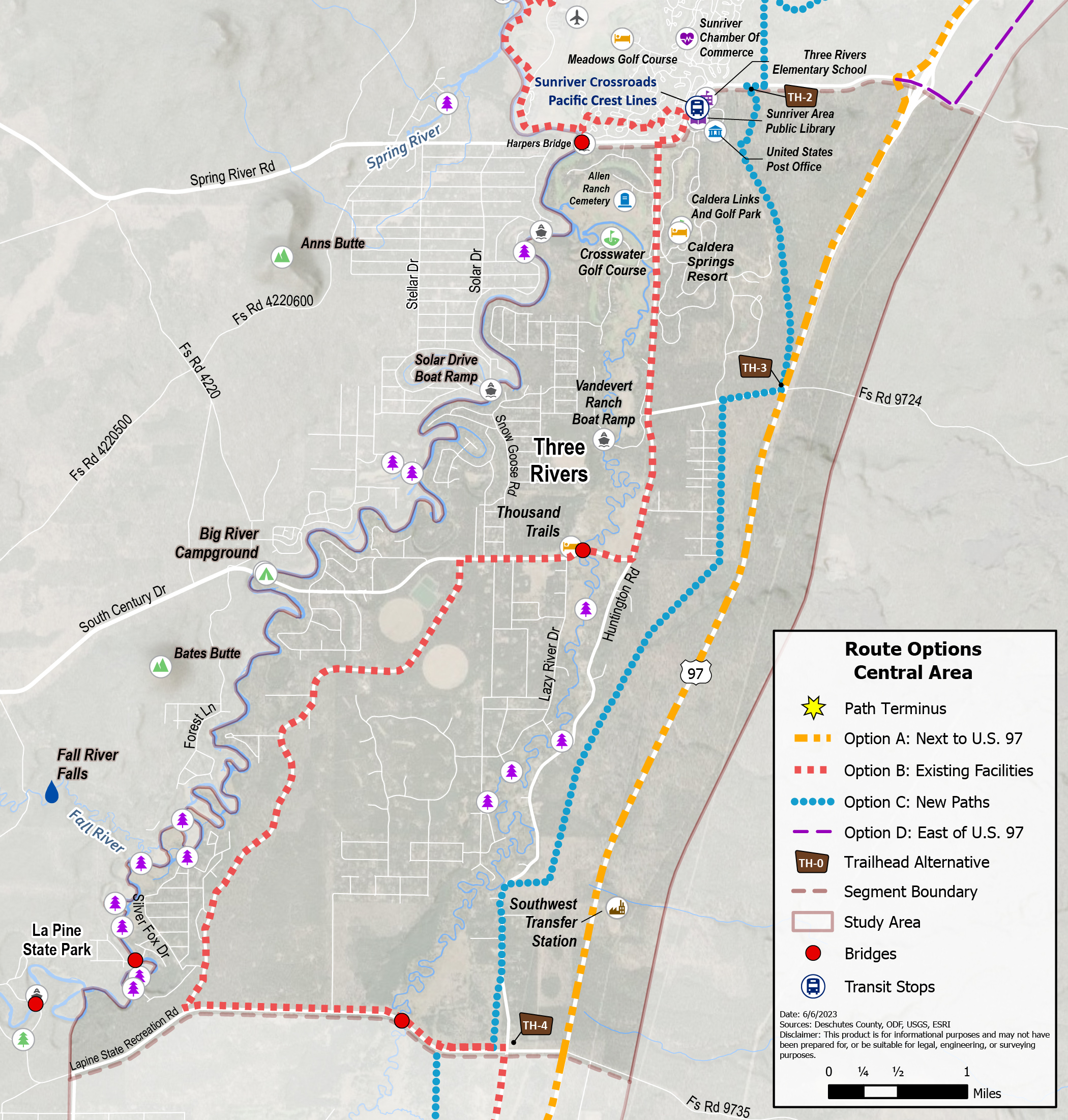
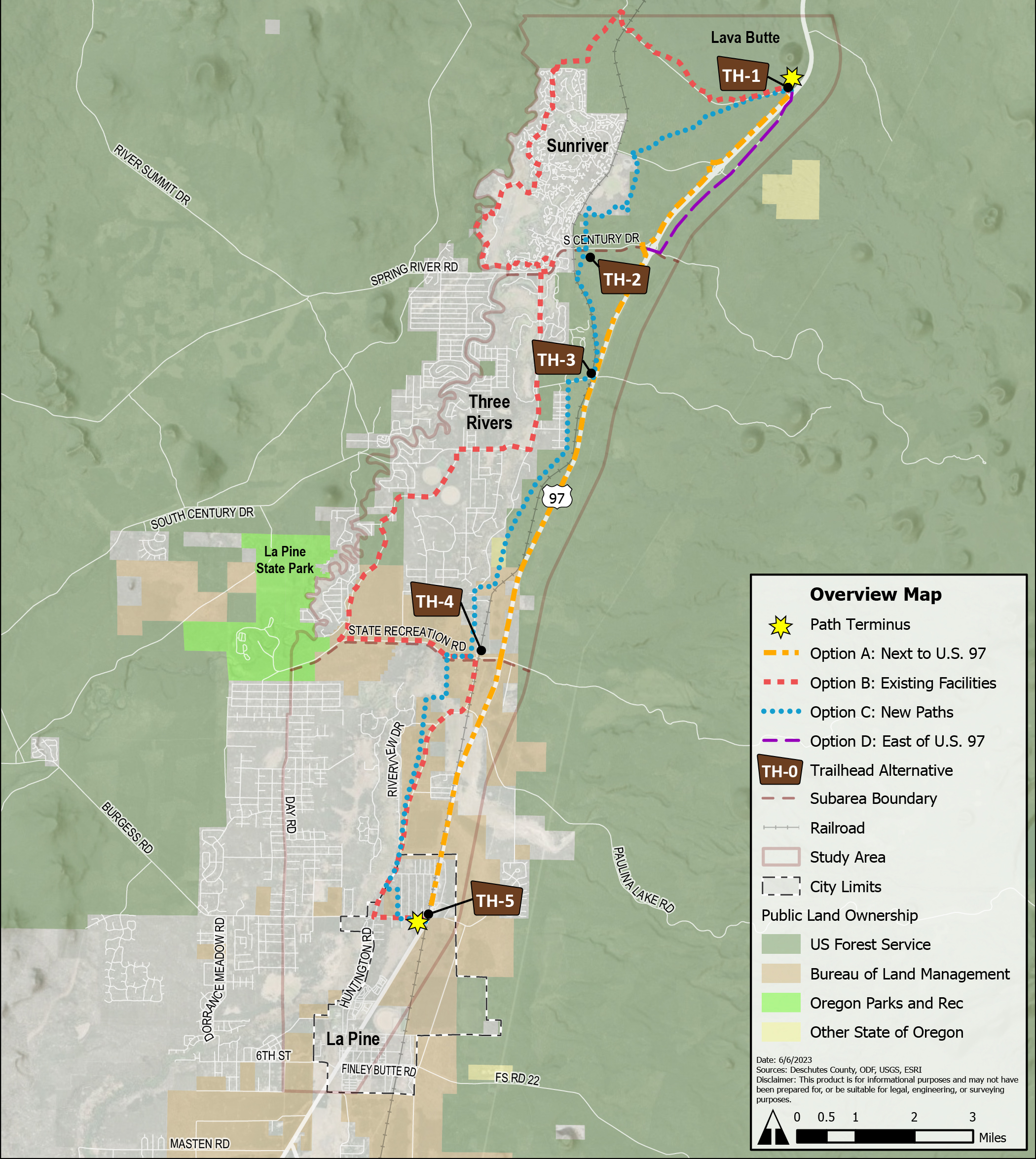
The project is considering route options in the study area, outlined in the map to the right.
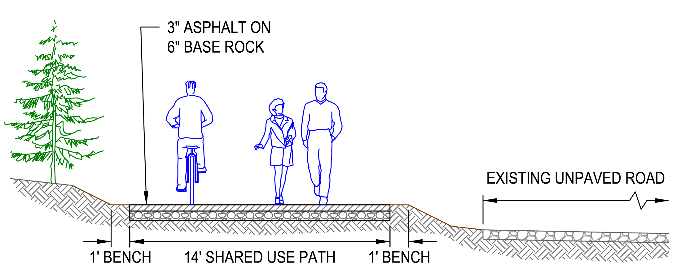
The route will loosely follow the north-south direction of U.S. 97, though it may be some distance from U.S. 97. At the north end, the route will join with the planned “Bend to Lava Butte Multi-Use Path” at the Lava Lands Visitor Center (scheduled to begin construction in 2024). At the south end, the route will connect with the recently-completed “U.S. 97 Wickiup Junction to First Street Multi-Use Path” at Burgess Avenue in La Pine. The route will be paved and ADA-compliant.
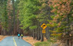
The multi-use path will provide outdoor recreation opportunities and transportation options to avoid the seasonal traffic and parking congestion in these popular areas.
View the full Lava Butte to La Pine Multi-Use Planning Study Existing Conditions Report on the project webpage.
Project Subareas
It is nearly 20 miles between Lava Butte and La Pine — a long distance for a path. For this reason, we are thinking about the path in three smaller areas:
North Area: between Lava Butte and Spring River Road/Century Drive.
Central Area: between Spring River Road/Century Drive and State Recreation Road.
South Area: between State Recreation Road and Wickiup Junction.

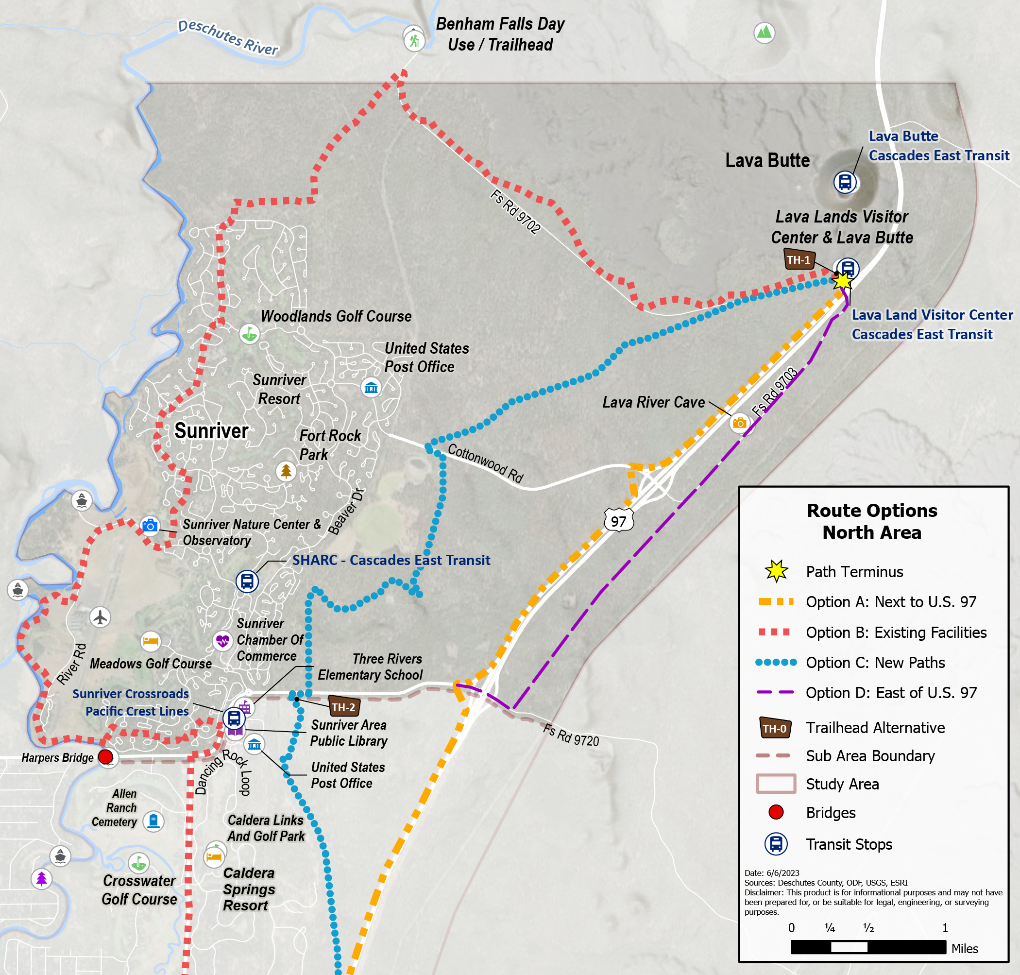
Option A: Separated Path Next to U.S. 97
This option would build a new separated path next to U.S. 97. The path would be near the highway, which would help simplify the approval process and could likely result in the route being built more quickly than the other potential options.
- This is a direct route between Lava Lands Visitor Center and Wickiup Junction.
- This path would be separated from motor vehicle traffic.
- The route would be near the highway and have exposure to traffic noise and air pollution.
- This route is not directly connected with many destinations or residential areas.
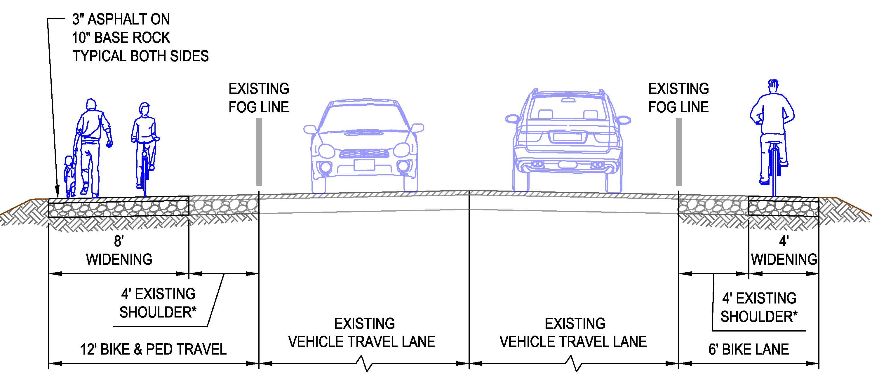
Option B: Widened Shoulders on a County Road.
This option would be along existing paths and roads to make efficient use of existing infrastructure. The route would connect with many residential areas and destinations, which would make it a convenient transportation option.
- This route would use existing paths in the area of Sunriver in the north portion. These paths are already busy during the summer, and bringing additional people would make them even busier.
- Sunriver’s paths are privately owned. Using them would require coordination with the owners.
- This route would use widened shoulders on existing roads south of Spring River Road, including South Century Drive, La Pine State Recreation Road, and Huntington Road. Roadway shoulders generally do not feel as comfortable for walking and biking as separated paths.
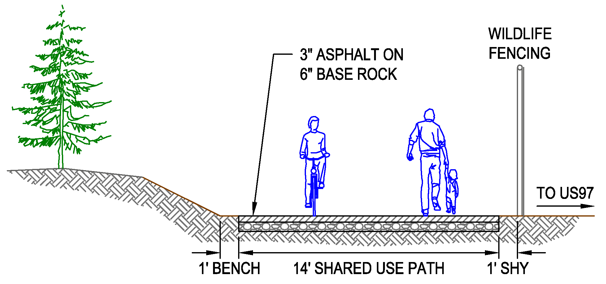
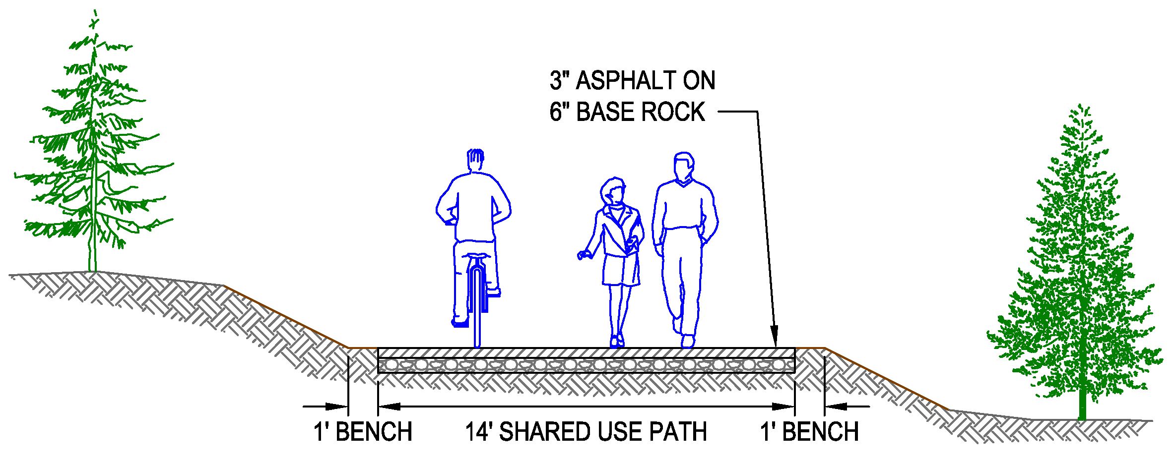
Option C: New Path Through Forest Area
This option would build new paths through undeveloped land. This route would be the most scenic and quiet but would not connect with many destinations.
- This route would require coordination with multiple landowners and the potential for a long approval process.
Option D: Path Parallel to an Existing Unpaved Road.
This option is only in the North Area. It would follow widened shoulders on Cottonwood Road and a path parallel to U.S. Forest Service roads east of U.S. 97.
-
This route would connect with Lava River Cave and U.S. Forest Service roads and trails.
-
This route is not directly connected with many other destinations or residential areas.
Five locations stand out for potential trailhead locations:
1. Lava Lands Visitor Center parking area.
- This would be at the north end of this path. It would connect with the planned Bend to Lava Butte Multi-Use Path.
- This location would be convenient for all options.
2. Forest Service Road NF-4000 just south of South Century Drive.
- This existing gravel forest road has a small pull-off area. It is on land managed by the U.S. Forest Service.
- This location would be convenient for Option C: New Paths.
3. Lot at the northwest corner of Vandevert Road and the railroad crossing.
- This existing gravel pull-off is on private property and would need to be coordinated with the property owners.
- This location would be convenient for Option A: Next to U.S. 97 and Option C: New Paths.
4. Lot at the northeast corner of State Recreation Road and Huntington Road.
- This existing gravel pull-off is on land managed by the Bureau of Land Management.
- This location would be convenient for all options.
5. Wickiup Junction Park and Ride.
- This would be at the south end of this path. It would connect with the recently-completed Wickiup Junction to First Street Multi-Use Path.
- Cascades East Transit Route 30 stops here.
- This location would be convenient for all options.

Stay connected!
Keep an eye out for more information on public input opportunities by signing up for the project email list.
You can always learn more about the project, find out about upcoming events and stay connected by visiting the project webpage.