About the Historic Columbia River Highway
Constructed between 1913 and 1922, the Historic Columbia River Highway overcame all odds. At the turn of the century, after visiting Europe’s great roads, two men -- Sam Hill and Sam Lancaster -- had a vision to create an even better road here in the United States designed exclusively for this new contraption called the automobile. This road would lay lightly on the land and take its users to the most beautiful spots and breathtaking vistas of the Columbia River Gorge.
In the early 1950s, many miles of the Historic Columbia River Highway were damaged or destroyed to pave the way for Interstate 84. The passage of the Columbia River Gorge National Scenic Area Act in 1986 motivated the Oregon State Legislature to commit to restore the entire Historic Highway to its glory days of the 1920s.
For More Information
Contact Katelyn Jackson, ODOT Community Affairs
Katelyn.Jackson@odot.state.or.us | 503-731-8503
Or Terra Lingley, Columbia River Gorge National Scenic Area Coordinator
Terra.M.Lingley@odot.state.or.us | 503-731-8232
Sign up for email updates about the Historic Columbia River Highway and State Trail.
Stations

Overview:
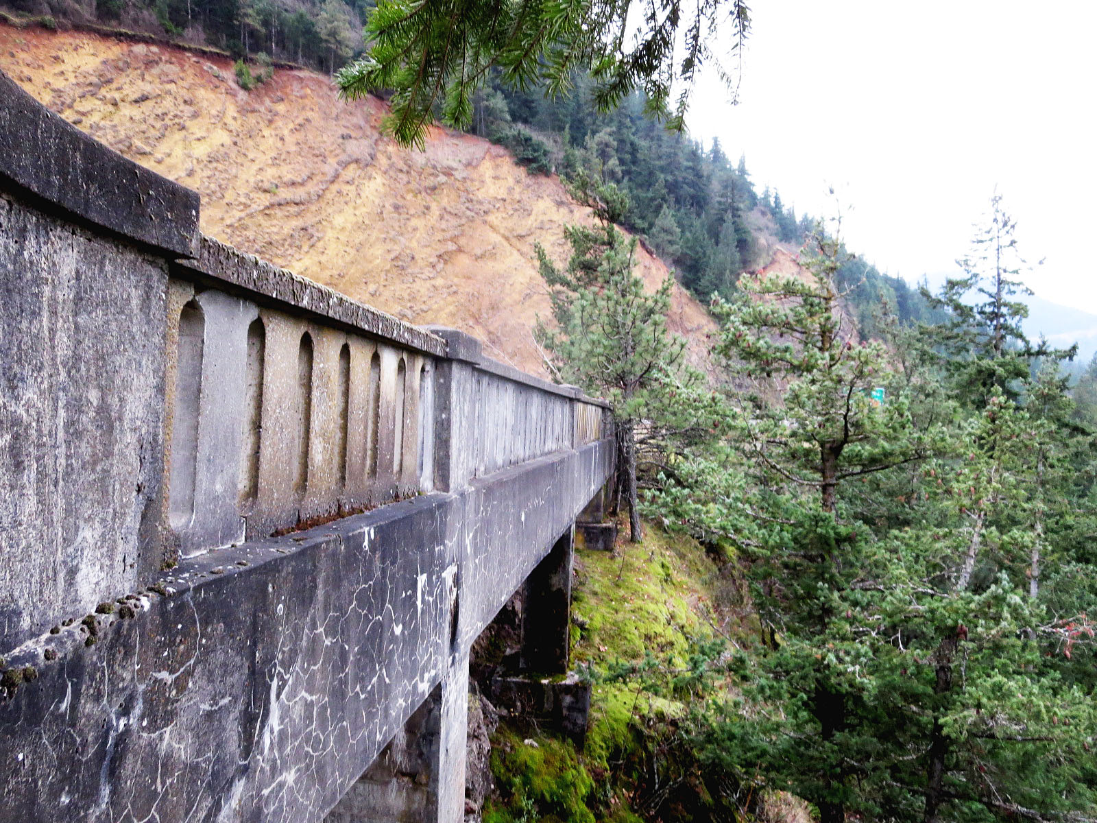
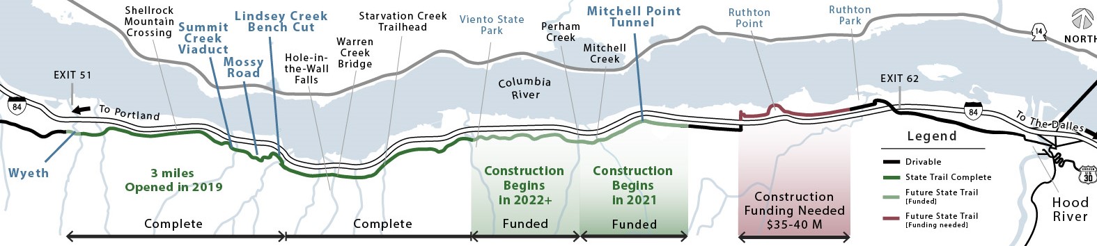
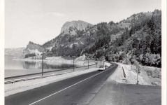
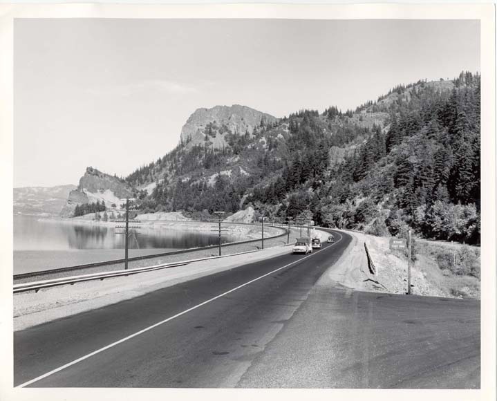
This segment of trail connects the existing Historic Highway State Trail at the Viento Trailhead to Mitchell Point and includes reconnecting 0.67 miles of original sections of the Historic Highway.
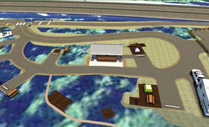
The project includes upgrades to the Viento Trailhead and improvements to the South Viento State Park Campground, including a new restroom. This segment of trail will cross Perham and Mitchell Creeks with two bridges with a look consistent with recent projects.
Construction of this trail segment will be challenging along the steep slopes and close proximity to the freeway. A mix of rockfall fences and rockfall mesh will be installed on six slopes adjacent to trail and I-84 with large cranes or helicopters to improve safety for trail and interstate users.


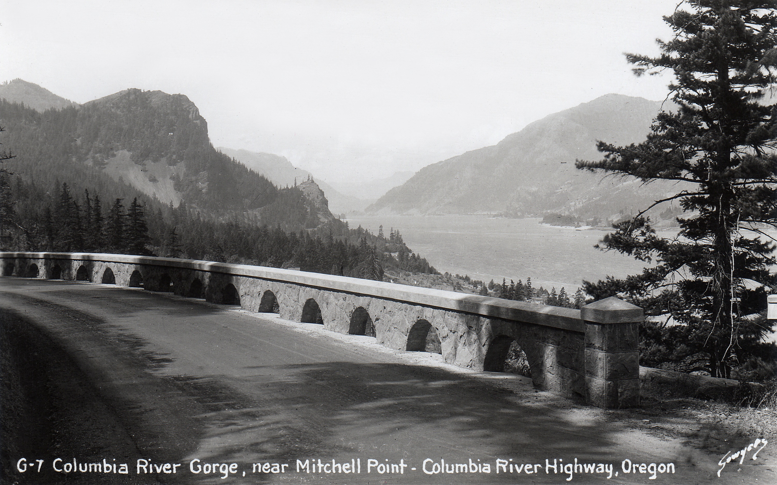
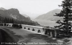
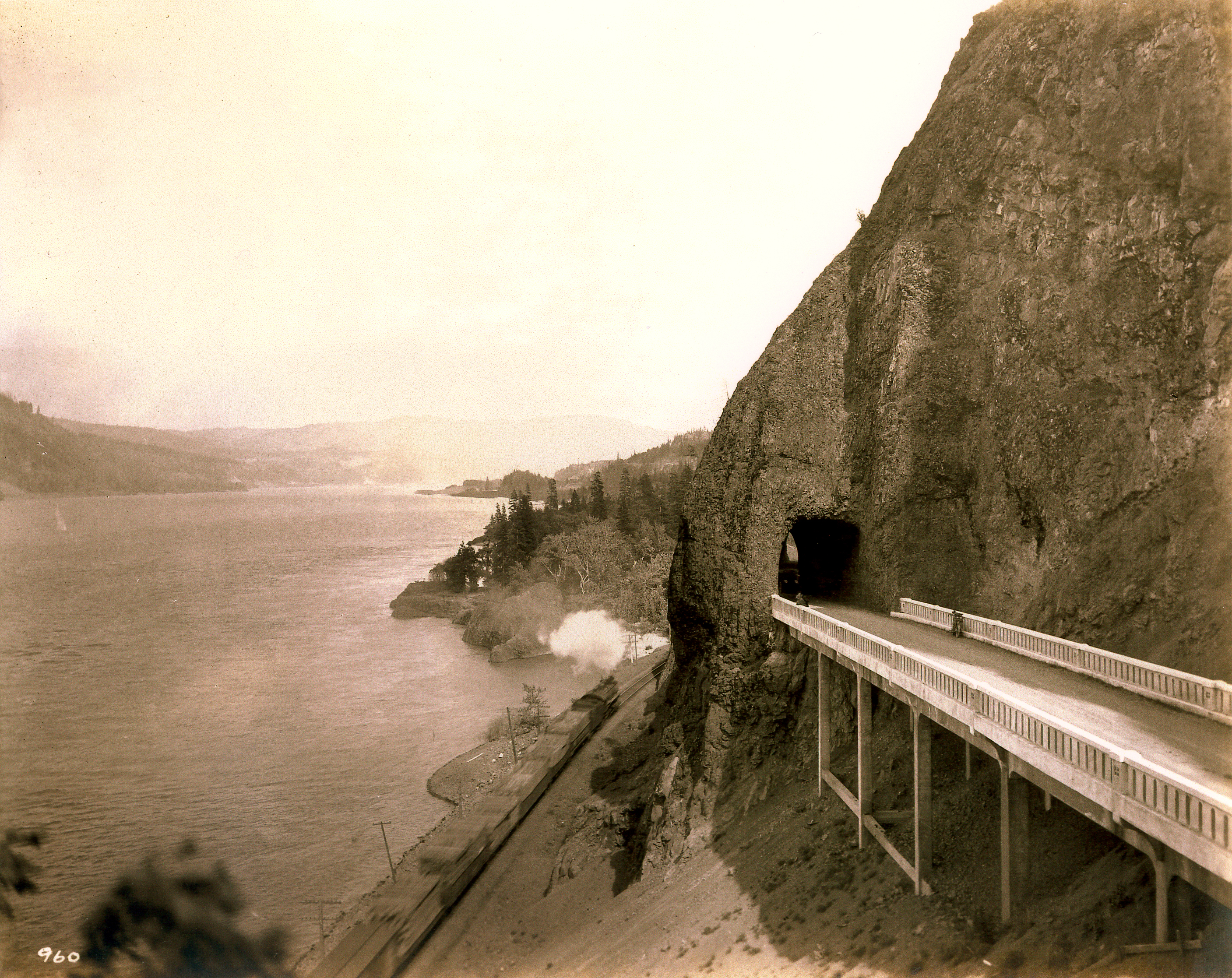
The iconic Mitchell Point Tunnel was a highlight of the original Historic Highway, but the construction of Interstate 84 destroyed the tunnel.
Now, we are preparing to break ground on constructing a new tunnel. There will soon be a 655-foot tunnel with five arched windows at Mitchell Point.
Design elements:
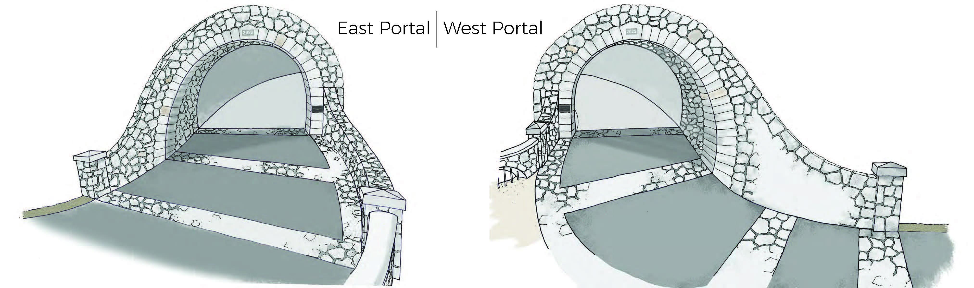
Arched windows
Through the design process, we were able to allow for five arched windows along the tunnel. This design is historically consistent with the original tunnel.
Lighting
Based on studies of other tunnels and simulations on different options, we concluded that natural light alone will be sufficient for trail users to transition from the outside light to inside the tunnel. There will be no artificial lighting inside the new tunnel.
Rockfall Mitigation
After simulating rockfall conditions, we have determined that rockfall mesh and fencing is necessary at both entrances, or portals, to the tunnel. The rockfall mitigation will increase safety by reducing the potential for rocks to land on the trail. By modifying the design, we were also able to minimize impacts to the vegetation on the slope.
Traffic
We will direct trail users to the parking lot off Exit 58 for Mitchell Point. Signs will note Mitchell Point Drive is local access only and we will provide a turnaround for emergency vehicle access.
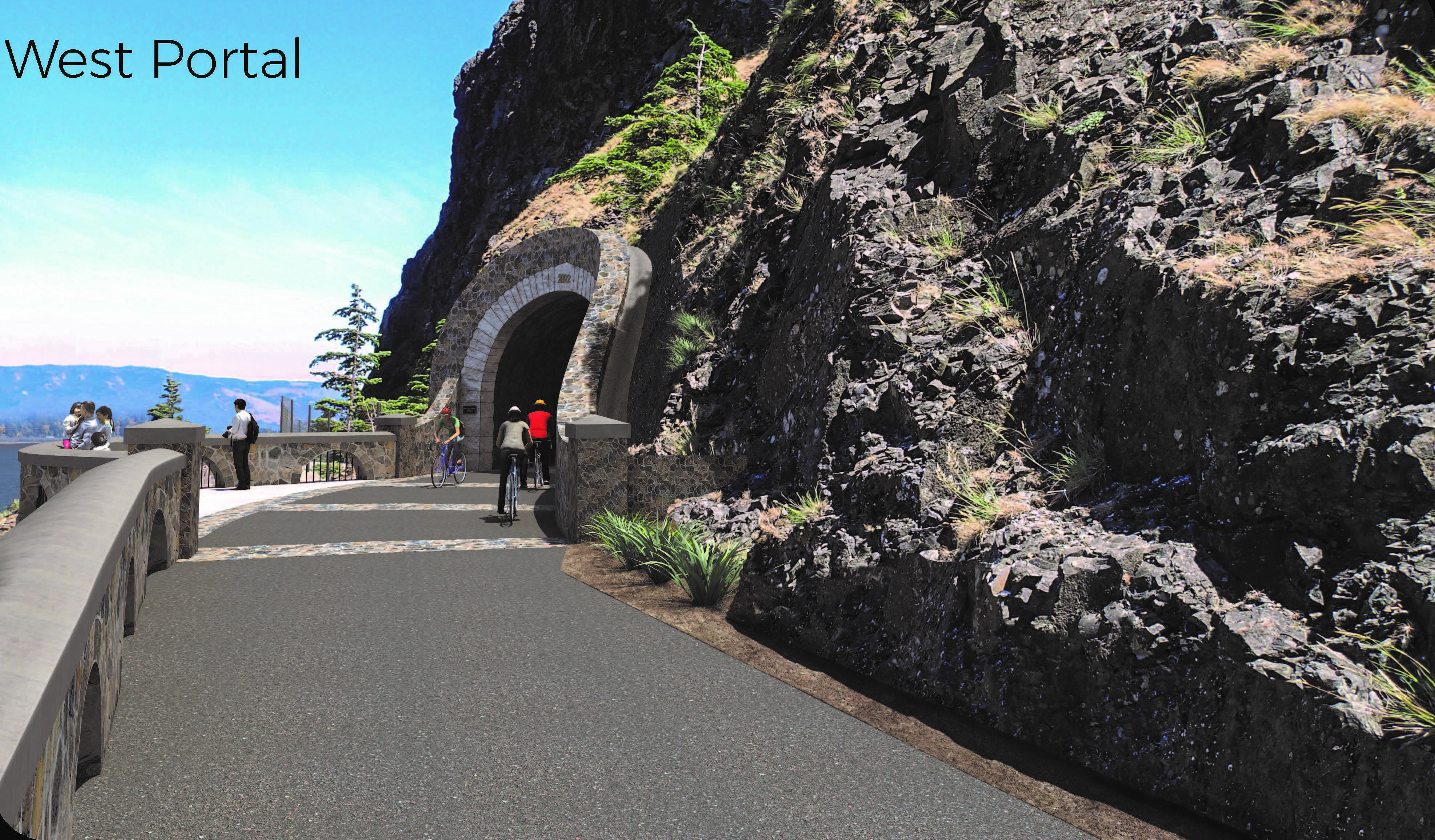
Slowing down cyclists
On each side of the tunnel, bands of stone will be inset into the trail. These bands, as shown in the above photo, will give visual and physical cues to trail users that the tunnel entrance is ahead.
Project history
Mitchell Point was the site of the iconic tunnel with its five arches overlooking the Columbia River. It was constructed in 1915, closed and filled in 1953 and destroyed in 1966 when blasting was required to widen the water-level highway (now Interstate 84).
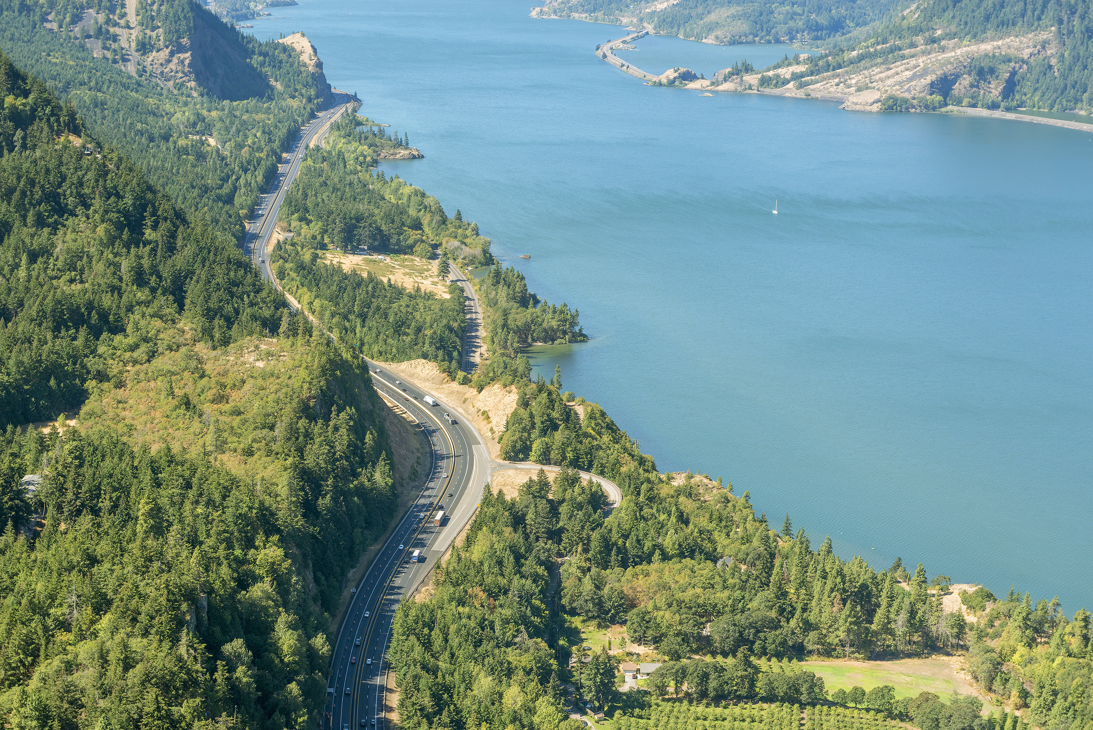
Mitchell Point is a formidable mountain that requires a structure to connect the western segments of the State Trail to Hood River and The Dalles. This segment received funds to design and construct a crossing to Mitchell Point into the Historic Columbia River Highway State Trail.
In 2015, ODOT’s consultant began evaluating seven alternatives for constructing a crossing at Mitchell Point. These alternatives included tunnels, viaducts (bridges over land), combinations of both and a trail alongside I-84.
Over time, the alternatives were narrowed down to three options for consideration: an intermediate length tunnel, a long tunnel or a bridge and trail. In 2018, we presented the alternatives for public comment. Based on public comment, the Historic Columbia River Highway Advisory Committee recommended the intermediate length design alternative, which was endorsed by the Oregon Parks and Recreation Commission.
We continued to refine the design and ODOT applied for and received the National Scenic Area Permit.


Just west of the City of Hood River, a section of the Historic Highway with world-class views of the Columbia River Gorge awaits to be reconnected as part of the Historic Highway State Trail.
This segment of trail will extend eastward from Mitchell Point on Mitchell Point Drive, cross underneath I-84, and proceed east to Hood River. We will build a trail on the north side of I-84 to connect with Ruthton Park, including restoring a section of original Historic Highway.
Plans currently include replacing the narrow and short undercrossing under I-84 with a new undercrossing just west of the existing location. The likely design would retain one-way vehicle traffic with a separated two-way path for trail users.
Next steps
We plan to apply for the Nationally Significant Federal Lands and Tribal Projects program call for projects anticipated in 2020. Some investigation and exploration work is anticipated to take place soon.
Connect with the project team
- Sign up for email updates about the Historic Columbia River Highway and State Trail to stay informed as the project progresses.
- Visit the www.HistoricHighway.org to learn more about the Historic Highway.
- Send questions or comments to the project team.
Thank you for participating!