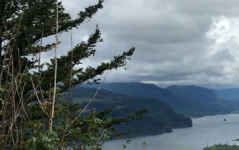
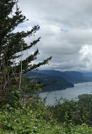
 The beauty of the Columbia River Gorge attracts more visitors each year, increasing traffic congestion on the two-lane Historic Columbia River Highway.
 For ADA (Americans with Disabilities Act) or Civil Rights Title VI accommodations, translation/interpretation services, or more information call 503 731 4128, TTY 800 735 2900 or Oregon Relay Service 7 1 1
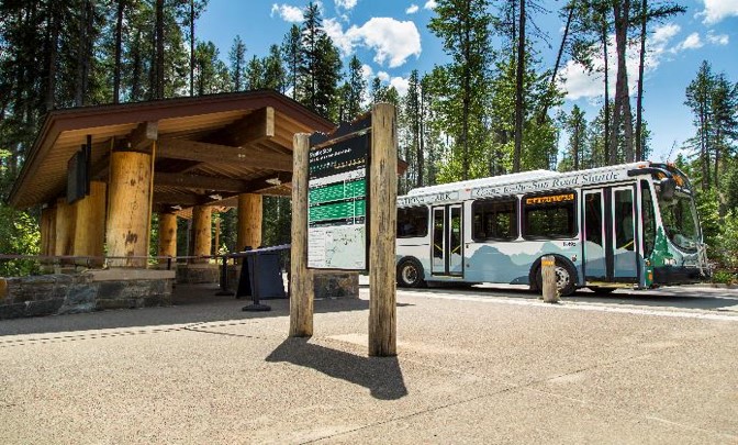
Stations
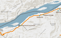

Study area: Focusing on the Waterfall Zone
The study area for the plan includes the drivable portion of the Historic Highway and connecting Multnomah County roads between the Portland Women’s Forum State Scenic Viewpoint and Ainsworth State Park. The study area also includes parking facilities for trailheads and viewpoints, including the Multnomah Falls parking lot on I-84.
2017 Fires
The Eagle Creek Fire of 2017 closed the Historic Highway, I-84 and popular destinations along the waterfall corridor.
Part of the Historic Highway remains closed following the Eagle Creek Fire. Tree felling and hazard removal work continues throughout the area, and many popular destinations and trails along the waterfall corridor remain closed. Once the area is safe, we expect these visitor numbers to return to prevous levels.
This plan will consider the effects of the fire when developing strategies to address traffic congestion and safety in the future.
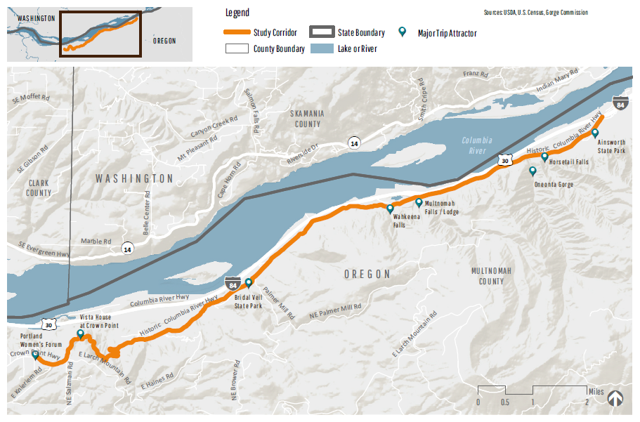
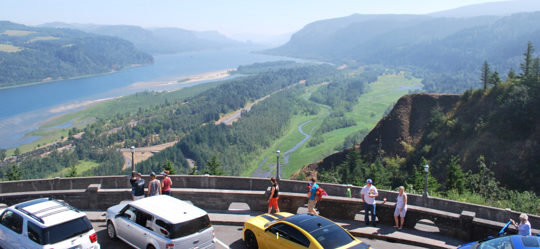


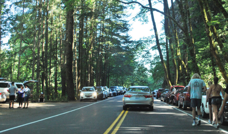
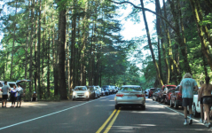
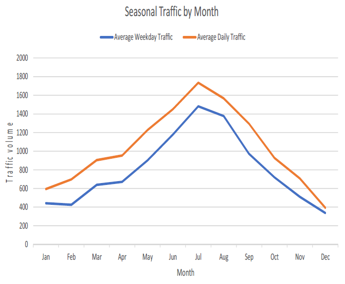
Most significant congestion and delay occurs in the eastern segment, between Bridal Veil Road and Ainsworth State Park. In the past 10 years, traffic along the Historic Highway grew nearly 50 percent as millions of tourists and recreation users visited the Gorge. Travelers experience significant delays on the Historic Highway from parking maneuvers and pedestrian activities, particularly during peak travel season.
On a typical summer weekend, travel along the Historic Highway is delayed by:
-
Vehicles circulating and idling in the roadway waiting to turn into parking lots or park along the side of the road.
-
Slow turnover rates at parking lots with higher demand for spaces than supply.
-
Vehicles waiting for pedestrians to cross the Historic Highway; over 1,000 people crossing every hour near Multnomah Falls.
-
Visitor growth over a longer “high season” and busy fair-weather days.
-
Large vehicles causing back-ups.
-
Vehicles re-entering the roadway from the shoulder or parking lots.
These challenges have created negative experiences for users and impacts to the area.
For more details review the Existing Conditions Summary.

Capacity improvements
Capacity improvements refer to tools that can accommodate more people without adding more vehicles to congested parking conditions. Some examples:
- Provide transit and shuttle services
- Expand park-and-ride facilities (outside the Historic Highway corridor)
- Tour bus use
Technology systems
Technology systems refer to tools that use computers, detectors, sensors, or other forms of technology to collect or provide information to system users or administrators. Some examples:
- Entrance, transit, or parking fee prepayment
- Closed-circuit cameras
- Media, social media, and apps
- Dynamic and variable message signs
- Traffic monitoring, data collection and analysis
- Real-time parking information, user-generated parking data, and dynamic parking occupancy counters
Transit
Transit refers to public transportation such as buses or shuttles. It can also include private transit like a tour bus. Some examples:
- Provide or add capacity to transit and shuttle services
- Transit technology
- Tour bus use
Mobility improvements
Mobility tools refer to operational improvements or programs that reduce delay for roadway users. That could include less congestion for vehicles, or the ability for transit or bicycles to move more efficiently. Some examples:
- Expand or improve bicycle and pedestrian facilities
- Crossing guards or grade separated crossings at busy pedestrian locations
- Parking management and enforcement
- Traffic enforcement and management
- Traffic circulation changes (e.g., 2-way to 1-way)
- Vehicle use restrictions
Experience improvements
Experience improvements refer to any program, tool, or operational change that are focused primarily on improving visitor experience. Some examples:
- Grade separated bicycle and pedestrian crossings
- Signage and wayfinding
- Reserved parking stalls
- Vehicle use restrictions
- Promoting bicycle and pedestrian travel

Click here to open the survey in a new window.
Questions marked with an asterisk * are required questions. Thank you for your time!
 You can connect with the project team at one of the three events listed below.
Next Steps
Thank you for participating and sharing your input. ODOT will use your feedback to inform their evaluation of potential scenarios and refine the Congestion and Transportation Safety Improvement Plan.
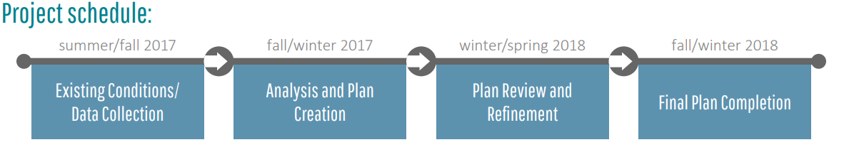
The project team expects to complete the Plan in winter 2018, after reviewing feedback shared online and at other community events.