
Click through each of the stations to learn more and provide your feedback as you go. Most stations have related survey questions. Click on "Survey Questions" at the bottom of the page. You can answer the related questions, then hit "Hide Window / Return to Open House" to keep moving through the stations. You can also take the entire survey after you have completed all the stations. Thank you!
Stations

= Page has questions.
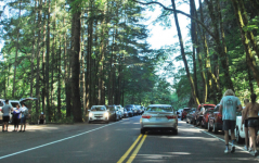
More people are visiting the Columbia River Gorge each year. For over 100 years, thousands of drivers, cyclists and hikers have used the Historic Columbia River Highway to access some of the Gorge’s most beautiful and popular destinations. As the population grows, more people seek out the beauty of the Columbia River Gorge.
We need to address traffic congestion
Traffic congestion on the Historic Highway has worsened in recent years, increasing safety concerns and affecting the experience of visitors and residents. The Oregon Department of Transportation is working with its partners to prepare the Congestion and Transportation Safety Improvement Plan.
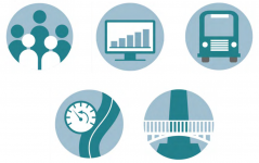
The plan aims to improve the experience for all people living, accessing and visiting the area by:
- Enhancing safety for all users including people who drive, walk, cycle and take public transportation.
- Reducing excessive delays due to traffic congestion and vehicles parked on the roadway shoulder.
- Minimizing conficts between cars, cyclists and pedestrians.
- Identifying sustainable funding to implement strategies.
- Providing improved access for recreational and scenic enjoyment of natural and cultural resources.
- Decreasing negative efects of traffic congestion and vehicles parked on the roadway shoulder on scenic, natural, cultural and recreational resources
Our focus is the waterfall corridor
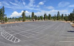
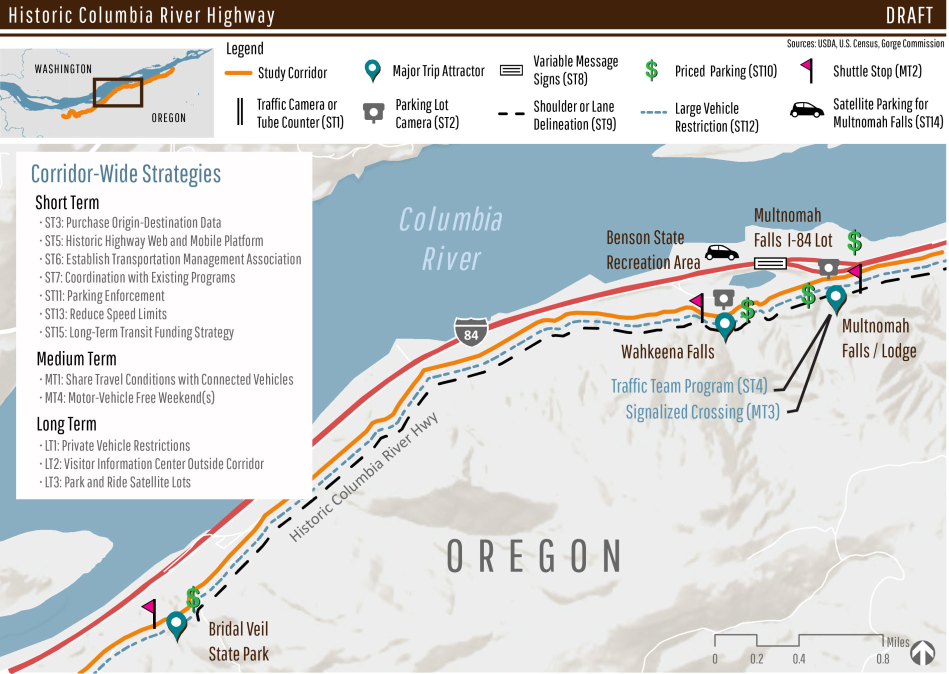
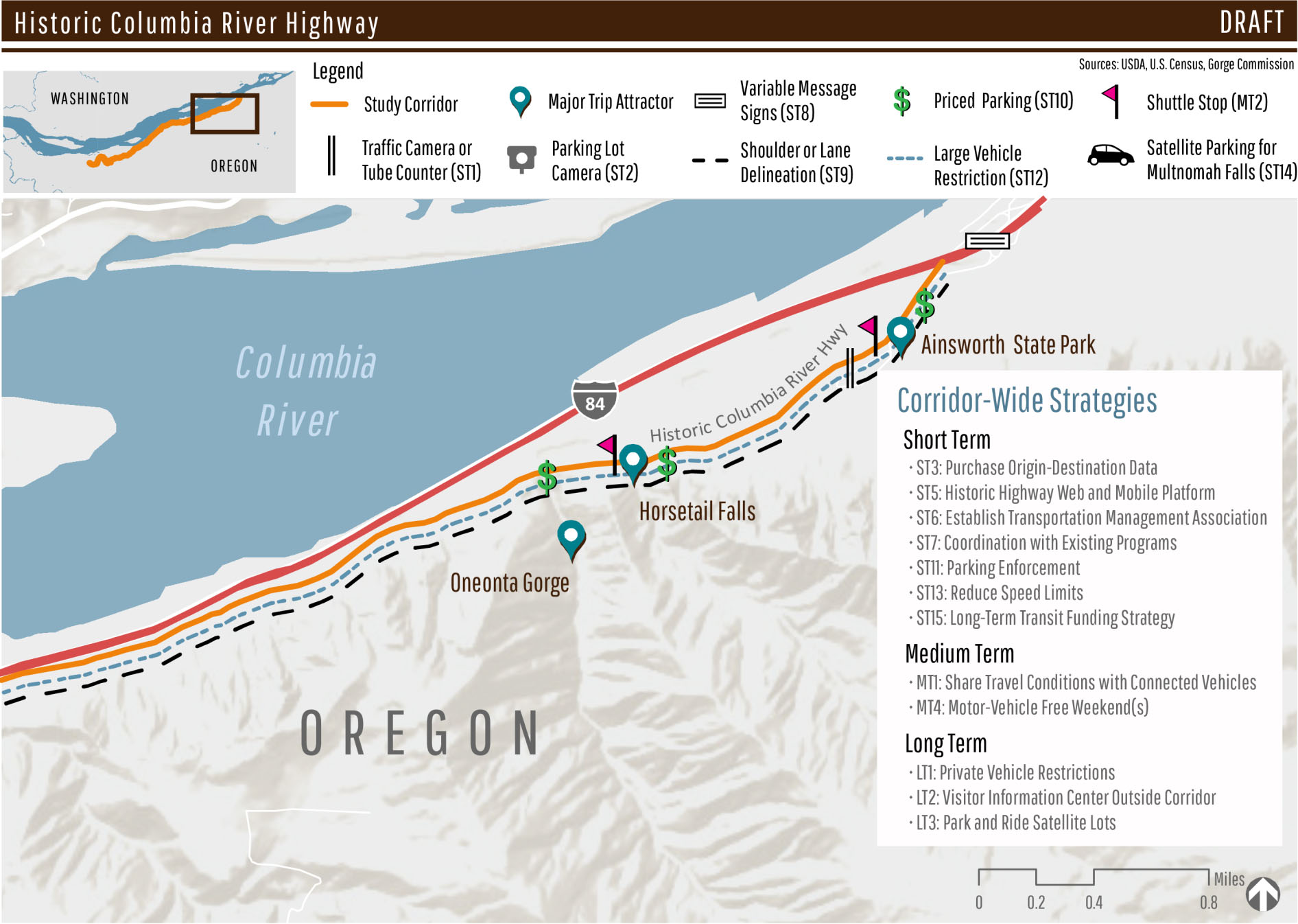
The study area for the Improvement Plan includes the drivable portion of the Historic Highway and connecting Multnomah County roads between the Portland Women’s Forum State Scenic Viewpoint and Ainsworth State Park. The study area also includes parking facilities for trailheads and viewpoints, including the Multnomah Falls parking lot on Interstate 84.
Through analysis and public input, the project team identified nine key issues (view full report).
- Traffic congestion related to parking behavior.
- Pedestrians crossing the Historic Highway causing vehicle delays.
- Parking at capacity.
- Increased visitor and vehicle numbers.
- Bicycle access and safety.
- Desire for more transit service.
- Large vehicle safety and delay.
- Negative user experience.
- Impacts to the environment.
Many tools considered
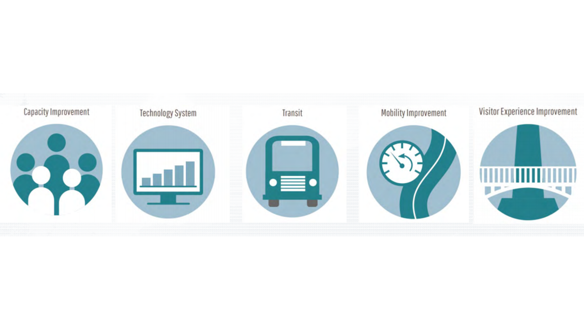
ODOT, the U.S. Forest Service, Multnomah County and Oregon State Parks reviewed many different tools to determine which will best improve safety and reduce congestion in the Historic Highway. Examples include:
- Technology systems: Variable message signs, real time parking and traffic information.
- Improvements to transit, bicycling and walking: Transit and shuttle service along the Historic Highway, park and ride facilities, improved bicycle and pedestrian facilities, traffic flagger teams at Multnomah Falls.
- Priced parking along the corridor, including at the Multnomah Falls I-84 and Historic Highway parking lots.
- Study of one-way travel on the Historic Highway.
- Improved signage and wayfinding.
- Large vehicle use restrictions.
The next stations will ask for your feedback on short, medium and long-term solutions for addressing congestion and transportation safety.

What are the short-term recommendations?
| Project | Description | Priority Level* |
|---|---|---|
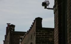
| Install traffic cameras and traffic counting devices. |
Install cameras at key pinch points, including at the Multnomah Falls Historic Highway parking lot and Wahkeena Falls to monitor vehicle flow. Data will inform recommendations on vehicle operations and pedestrian crossings. |
High |
|
Install cameras in parking lots. |
Install cameras to monitor and collect data at parking lots, including at the Multnomah Falls Historic Highway parking lot and Wahkneena Falls. |
High |
| Purchase data on where travelers begin their trip to the Waterfall Corridor. | These data would provide more details on how people use the Historic Highway and provide information on travel patterns and behavior. | Low |
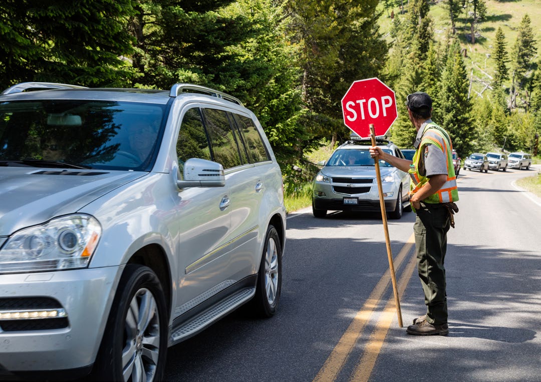
| Add a flagger to direct traffic at Multnomah Falls during peak times. | Between Memorial Day and Labor Day, a flagger could be in place between 9 a.m. and 5 p.m. seven days a week during peak visitation. | High |
| Develop an app for Historic Highway information. | The app would allow users to learn about parking fees, transit schedules, and discover best times to visit popular attractions prior to arriving in the Historic Highway corridor. | Medium |
| Form a Transportation Management Association. | This provides an institutional framework for programs and services and allow partners to collectively provide transportation services. The association would take the lead on proposed strategies, including managing shuttle services. | High |
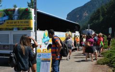
| Coordinate with existing programs. | Continue coordination with Ready, Set, GOrge! Campaign and Columbia Gorge Express bus service to improve visitor experience in the National Scenic Area, including support for visitors who speak languages other than English. | Medium |
| Install variable message signs. | Recommended locations for signs include to the west of Troutdale (Interstate 84 Exit 17) and near Ainsworth State Park and/or Bridal Veil. | Medium |
| Improve roadway striping. | Install additional striping on the highway to mark shoulders and prevent vehicles parking in the travel lane. | High |
| Charge for parking. |
Implement year-round, timed, paid parking at the I-84 Multnomah Falls lot and other locations along the Historic Highway. Implement paid parking at all trailheads and attractions throughout the Historic Columbia River Highway at: the Portland Women’s Forum, Vista House, Latourell Falls, Bridal Veil, Angel’s Rest, Wahkeena Falls, Multnomah Falls Historic Highway lot, Oneonta Gorge, Horsetail Falls and Ainsworth State Park. This recommendation requires an effective pricing strategy coupled with an enforcement policy. |
High |
| Parking enforcement. |
Implementing parking enforcement is critical to a successful paid parking strategy. Could use a third-party organization handing out warning/tickets. License Plate Recognize software could cover a large area. An additional element of enforcement is deterring informal parking. Signage, education, and physical barriers (where applicable) can help deter informal parking, in addition to enforcement. Outreach materials in other languages is important to ensuring compliance and avoiding disproportionate impacts to those who do not speak English. |
High |
| Restrict large vehicles. | Restrict large vehicles, including oversized recreation vehicles and trailers between East Larch Mountain Road and Ainsworth State Park. | Medium |
| Reduce Speed limits. | Reduce vehicle speed limits consistent with the historic and multi-modal nature of the roadway. | Medium |
| Use Benson Lake for Multnomah Falls parking. | Use Benson Lake area as new parking for Multnomah Falls and formalize path between Benson Lake and Multnomah Falls south of I-84. | Medium |
| Pursue long-term Columbia Gorge Express funding | Funding for the Columbia Gorge Express continues through fall 2020. Establish a funding source to continue service. | Medium |
*The priority levels shown are draft recommendations from the project team. Your feedback will help inform final recommendations.
Please submit feedback by clicking on the "Survey Questions" button on the bottom of the page.
Once you answer the questions about short-term strategies, you can click "Hide Window / Return to Open House" to move to the next station: Medium-term strategies.
What are the medium-term recommendations?
| Project | Description | Priority level* |
|---|---|---|
| Share traveler information through connected vehicles |
Share information on travel and parking conditions and travel options with connected vehicles via wireless connected cloud computing with the public through applications. |
Medium |
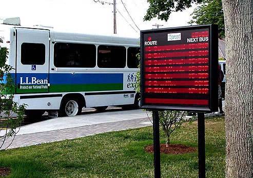
| Historic Highway shuttle service |
Implement shuttle service along the Historic Highway along the Waterfall Zone. Shuttles could accommodate 20 to 30 passengers at a time, serve destinations not currently served by the Columbia Gorge Express, but allow transfers between the two services. Address congestion along the Historic Highway before the shuttle is implemented; congestion limits the utility of a shuttle service. Recommended stops: Portland Women’s Forum, Vista House, Bridal Veil State Park, Wahkeena Falls, Multnomah Falls, Horsetail Falls, and Ainsworth State Park. |
High |
| Signalized crossing at Multnomah Falls | Add a signal (or other traffic control) to the marked crosswalk in front of Multnomah Falls Lodge. Must also meet Columbia River Gorge visual requirements. | Medium |
| Motor Vehicle weekend restrictions | Temporarily restrict motor vehicles on the Historic Highway to prioritize people traveling by other modes and to test the effects of a vehicle restriction. | Low |
*The priority levels shown are draft recommendations from the project team. Your feedback will help inform final recommendations.
Please submit feedback by clicking on the "Survey Questions" button on the bottom of the page.
Once you answer the questions about medium-term strategies, you can click "Hide Window / Return to Open House" to move to the next station: Long-term strategies.


What are the long-term recommendations?
| Project | Description | Priority level* |
|---|---|---|
| Private vehicle restrictions. |
Restrict private vehicles on portions of the Historic Highway. This would be implemented in peak or full seasons, after a Historic Highway shuttle has been implemented and is experiencing significant delays. |
Medium |
| Visitor center outside of the corridor. |
Open a visitor information hub in a community near the Historic Highway to act as a gathering place to share information about the Historic Highway, parking and transportation options. Serves as a robust source of information for the Columbia Gorge National Scenic Area and complement existing visitor centers. |
Low |
| Expanded park-and-ride facilities. |
Develop park-and-ride satellite lots to help transport visitors to key destinations through a frequent and fixed-route shuttle service. Use existing parking lots in nearby communities on weekends and during the summer as low-cost options. |
Medium |
*The priority levels shown are draft recommendations from the project team. Your feedback will help inform final recommendations.
Please submit feedback by clicking on the "Survey Questions" button on the bottom of the page.
Once you answer the questions about long-term strategies, you can click "Hide Window / Return to Open House" to move to the next station: Next Steps.


Stay informed
- Visit the project website to find the most current project information.
- Sign up for email updates.
- For more information, contact Terra Lingley, ODOT Columbia River Gorge National Scenic Area Coordinator, at 503-731-8232.