If you need this material in an alternative format or for ADA (Americans with Disabilities Act) or Civil Rights Title VI accommodations, translation/interpretation services, or more information call 503-302-8926, TTY 800-735-2900 or Oregon Relay Service 7-1-1.
Stations
About
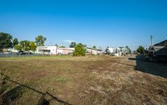
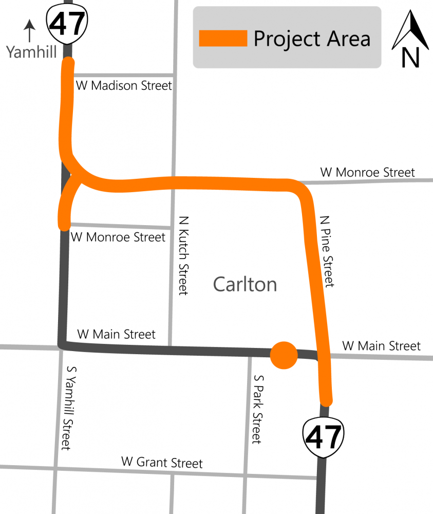
The number of vehicles on OR 47 in downtown Carlton has grown over the past 10 years. Since Yamhill Street and Main Street were built decades ago the roads, curbs and corners are difficult for today's vehicles to navigate.
This project has changed over time. We worked together and found that moving OR 47 to Monroe Street would better serve the community.
The new route would:
- Reduce congestion and improve the flow of traffic through Carlton.
- Make it safer for pedestrians on Main Street in downtown Carlton.
- Make it safer for bikes and pedestrians through the new OR 47.
- Make it safer when large trucks drive through Carlton.
We're also planning to make the curb ramps at the mid block crossing on Main Street between South Park Street and Pine Street ADA accessible.
Schedule
There are a lot of steps to design a project like this and it takes a while to make sure we have every detail right.
If this project stays on schedule, we estimate construction starting in 2025.
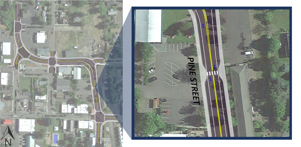
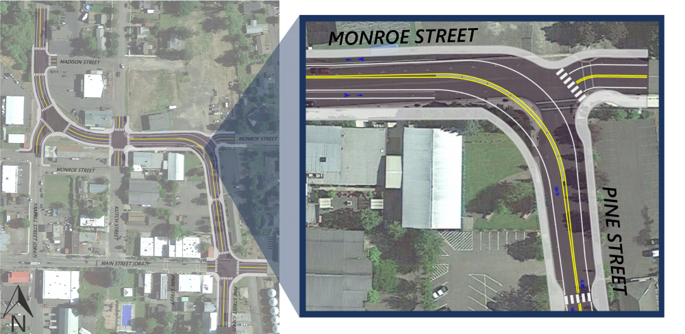
Click on image to enlarge.
Updates to the proposed layout based on your input
Thank you to everyone who has reached out to us about the project. We've listened to your thoughts and concerns and have added details to our project based on your feedback.
We've added:
- Six feet wide sidewalks throughout most of the area with some locations that are up to ten feet wide.
- Bike lanes on Monroe Street.
- Two possible crossings with pedestrian activated warning lights as an enhancement. The two locations we're looking at right now are to help people safely get to the soccer field and community pool:
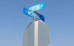
- At the new Monroe Street and Kutch Street intersection.
- Mid block on Pine Street between Monroe Street and Main Street.
- Curb extensions, called bulb outs, extend the sidewalk into the parking lane. This shortens the distance a pedestrian walks to cross the street. We're trying to maintain as much on street parking as possible.
Some features that make the area safer, like the bulb outs, need extra space and would remove parking spaces. The proposed layout would remove about 14 on street parking spaces throughout the project area.
We're also planning to make the curb ramps at the mid block crossing on Main Street between South Park Street and Pine Street ADA accessible.
This was supported by feedback from the recent community survey that prioritized:
- Slowing down vehicle speed in the project area.
- Adding crosswalks in the project area.
We also heard that pedestrian safety is a high priority. Your feedback helped us prioritize safety and remove some parking.
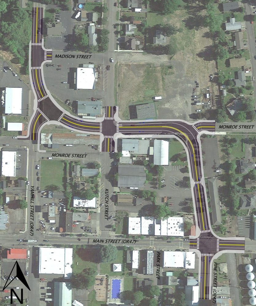
Click on image to enlarge.
Note: This drawing isn't to scale. It's a rendering to give a better idea of the proposed layout. The layout and features may change based on your feedback and project funding.
Your feedback is an important part of our process
 We received 256 responses to our recent community survey and more than 60 questions and comments from other residents. Your feedback and information on priorities have helped us improve the proposed layout.
We answered your most common questions in a frequently asked questions document.
In this online open house, you can take a look at the proposed layout, learn how it would work and about the different features. At the last station of the online open house, you'll find a comment form where you can share your thoughts and questions. You can also learn more about the upcoming the City of Carlton community meetings – we hope to see you there!
Learn more by clicking on the titles below to expand the boxes.
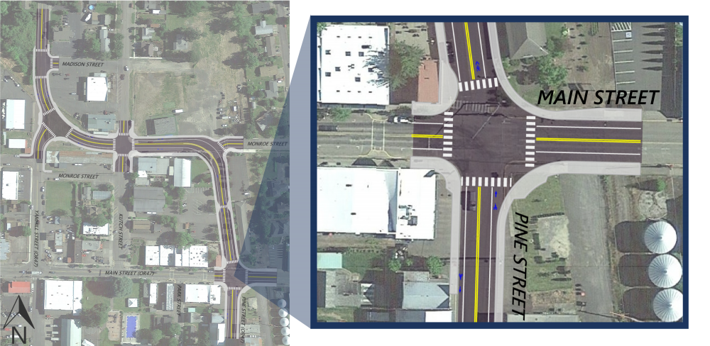
With the proposed layout, this intersection:
Would become a two way stop. Traffic moving east or west on Main Street would be stopped while traffic moving north or south on Pine Street wouldn't be stopped. The overhead flashing lights should not be needed with the more typical intersection.
We heard you
- The blinking lights and three way stop aren't very common and can be confusing to drivers. The proposed layout would change the intersection to a more common two way stop controlled intersection.
- We're looking at the southeast corner of Pine Street and Main Street to see if we can make it look more like the southwest corner and still have it work for all of the traffic that turns at this intersection.
- We're also looking to see if there are other safety features we can add to help slow traffic entering the town.
Other items we're exploring:
Traffic signal
 Traffic signals can be good solutions to address congestion when appropriately located and give more defined timing for crossing the streets. Installing a traffic signal requires that several national and state criteria or requirements be met and that they be placed where they meet driver expectations, like in a town.
We've looked at the traffic data at this location and the results show that although there are peak periods of congestion, there isn't enough traffic throughout the day for us to install a traffic signal. If we consider future growth in vehicle and pedestrian traffic, the intersection may still not meet the requirements in the next 10 years or more. A traffic signal at this location would likely add $1 million or more to the cost of the project.
All way stop
 Like with traffic signals, national and state criteria or requirements must be met to install stop signs on all lanes of the intersection and shouldn't be used to control speed. We've looked at the traffic data at this location and the results show that there isn't enough traffic using this intersection to install an all way stop. We'll continue looking at this option if future traffic levels are close to the required criteria.
It’s important to note that semi trucks driving on OR 47 are sometimes loud, which can be disruptive if you're having fun in the downtown core. Semi trucks make more noise when they have to stop and accelerate from a stop, making about 30% to 50% more noise than if they were able to continue without stopping. An all way stop at this location would have minimal effect on the cost of the project.
Roundabout
 Roundabouts can be good solutions to help slow vehicles and make it easier for people to cross the street. A standard roundabout designed to handle the semi trucks that come through Carlton would need to have a diameter of about 130 feet or larger. This size would interfere with the surrounding businesses and other land uses or even require them to be moved.
A smaller roundabout may be possible but would be less pedestrian friendly. Semi trucks passing through a smaller roundabout can’t stay in their lane and would need to drive over some of the curbs and islands, which can conflict with pedestrians or other traffic in the roundabout. A roundabout at this location would likely add $2-3 million or more to the cost of the project.
Camera and radar speed enforcement
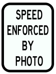 Cameras used to issue speeding tickets can help slow down traffic, but not always as much as a person may think. Oregon law says that speed cameras can only issue a ticket if the vehicle is going 11 mph or more over the speed limit. This means that a driver could travel as much as 30 mph through downtown Carlton without getting a ticket, assuming the posted speed is 20 mph.
The courts historically dismiss many of these tickets – for example, about 45% of tickets in the City of Portland get dismissed. Current state law also specifies how the cameras can be used and which cities may use them. It's possible the Oregon Legislature will allow speed cameras to be used in other locations. For now, this option may not be possible in Carlton. We don't know the cost to install or maintain cameras. We'll continue to talk about this option with the City of Carlton.
With the proposed layout, the intersection
- Would have new ADA accessible curb ramps at each corner.
- Would likely have marked crosswalks. Adding crosswalks may require new street lighting.
- Would have six feet wide sidewalks.
- Would continue the bike lane on South Pine Street up to the Main Street intersection.
- Would have an extended curb, called a bulb out, to help shorten the length a pedestrian has to walk to cross the street.
We're also planning to make the curb ramps at the mid block crossing on Main Street between South Park Street and Pine Street ADA accessible.
We heard you
Slowing down vehicle speed in the project area is a priority for the community. We're currently using a desired speed of 20 mph for designing the road. Besides shortening the distance to cross the intersection, bulb outs extend into the parking lane to narrow the roadway. They make it easier for drivers to see pedestrians and vehicles take corners slower since the road is narrower.
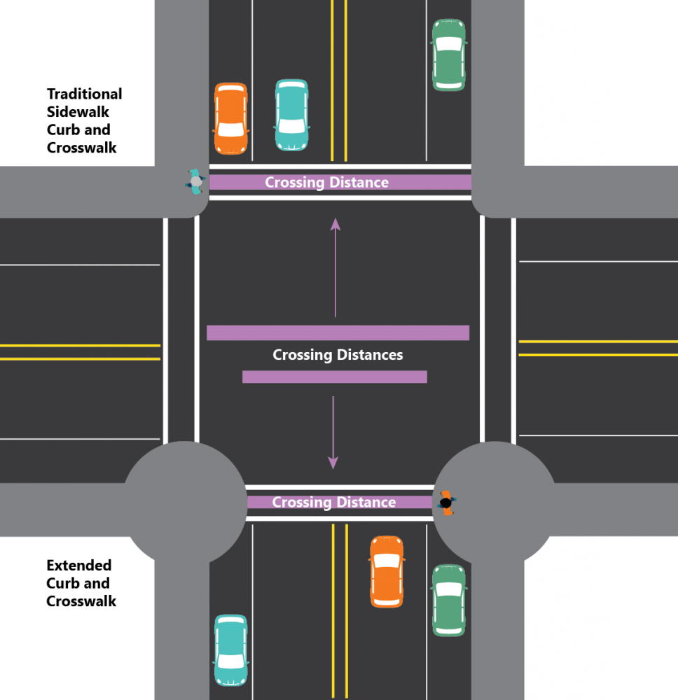
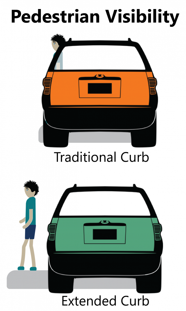
Extended curbs vs traditional curbs
The graphics below show some of the safety benefits of an extended curb compared to a traditional curb.
Extended curbs mean:
- Pedestrians spend less time on the road as they cross the street since it's a shorter distance to walk.
- It's easier for drivers to see pedestrians, even if cars are parked along the side of the road.
- Drivers will be more cautious and go slower since the road is narrower.
Click on image to enlarge.
The proposed layout:
- Wouldn't change the on street parking on Main Street.
- May remove a spot or two of on street parking on the west side of Pine Street to make room for the extended curb.
- Would add more on street parking on the east side Pine Street.
- Would have slow but steady moving traffic on Pine Street, the new OR 47, as drivers wouldn't have to stop at a stop sign anymore.
We heard you
A lot of community activities happen near Main Street and it'd be nice to not have to compete with the highway traffic noise. The proposed layout realigns OR 47 to get highway traffic off of Main Street. This would allow the city to close Main Street for community events.
Learn more by clicking on the titles below to expand the boxes.
We heard you
 Pedestrian safety is a priority. We're talking with the city about possibly installing a rectangular rapid flashing beacon. This would be a pedestrian activated flashing light at the crosswalk that would alerts drivers that a pedestrian wants to cross the street. Adding crosswalks may require new street lighting.
The proposed layout would include extended curbs at the crosswalk, called bulb outs. These not only would make crossing the road safer for pedestrians, they would also make the road narrower so drivers would be more cautious through the area.
We heard you
Pedestrian safety is a priority. The proposed layout would add a new crosswalk mid block between Monroe Street and Main Street. The sidewalk would be six feet wide and have extended curbs, called bulb outs, that make crossing safer for pedestrians.
We're talking with the city about possibly installing a rectangular rapid flashing beacon, which is a pedestrian activated flashing light that alerts drivers a pedestrian is wanting to cross the street. Adding crosswalks may require new street lighting.
Extended curbs vs traditional curbs
The graphics below show some of the safety benefits of an extended curb compared to a traditional curb.
Extended curbs mean:
- Pedestrians spend less time on the road as they cross the street since it's a shorter distance to walk.
- It's easier for drivers to see pedestrians, even if cars are parked along the side of the road.
- Drivers will be more cautious and go slower since the road is narrower.
Click on image to enlarge.
We heard you
Based on what we heard from the recent community survey, pedestrian safety is a bigger priority to the community than on street parking. The extended curbs would make the area safer for pedestrians but might remove a couple of on street parking spots along Pine Street.With this proposed layout, pedestrians would have a six foot wide sidewalk on both sides of Pine Street.
Learn more by clicking on the titles below to expand the boxes.
We heard you
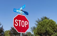
Slowing traffic in the project area is a priority. At this location, the proposed layout has a curved corner and a median that would prevent drivers from making left turns at the intersection. Let's explore how traffic would move through the area with and without the median.
With median
How traffic would flow through the intersection with the median:
- If you're driving north on Pine Street, you could turn right onto Monroe Street or follow the curve left and go on Monroe Street.
- If you're driving west on Monroe Street, you'd stop at the stop sign and when it's safe you could make a slight right turn to continue on Monroe Street.
- If you're driving east on Monroe Street, you'd follow the curve right to go onto Pine Street.
The curve of the road, the median in the center and sidewalks on either side would help cause drivers to slow down as they go around the corner. Since the median prevents left turns from happening at the intersection, there would be fewer turning movements at the intersection for drivers to pay attention to.
Drivers wanting to make the left turn from Monroe Street or continue eastbound on Monroe Street would need to use other streets to reach their destination.
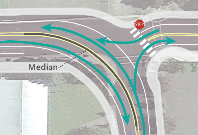
Click on image to enlarge.
Without median – making a left turn
Without a median preventing left turns, there'd be a lot of different movements that a driver would have to be aware of and it could lead to crashes.
The graphic shows a driver making a left turn with a red dashed line and shows the possible risks with numbered icons. The numbered risks in the graphic are explained below.
If someone isn't paying attention, there'd be a risk of crashes if:
- Westbound drivers miss the stop sign thinking they can proceed straight through the intersection. The driver may also need to pull forward to try to see oncoming northbound traffic and could block the crosswalk.
- Westbound drivers on Monroe Street can’t tell if eastbound cars are going to continue straight or follow the path onto Pine Street.
- Drivers traveling west on Monroe Street may not see cars approaching on Pine Street as they continue through the intersection.
- Drivers traveling west on Monroe Street don't see cars as they take the right turn to go onto Pine Street.
- Drivers turning left from Monroe Street to go south on Pine Street may not be seen by drivers northbound on Pine Street.

Click on image to enlarge.
Things to note:
- Without a median, the road may not look as narrow and may cause drivers to speed around the corner.
- You may have noticed that the proposed layout has more space than a traditional intersection. The left turning car would have to cross the crosswalk, some space between the crosswalk and lane, the northbound Pine Street lane and the center line to get to their lane. The driver may not realize how much time they actually need.
Without median – continuing east on Monroe Street
Without a median preventing left turns, there'd be a lot of different movements that a driver would have to be aware of and it could lead to crashes.
The graphic shows a driver continuing east with a red dashed line and shows the possible risks with numbered icons. The numbered risks in the graphic are explained below.
If someone isn't paying attention, there'd be a risk of crashes if:
- Drivers stopped abruptly to wait for it to be safe to continue east through the intersection. Even if this didn't cause a crash, it could cause a backup, which could impact the area and nearby businesses.
- Drivers traveling east on Monroe Street don't see cars as they take the left turn from Pine Street to Monroe Street.
- Drivers traveling east on Monroe Street don't see cars driving west on Monroe Street as they take the slight right turn.
- Eastbound drivers on Monroe Street can’t tell if westbound cars are going to continue straight or follow the path onto Pine Street.
- Drivers traveling east on Monroe Street don't see pedestrians as they try to cross Monroe Street.
- Drivers traveling east on Monroe Street don't see cars on Pine Street turn right to go east on Monroe Street.
Click on image to enlarge.
Things to note:
- Without a median, the road may not look as narrow and may cause drivers to speed around the corner.
- You may have noticed that the proposed layout has more space than a traditional intersection. They would have to cross the center line, the northbound Pine Street lane, some space between the crosswalk and lane and the crosswalk to continue straight. The driver may not realize how much time they actually need.
Other items we're exploring:
All way stop
National and state criteria or requirements must be met to install stop signs on all lanes of the intersection and shouldn't be used to control speed. We haven't looked at the traffic data at this location to know if there is enough traffic using this intersection to install an all way stop.
It’s important to note that semi trucks driving on OR 47 are sometimes loud, which can be disruptive if you're having fun in the downtown core. Semi trucks make more noise when they have to stop and accelerate from a stop, making about 30% to 50% more noise than if they were able to continue without stopping. An all way stop at this location would have minimal effect on the cost of the project.
Roundabout
Roundabouts can be good solutions to help slow vehicles and make it easier for people to cross the street. A standard roundabout designed to handle the semi trucks that come through Carlton would need to have a diameter of about 130 feet or larger. This size would interfere with the surrounding businesses and other land uses or even require them to be moved.
A smaller roundabout, as shown in the graphic, may be possible but would be less pedestrian friendly. Semi trucks passing through a smaller roundabout can’t stay in their lane and would need to drive over some of the curbs and islands, which can conflict with pedestrians or other traffic in the roundabout. A roundabout at this location would likely add $2-3 million or more to the cost of the project.
Things to note:
- A roundabout would remove more on and off street parking as shown in blue in the graphic.
- A roundabout would require more land, impacting some businesses and private property including the soccer field.
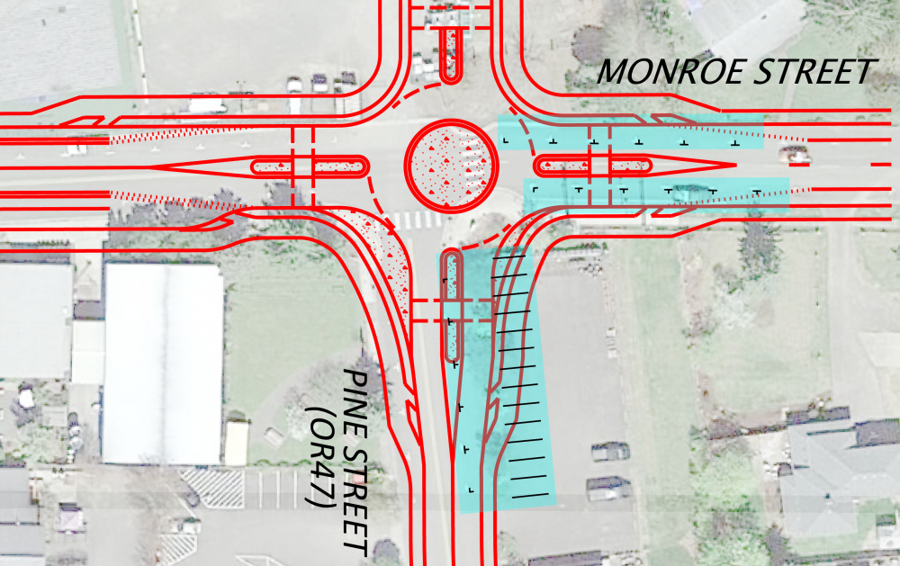
Click on image to enlarge.
We heard you
Pedestrian safety is a priority, the proposed layout would have six feet wide sidewalk, would likely have a marked crosswalk across Monroe Street and new ADA accessible curb ramps. Adding crosswalks may require new street lighting.
The crosswalk would have extended curbs, or bulb outs, that:
- Allow pedestrians to spend less time on the road as they cross the street since it's a shorter distance to walk.
- Make it easier for drivers to see pedestrians, even if cars are parked along the side of the road.
- Drivers will be more cautious and go slower since the road is narrower.
Extended curbs vs traditional curbs
The graphics below show some of the safety benefits of an extended curb compared to a traditional curb.
Click on image to enlarge.
We heard you
Based on what we heard from the recent community survey, slowing down vehicle speed is a bigger priority to the community than on street parking. In the proposed layout the slight curve of the road, the median in the center and sidewalks on either side would help cause drivers to slow down as they go around the corner. These features that would help slow traffic would require removing some on street parking.
The proposed layout would:
- Remove several on street parking spots on Pine Street.
- Remove several on street parking spots on Monroe Street.
- Have slow but steady moving traffic making the curve to continue on the new OR 47.
Learn more by clicking on the titles below to expand the boxes.
We heard you
Pedestrian safety is a priority. We're talking with the city about possibly installing a rectangular rapid flashing beacon. This would be a pedestrian activated flashing light at the crosswalk that would alert drivers that a pedestrian wants to cross the street. Adding crosswalks may require new street lighting.
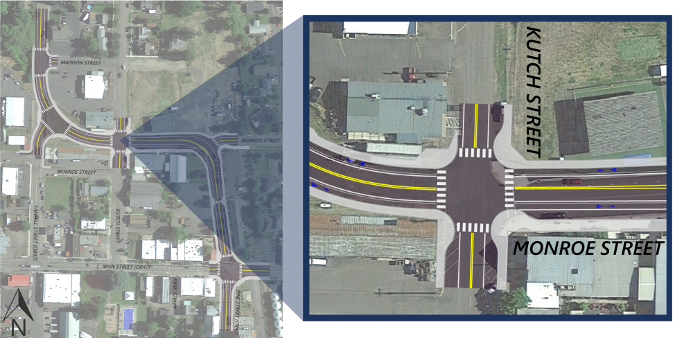
With the proposed layout, the intersection:
- Would become a two way stop, meaning stop signs on either side of Kutch Street. Drivers traveling on Monroe Street wouldn't have a stop sign.
- Would have extended curbs, making the road appear more narrow, so drivers would drive slower and more cautiously through the intersection and as they turn.
We heard you
Pedestrian safety is a priority. We're talking with the city about possibly installing a rectangular rapid flashing beacon. This would be a pedestrian activated flashing light at a crosswalk that would alert drivers that a pedestrian wants to cross the street. Adding crosswalks may require new street lighting.
The proposed layout would have:
- Bike lanes in both directions on Monroe Street.
- Six feet wide sidewalk throughout most of the area.
- A ten feet wide section on the south section between Kutch Street and Pine Street.
- New ADA accessible curb ramps at each corner.
- Extended curbs, called bulb outs, that mean:
- Pedestrians spend less time on the road as they cross the street since it's a shorter distance to walk.
- It's easier for drivers to see pedestrians, even if cars are parked along the side of the road.
- Drivers will be more cautious and go slower since the road is narrower.
Extended curbs vs traditional curbs
The graphics below show some of the safety benefits of an extended curb compared to a traditional curb.
Click on image to enlarge.
Other options we're looking at:
Pedestrian bridge
 Another idea we heard in our recent community survey was to add a pedestrian bridge on the east side of Kutch Street crossing Monroe Street. Our goal is to make the area safe and accessible for all whether you drive, ride, walk and roll. We’re excited to work with a caring community that prioritizes pedestrian safety – it’s a main goal of this project and a stated priority from you.
Pedestrian bridges can be effective at helping people safely cross busy streets. They work best when the surrounding area makes it easy for a person to get up onto and across the bridge. Pedestrian bridges need to meet current ADA standards to make sure that they can be used by all. A pedestrian bridge tall enough for traffic to travel under would require either long gentle ramps or elevators to be accessible.
Either way, a pedestrian bridge would take up a lot of room. If placed at a location along Monroe Street, a bridge would likely interfere with the surrounding businesses, maybe even requiring them to be moved. Using the pedestrian bridge would take more time for a person to cross the road. What we've learned from other communities, has taught us that many people won't use a pedestrian bridge if it takes more than twice as long as crossing at street level. A pedestrian bridge at this location would likely add $2-3 million or more to the cost of the project and would have recurring costs to maintain and clean.
We heard you
Based on what we heard from the recent community survey, pedestrian safety is a bigger priority to the community than on street parking. The extended curbs would make the area safer for pedestrians, but would also remove a couple of on street parking spots along the west side of Kutch Street.
The proposed layout includes a loading zone on Monroe Street near Celestial Hill Vineyard and Tendril Wine Cellars so that traffic can continue to flow on OR 47 during business deliveries.
Learn more by clicking on the titles below to expand the boxes.
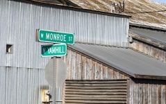
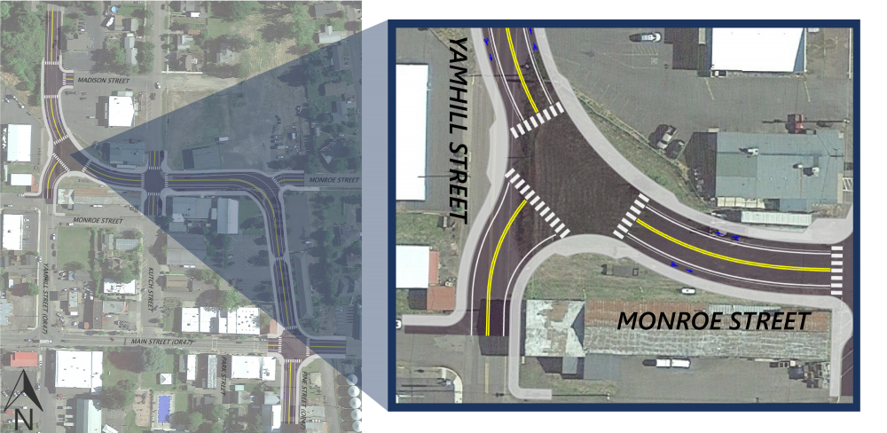
With the proposed layout, traffic on northbound Yamhill Street would have a stop sign at the intersection. Drivers traveling the new OR 47 wouldn't have stop signs.
We heard you
- Based on the information we learned in the recent community survey, slowing down vehicle speed in the project area is your top priority. In the proposed layout, the new OR 47 would be curved to help cause drivers to slow down as they go around the corner.
- We're looking to see if we can tighten the curve, which would slow drivers down even more and have less impact to the nearby businesses.
Other items we're exploring:
All way stop
National and state criteria or requirements must be met to install stop signs on all lanes of the intersection and shouldn't be used to control speed. We haven't looked at the traffic data at this location to know if there is enough traffic using this intersection to install an all way stop.
It’s important to note that semi trucks driving on OR 47 are sometimes loud, which can be disruptive if you're having fun in the downtown core. Semi trucks make more noise when they have to stop and accelerate from a stop, making about 30% to 50% more noise than if they were able to continue without stopping. An all way stop at this location would have minimal effect on the cost of the project.
Roundabout
Roundabouts can be good solutions to help slow vehicles and make it easier for people to cross the street. A standard roundabout designed to handle the semi trucks that come through Carlton would need to have a diameter of about 130 feet or larger. This size would interfere with the surrounding businesses and other land uses or even require them to be moved.
A smaller roundabout may be possible but would be less pedestrian friendly. Semi trucks passing through a smaller roundabout can’t stay in their lane and would need to drive over some of the curbs and islands, which can conflict with pedestrians or other traffic in the roundabout. A roundabout at this location would likely add $2-3 million or more to the cost of the project.
 We heard you
Pedestrian safety is a priority. The proposed layout:
- Would have six foot wide sidewalks on both sides of the new OR 47.
- Would add new ADA accessible curb ramps.
- Would likely have marked crosswalks. Adding crosswalks may require new street lighting.
The current layout:
- Wouldn't change the on street parking on Yamhill Street or Monroe Street.
- Would have bike lanes on the new OR 47.
- Would have six feet wide sidewalks on both sides of the new OR 47.
Learn more by clicking on the titles below to expand the boxes.
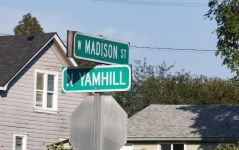
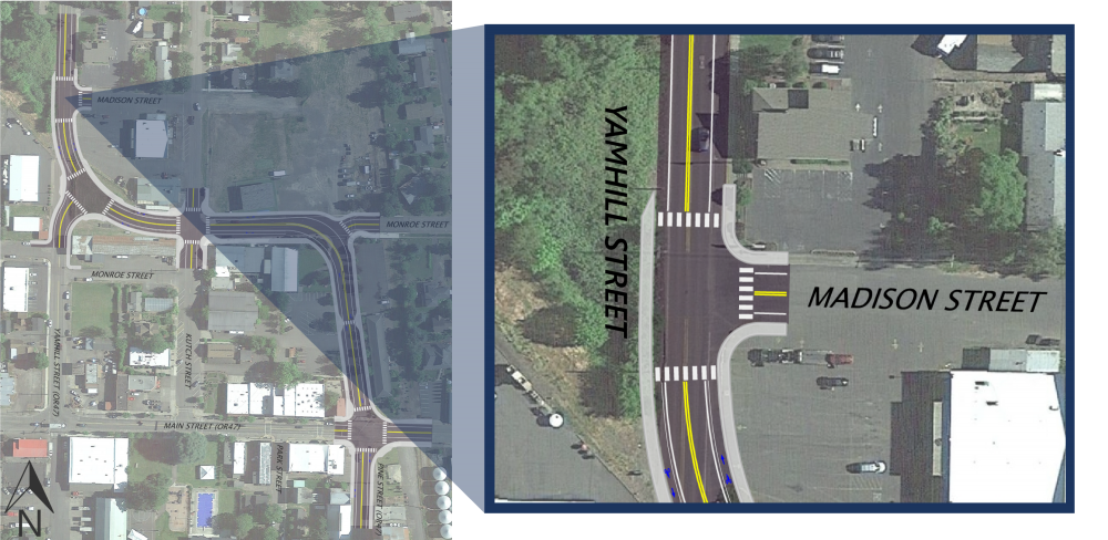
With the proposed layout, traffic on Madison Street would have a stop sign at the intersection. Drivers traveling on the new OR 47 wouldn't have stop signs.
We heard you
We're looking to see if there are other safety features we can add to help slow traffic entering the town.
Other items we're exploring:
Camera and radar speed enforcement
Cameras used to issue speeding tickets can help slow down traffic, but not always as much as a person may think. Oregon law says that speed cameras can only issue a ticket if the vehicle is going 11 mph or more over the speed limit. This means that a driver could travel as much as 30 mph through downtown Carlton without getting a ticket, assuming the posted speed is 20 mph.
The courts historically dismiss many of these tickets – for example, about 45% of tickets in the City of Portland get dismissed. Current state law also specifies how the cameras can be used and which cities may use them. It's possible the Oregon Legislature will allow speed cameras to be used in other locations. For now, this option may not be possible in Carlton. We don't know the cost to install or maintain cameras. We'll continue to talk about this option with the City of Carlton.
We heard you
Pedestrian safety is a priority. With the proposed layout, pedestrians would have six feet wide sidewalk on both sides of the new OR 47.
With the proposed layout, the intersection:
- Would have new ADA accessible curb ramps at each corner.
- Would likely have marked crosswalks. Adding crosswalks may require new street lighting.
The proposed layout:
- Wouldn't change the on street parking on Yamhill Street or Madison Street.
- Would have bike lanes on the new OR 47.
- Would have six feet wide sidewalks on both sides of the new OR 47.
Comments or questions?
Use the form below to tell us your thoughts and let us know if you have questions.
Stay connected
 You can always learn more about the project, find answers to your questions and stay connected by visiting the project webpage.
 If you have not already, sign up to receive future updates about this project.
Please help us spread the word about this online open house.
Feel free to share this with your friends and neighbors so that we can get their feedback.
Thank you for participating!